![]()
Cycling Quill Hill, Maine - Maine’s hardest bike climb.
Ride 4.2 miles gaining 1,404’ at 6.3% average grade.
Quill Hill is a private road build by Adrian Brochu beginning in 2010 to his death in October, 2019. Adrian’s philosophy was “build it and they will come.” Indeed, he built it and many have come to what is billed as “Maine’s best and most accessible views.” See more at https://www.quillhillmaine.com/
Climb summary by PJAMM ambassador, Dan Razum.
This is a fairly isolated climb in rural Maine. The mountains and landscape in the area are quite scenic
so this climb is worth doing if you get a chance. The road is dirt but well packed so it is no problem
for a road bike. However, it is probably best not to do this ride during wet conditions, either
rain or snow, as the surface could be slippery. The road is dirt because it is actually private property,
built and maintained by a local man, and pavement is obviously very expensive. There is no official
entrance fee but there is a box where they request donations, $5 per person when we visited in July 2023.
![]()
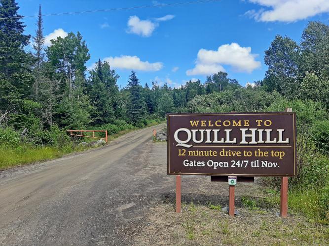
The climb starts at the intersection of the access road with Rte 16. There is a large sign at the
intersection, welcoming you to Quill Hill and there is enough space behind the sign to park a couple
of cars so it is possible to park at the base of the climb, if you don't want to ride from further
away on Rte 16.
![]()
Start of climb.
Quill Hill Access Rd starts out with a double digit ramp but soon mellows out for a couple of miles.
Then the last mile or so to the summit is also fairly steep. Although the road is not paved, the surface
is pretty smooth, without much loose sand or gravel, and we didn't have any issues riding it. It is
basically two lanes wide the entire way and near the top there is a one way loop, so traffic coming down
doesn't interfere with traffic going up.
![]()
You may encounter a small amount of traffic, other people visiting the summit, but the road is wide enough
and the traffic slow enough that it wasn't a concern for us.
![]()
There is thick foliage on the lower parts of the climb. About three quarters of the way up the trees thin
out and we start to get nice views. The trees aren't very tall, even at the start, so there isn't a
whole lot of shade, but that's ok since it's usually not too hot in this part of the country anyway.
![]()
At the top is a large parking area with signs explaining the history of the area and how the road was
built by Adrian Brochu from 2008 to 2013. There are also very scenic views in all directions. The views
at the top make the climb well worth it.
![]()
![]()
Finish

 We've partnered with Sherpa-Map.com to bring you the best route planning tool. With a PRO Membership you can use this climb as a reference when creating your route.

