![]()
We start at Castolon Visitor Center. Unfortunately, there isn't much at the Visitor Center because it was burned in a large fire in 2019. There are plans to try to restore the Visitor Center but it will probably take several years.
![]()
![]()
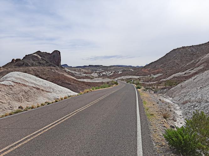
After we exit the parking lot, we start climbing a gentle gradient. The landscape has many scenic peaks scattered around, remnants of volcanic activity in the area long ago.
![]()
![]()
There are several little parking areas along the climb with plaques explaining in more detail the formation of the surrounding mountains. It is worth stopping and reading some of the plaques to learn more about the area. Apparently, Big Bend had several volcanoes and was a sea bed, millions of years ago. Many dinosaur fossils have been found in the park, although not necessarily along this particular road.
![]()
There are several sections of flat and downhill along this ride. The last couple of miles climb continuously, with a fairly uniform grade, until we finally arrive at the exit for Sotol Vista. We turn right and ride a quarter of a mile or so to arrive at the end of the climb. We are rewarded with nice views of the entire valley below and Mexico in the distance.
![]()
![]()
There is a variety of scenery and the climbing is never too steep, making this an enjoyable climb. The road is in good condition and although there isn't any shoulder, traffic is light so safety is not a concern. However, we are riding in the desert and it can get hot, so make sure to bring plenty of liquids. The climb is fairly remote and there are no provisions along the way although there are restrooms at the start and at the end of the climb.
![]()
If you want to add miles, before the climb you can ride from Castolon Visitor Center in the opposite direction. The road is mostly flat and follows the Rio Grande for about 8 miles to Santa Elena Canyon, where the road ends. Santa Elena Canyon is a narrow canyon, cut from the rock by the Rio Grande river over time. The canyon is visible from well over 20 miles away, as a sharp notch in the mountain. A side trip to Santa Elena Canyon is well worth the effort.
![]()
![]()
Rio Grande River.
Mexico left, USA right.
![]()
Thank you Dan!!

 We've partnered with Sherpa-Map.com to bring you the best route planning tool. With a PRO Membership you can use this climb as a reference when creating your route.

