29.1
PDI
11.8 mi
DISTANCE
4,462 ft
GAINED
7.2 %
AVG. GRADE
FULL CLIMB STATS
Page Contributor(s): Ard Oostra, Montreux, Switzerland
INTRO
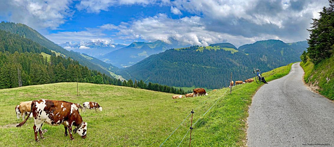
This 11.8 mile bike climb is located in Valais, Switzerland. The average gradient is 7.2% and there is a total elevation gain of 4,462 ft, finishing at 5,863 ft.
Use the profile tool, route map, and weather forecast to conquer this cycling climb.
Use the profile tool, route map, and weather forecast to conquer this cycling climb.
PLAN YOUR ROUTE
7.2% average grade. 71% of the climb is at grade 5-10% and 9% at 10-15%. The steepest 500 meters is 10.6% and steepest kilometer 10.4%.
See more details and tools regarding this climb's grade via the “Profile Tool” button above.
Roadway: One lane paved roadway in good shape.
Traffic: Minimal.
Parking: A block from the start of the climb on Route 21 - Map; Street View.
Provisions: Restaurant Chalet Neuf at kilometer 18 near the finish of the climb.
Before heading out on any cycling adventure check out our Things to Bring on a Cycling Trip and use our interactive check list to ensure you don't forget anything.
This is one of the milder climbs in the greatest climbing area in the world - See PJAMM's Valais, Switzerland climb area page. Use the “Routes in Area” button on the menu bar above to see other bike climbs in this area.
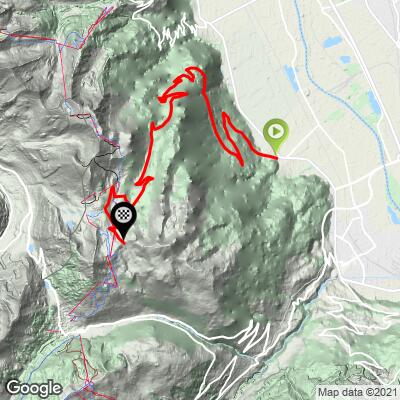
ROUTE MAP
MEMBER RATING
CURRENT WEATHER
PJAMM TRIPS ADVENTURE STARTER BUNDLES
Check out PJAMM Adventure's prepackaged (self-guided) cycling trips. They will help you plan, document and conquer your next adventure.
NEARBY CLIMBS (0) RADIAL PROXIMITY
FROM No Climbs Found
MEMBER REVIEWS & COMMENTS
Let us know what you thought of this climb. Signup for our FREE membership to write a review or post a comment.
Already have an account?
LOG IN HERE
thall1
Enjoyability: 83/100