
25.1
PDI
9.4 mi
DISTANCE
3,736 ft
GAINED
7.6 %
AVG. GRADE
FULL CLIMB STATS
Page Contributor(s): Ard Oostra, Montreux, Switzerland
INTRO
Chindonne - Monthey is a 15.1 km (9.4 mi) climb from the Rhône valley floor at Monthey, 452 m (1,484 ft), up the hillside toward Les Giettes and on to the Auberge de Chindonne at 1,590 m (5,217 ft). It gains 1,139 m (3,736 ft) at a 7.6% average grade and ranks #65 in Switzerland and #558 in the world by our rankings.
The climb has two halves. The first 4 km (2.5 mi) stay moderate, between about 4% and 7%, and from kilometer 5 the road settles into a steady 8% to 10% for roughly 10 km (6.2 mi). The steepest kilometer, the twelfth, averages 9.9%, and 81% of the route sits between 5% and 10%, so it rewards pacing more than power. The road is narrow and one lane wide, and riders describe it as calm and wilder toward the top.
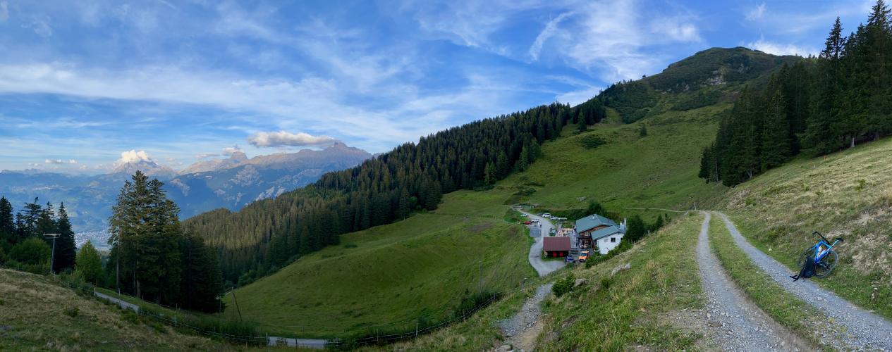
The finish is a real destination: the Auberge de Chindonne is a mountain inn on the Dents du Midi Trail with a panoramic terrace, so there is a proper lunch stop waiting at the top.
PLAN YOUR ROUTE
 We've partnered with Sherpa-Map.com to bring you the best route planning tool. With a PRO Membership you can use this climb as a reference when creating your route.
 7.6% average grade over 15.1 km (9.4 mi). 81% of the climb is at 5-10% and 7% is at 10-15%. The steepest 100 yards runs at 11.5%, the steepest 500 m (0.3 mi) at 10.7%, the steepest kilometer at 9.9% and the steepest mile (1.6 km) at 9.7%. The steepest 5 km (3.1 mi) averages 9.1% and the steepest 10 km (6.2 mi) 8.7%.
The first 4 km (2.5 mi) average under 6%, then the remaining 11.0 km (6.9 mi) average 8.3%, easing to about 5% in the final kilometer.
Roadway: Narrow one-lane paved road in good to fair condition. Rider reports mention coarse-textured sections with some potholes and cracks, so keep your line on the descent. The road is open to cars in summer all the way to the inn.
Traffic: Minimal.
Parking: The soccer fields on Avenue du Simplon and Avenue de l'Europe in Monthey are the closest parking we know of to the start - Map.
Provisions: There are a couple of spots to get food and drinks along the way, and the Auberge de Chindonne sits at the finish with local Valais wines, BBQ from its own smokehouse and free water. Opening days change with the season - in 2024 it was open daily from late June through August and closed Mondays and Tuesdays from September to mid-October - so check before you ride up on a weekday in autumn.
Gear: A compact crankset with a 32- or 34-tooth cog covers the steady 8% to 10% middle of the climb. The finish is more than 1,100 m (3,600 ft) above the valley, so carry a windproof layer for the descent.
Before heading out on any cycling adventure check out our Things to Bring on a Cycling Trip and use our interactive check list to ensure you don't forget anything.
This climb is in the heart of the greatest climbing area in the world - see PJAMM's Valais, Switzerland climb page. Our Portes de Culet page covers the Val d'Illiez side of Monthey and our Pas de Morgins page covers staying in Montreux, so here is what is up the hill.
The Auberge de Chindonne has 4 private rooms and 5 dorm rooms for up to 70 guests, and in summer a postal bus runs from Monthey to Les Cerniers, handy for a one-way ride. The Centre sportif des Jeurs and the Refuge de Valerette are both within 1 km (0.6 mi) of the inn for a short walk. Les Giettes, below the inn, is also reached by a separate 9.8 km (6.1 mi) climb from Massongex that gains 741 m (2,431 ft) and lists the Chalet des Cerniers and the Buvette de Chindonne as food stops. Use the “Routes in Area” button on the menu bar above to see other bike climbs in this area.
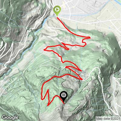
ROUTE MAP
MEMBER RATING
CURRENT WEATHER
PJAMM TRIPS ADVENTURE STARTER BUNDLES
Check out PJAMM Adventure's prepackaged (self-guided) cycling trips. They will help you plan, document and conquer your next adventure.
NEARBY CLIMBS (0) RADIAL PROXIMITY
FROM No Climbs Found
MEMBER REVIEWS & COMMENTS
Let us know what you thought of this climb. Signup for our FREE membership to write a review or post a comment.
Already have an account?
LOG IN HERE
