36.5
PDI
6.1 mi
DISTANCE
3,766 ft
GAINED
11.9 %
AVG. GRADE
FULL CLIMB STATS
Page Contributor(s): Ard Oostra, Montreux, Switzerland.
INTRO
Zettersfeld is a 6.1-mile paved climb above Lienz in Austria's East Tyrol, gaining 3,766 feet at an average grade of 11.9% on the way to the Zettersfeld ski and hiking area at 6,290 feet. It's currently the 145th-hardest climb in the world in our database.
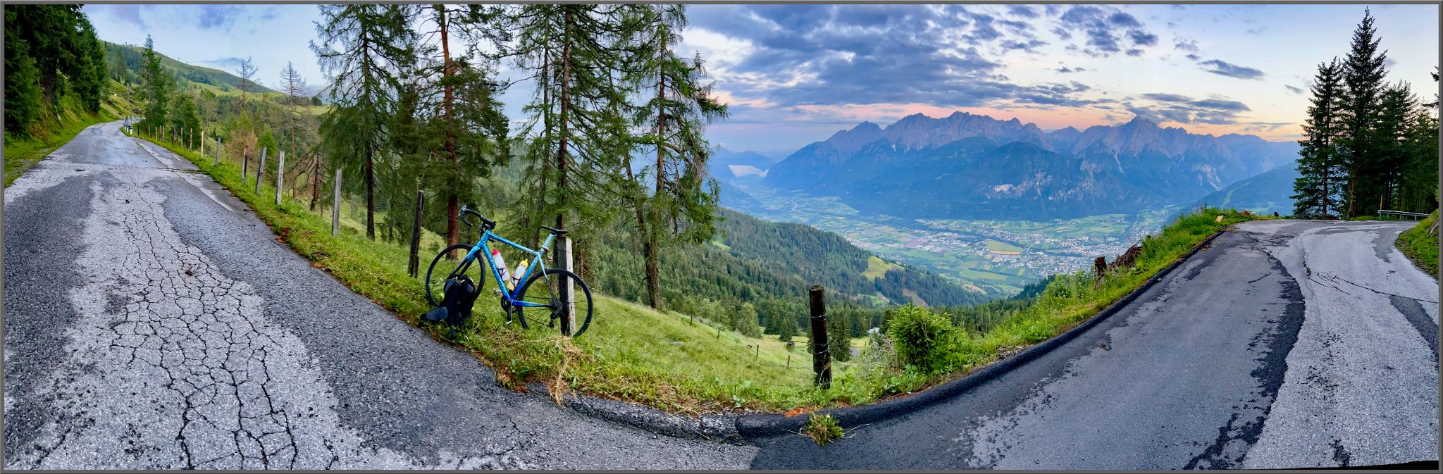
What sets it apart isn't one brutal ramp but how consistently steep the whole thing is - the grade rarely dips into single digits and almost never flattens, climbing through roughly ten hairpin turns in a narrow upper section cut into the mountainside. The road is the Thurner Zettersfeldstrasse, a tolled mountain road built between 1972 and 1977, and it tops out at Sporthotel Hochlienz next to the base of the Zettersfeldbahn cable car, with panoramic views over the Lienzer Dolomiten, the Gailtal Alps, and the Carnic Alps on a clear day.
East Tyrol has an unusually dense concentration of hard climbs packed into a small area around Lienz, and Zettersfeld is one of the steepest of the bunch. A toll-free alternative, the Faschingalmstrasse from nearby Gaimberg, climbs a different, gentler route up the same mountain if you're looking to compare the two.
PLAN YOUR ROUTE
 We've partnered with Sherpa-Map.com to bring you the best route planning tool. With a PRO Membership you can use this climb as a reference when creating your route.
 Zettersfeld's defining feature isn't a single brutal pitch - it's how unrelentingly steep the whole climb is. The average grade sits at 11.9% over 6.1 miles, and the gradient almost never lets up or flattens out along the way.
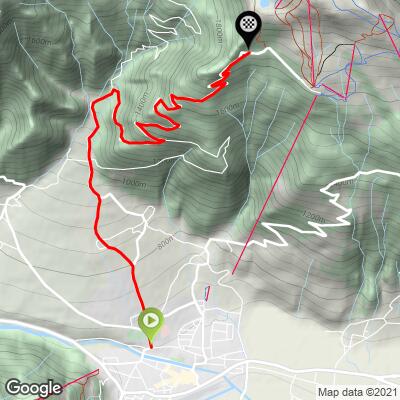
The steepest sustained kilometer averages 14.9%, and the steepest half-kilometer touches 15.4% - both in the switchbacked midsection above the toll gate. The first quarter-mile out of the lower slopes starts just as hard, at 15.4%, so there's no easing into this one. Gear low and expect to stay there for most of the ride.
Roadway: The road is paved the entire way and generally in good condition, though older, slightly weathered asphalt shows up in the lower-middle stretch near the toll gate. It's the Thurner Zettersfeldstrasse, a mountain toll road built between 1972 and 1977 that narrows to roughly one lane's width through about ten hairpin turns in its upper section, so ride predictably and watch for descending traffic in the switchbacks.
Traffic: Traffic is light to moderate - mostly visitors driving up to the Zettersfeld ski area, hikers, and the occasional service vehicle for the Zettersfeldbahn cable car. A toll (cars and motorcycles pay at the gate) keeps casual car traffic down; cyclists are typically waved through free of charge, as is standard on Austria's other alpine toll roads, though it's worth confirming at the booth.
Parking: Most riders start right from central Lienz, where street parking and several public lots are available near the Hauptplatz. There's also a large, free car park at the top near the Zettersfeld valley station if you'd rather shuttle up and ride other nearby climbs from there instead.
Bring the lowest gearing you have - a compact or triple crank with a wide-range cassette makes a real difference here, since the road rarely relents below 10% and several stretches sit at 14-15%.
Lienz is a full-service town with bike shops, supermarkets, and cafes for stocking up before you start, but there's nothing along the climb itself until the top. At the summit, the restaurant "Die Alm" and the Sporthotel Hochlienz both serve food and drinks in season, a good spot to refuel before the descent.
Before heading out on any cycling adventure check out our Things to Bring on a Cycling Trip and use our interactive check list to ensure you don't forget anything.
Zettersfeld is best ridden from late spring through early fall - check for lingering snow near the top early or late in the season, since the finish sits close to 6,300 feet. East Tyrol has an unusually dense cluster of hard climbs around Lienz, so it's easy to pair this one with a neighboring ascent like the Faschingalmstrasse from Gaimberg if you want a bigger day out.
If you'd rather check conditions before committing, our Weather tool can show you what's happening at the summit before you leave Lienz.
ROUTE MAP
MEMBER RATING
CURRENT WEATHER
PJAMM TRIPS ADVENTURE STARTER BUNDLES
Check out PJAMM Adventure's prepackaged (self-guided) cycling trips. They will help you plan, document and conquer your next adventure.
NEARBY CLIMBS (0) RADIAL PROXIMITY
FROM No Climbs Found
MEMBER REVIEWS & COMMENTS
Let us know what you thought of this climb. Signup for our FREE membership to write a review or post a comment.
Already have an account?
LOG IN HERE