![Strawberry Pass, BC, CAN Cycling Strawberry Pass, BC, CAN - road, bike leaning against share the road sign.]()
Cycling Strawberry Pass, BC, CAN
Ride 25 kilometers gaining 1,156 meters at 4.3% average grade.
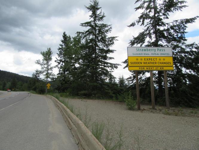
Strawberry Pass is located in the Rossland Range which is a subrange of the Monashee Mountains of the Colombia Mountains.
![Strawberry Pass, BC, CAN - Trail, CAn]()
We begin the climb in Trail, BC, CAN (population 7,709; 2016)
The first 7.7 km /4.8 miles of this climb from Trail to Rossman are the crux of the climb at 7.7% gaining 576m/1,890’. The 7.7 kilometers from town to town are along a fairly busy but wide road with a varying 50 to 60 kph posted speed limit which seems to be honored by most of the many motorists that passed us during our early afternoon mid-week climb. While we are always in either town or the outskirts of them, there is a wooded buffer between the roadway and houses for several kilometers so we do not have such a residential feel, although we are on a highway, after all.
![Strawberry Pass, BC, CAN Bike climbStrawberry Pass, BC, CAN - cyclist riding past 60 km/h sign]()
Hwy 22 between Trail and Rossland
![Strawberry Pass, BC, CAN Bicycle ride Strawberry Pass, BC, CAN - Hwy 22 / 3B sign next to road]()
Turn from Hwy 22 to Hwy 3B at km 9.3 in Rossland.
Turning onto Hwy 3B at km 11.7 we pass Red Mountain Ski Resort at kilometer 16 and for the next 11 kilometers to the top of the climb we are in a rural unpopulated forested setting.
![Strawberry Pass, BC, CAN]()
![Strawberry Pass, BC, CAN Climbing by bike Strawberry Pass, BC, CAN - sign to Red Mountain Ski resort]()
There are a couple brief descents along the route between 11 and 13 km. There is a visual phenomenon that occurs over the last 3.2 kilometers of this climb – the roadway, to my eye anyway, seemed to unequivocally descend while my Garmin constantly showed .5 to 3% grade and I continued to gain altitude. Over the same 3.2 kilometers retracing our route from the summit, the 3.2 kilometers that looked downhill (but were actually uphill) correctly appear and feel downhill – the difference is that they also register as downhill on my Garmin – quite the mirage, to my eye!
![Strawberry Pass, BC, CAN Biking Strawberry Pass, BC, CAN - garmin cycling computer]()
The last 3 km of the climb are uphill at .5 to 3%. . . but . . .
![Strawberry Pass, BC, CAN Bicycling Strawberry Pass, BC, CAN - garmin edge 1000 headset and road]()
. . . it sure didn’t look that way . . .
Roadway surface and traffic: The roadway throughout the climb (both in the Trail/Rossmann area and on Hwy 3B (wide single lane in each direction) is excellent and with a good shoulder (the shoulder is a bit bumpy in spots after passing the Red Mountain Resort, but of good enough quality to ride on if preferred) and certainly to avoid traffic when you hear it coming). Although on a highway for much of the climb, the traffic was mild throughout, although the posted limit on Highway 3B for most of the route is 100 kph.
![Strawberry Pass, BC, CAN Cycling Strawberry Pass, BC, CAN - cyclists descending roadway]()
A fun descent.

 We've partnered with Sherpa-Map.com to bring you the best route planning tool. With a PRO Membership you can use this climb as a reference when creating your route.

