![]()
Cycling Paulson (Bonanza) Pass, BC, CAN
Ride 25 kilometers gaining 1,012 meters at 4% average grade.
![]()
Depends on your point of view . . .
. . . steepest ½ kilometer is 8%.
Paulson Pass (also known as Blueberry Pass) begins at Christina Lake at the bottom of a long haul up Hwy 3 to the unmarked pass.
![]()
We follow a pleasant creek for the first few kilometers during a gradual initial climb (3.5% for the first 12.8 km/8 miles). At the 12.8 km/8 mile mark the grade increases to 6% for the next 9.6 km/6 miles until dropping back to 3% for the final 2.7 km/1.7 miles to the summit.
The Paulson bypass (Paulson Detour Road) is at 16.9 km /10.5 miles and permits us to bypass the Paulson Bridge at km 17 if we so choose. The bypass is a longer route and is 5.9 km / 3.7 miles which cuts off the bridge but only 3.4 km / 2.1 miles (i.e., it adds 2.5 km/1.6 miles to the climb - but could be an adventure). Youtube Video of vehicle driving the bypass.
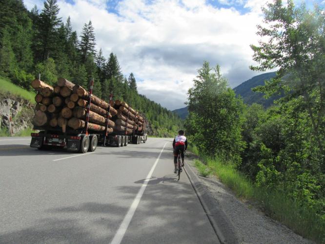
We cross the 100 meter Paulson Bridge at 17 kilometers. This bridge can be unnerving if a big rig is encountered on the way across - the bridge actually shakes noticeably as the semi-truck passes over it.
![]()
![]()
In these remote areas of British Columbia, be prepared for the cool and unexpected – at kilometer 5 during our climb a bear cub ran across the road directly in front of us – too fast for my camera quick draw, though – opportunity lost!
Roadway surface and traffic: As with nearly all Canadian climbs we undertook during our visit, this roadway surface is excellent and there is a good shoulder which does give us some comfort from the highway traffic that does pass at highway speeds of 80-100 kph.
![]()
Note of caution: This climb is along a Highway 3 and has moderate traffic that can pass at high speed, including big rigs. The posted speed limit in places is 100 kph [check photos] (62 mph). This climb has been done 161 times by Strava members as of June 17, 2019 when we climbed it, so it is not completely off limits to cyclists. We believe the best time to climb this grade would be very early on a weekend morning. This is not a climb for those high traffic averse.
![]()

 We've partnered with Sherpa-Map.com to bring you the best route planning tool. With a PRO Membership you can use this climb as a reference when creating your route.

