![Crystal Avenue Cycling Crystal Avenue - steep grade sign]()
Cycling Crystal Mountain - Glenrosa Road, Westbank, BC, CAN
Ride 15.4 kilometers gaining 831 meters at 5.4% average grade.
This is a long climb that begins near the eastern shore of the central section of giant Lake Okanagan (home to 6 top Canada climbs - Silver Lake (Vernon), Postill Lake Road (Kelowna), Hwy 97C (Peachland), Carmi Avenue, and Apex Mountain (Penticton). The first 6 kilometers are unremarkable, passing through residential areas, along Hwy 97 for just shy of a kilometer and then on the busy lower section of Glenrosa Road for 3.2 km/2 miles.
![Crystal Avenue Bike climb Crystal Avenue - Lake Okanagan -]()
Lake Okanagan
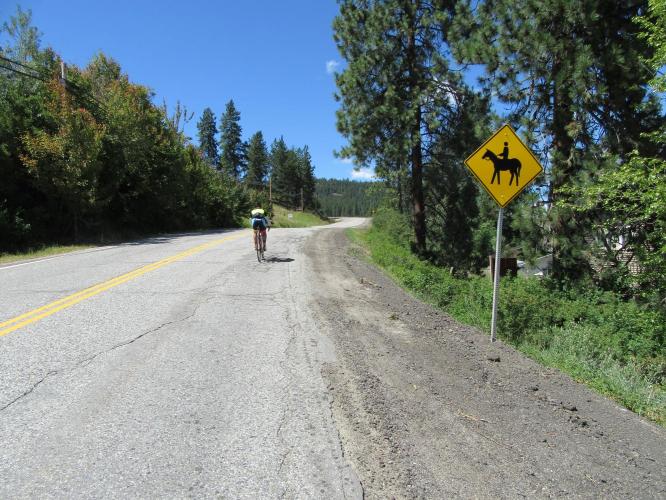
We leave the hussle and bussle behind us at about kilometer 6/mile 3.5 where the road narrows a bit and traffic drops to mild and is ultimately very infrequent.
![Crystal Avenue Biking Crystal Avenue - cyclist riding by horse sign]()
We begin to get all of our money’s worth and more from 6 kilometers to the end of the climb. At 6 km the surroundings transition quickly from residential/commercial to very rural with meadows and grasslands for a few kilometers and finally uninhabited forested surroundings beginning at kilometer 8, at the cattle guard. From kilometer 6 to the end of the climb at about 15.5 km, we are nearly always alone, with only an occasional vehicle passing. The final pleasant and peaceful 7-8 kilometer’s belie the fairly busy start to the climb.
![Crystal Avenue Climbing by bike Crystal Avenue - meadow with cattle]()
![Crystal Avenue Climbing Crystal Avenue by bike - cattle guard and roadway]()
There are a few steep 100-200m stretches of 10-12%, and the final brief segment up to the resort gate is a test, but otherwise this is a manageable and comfortable climb. There are aspens along a couple of the steep pitches and the wind blowing through their leaves is quite soothing as we strain up the double digit grades we do encounter.
![Crystal Avenue Bicycle ride Crystal Avenue - flowers along roadway]()
![Crystal Avenue Biking Crystal Avenue - finish at ski resort]()
Finish
There is a “Leaving West Kelowna” sign at kilometer 12.4, but truth be told, we left civilization 2 ½ kilometers earlier. Pay careful attention at the 12-13 kilometer mark for a few fleeting views to the right of Lake Okanagan.
![Crystal Avenue]()
![Crystal Avenue]()
![Crystal Avenue]()
Roadway surface and traffic: The roadway surface is good throughout the climb. The roadway is two lanes with a center yellow line, but no shoulder although that is of no consequence as there is very little traffic along what is a very safe route after the 6 kilometer mark. While traffic is busy for the first 6 kilometers of this climb, there is a shoulder in the highest and fastest traffic sections so we rate this as a fairly safe and comfortable ride.

 We've partnered with Sherpa-Map.com to bring you the best route planning tool. With a PRO Membership you can use this climb as a reference when creating your route.

