![]()
Cycling Gila Monster
Ride 10.3 miles gaining 1,964’ at 2.9% average grade (4.6% climb only).
The climb starts at the intersection of Route 35 and Route 15 and it climbs up Route 15 towards Pinos Altos.
![]()
It starts off as a two lane road but it quickly becomes a single lane.
![]()
![]()
The road is narrow with no shoulder but the pavement is in good condition. There is some traffic but not too much and it's mostly tourists who aren't driving very fast.
![]()
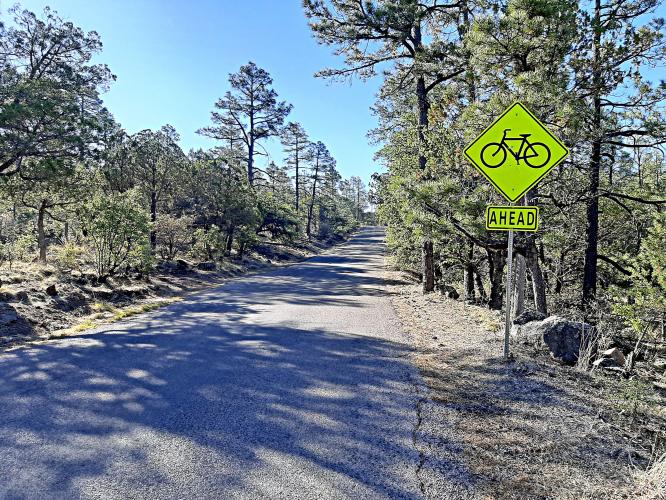
The road is very twisty in the first third and the last third of the climb and straight in the middle. In the twisty portions any traffic barely goes faster than a bicycle, so the climb feels safe, despite how narrow the road is. We saw several signs alerting cars to cyclists, so there is an attempt to make the road cycle friendly. There is one cattle guard grate in the first third of the climb.
![]()
We start out with the steepest part of the climb for the first 3 miles or so. It doesn't reach double digits, though, so it isn't too bad. Plus, the curves make it interesting and there are occasional views of the nearby mountains.
![]()
After 3 miles the road straightens out and there are a few short downhill sections. We are traveling along the ridge line, with occasional views of the mountains on either side. We encountered hazy air in the early morning, which blocked some of the views, but the haze burned off a couple hours after sunrise so we had good views on the descent.
![]()
After the straight portion the road becomes twisty again and we start entering a pine forest, with some shade. The vegetation changes a lot as we climb, from small shrubs at the beginning to tall pines at the end. The top of the climb is where a dirt road to a hiking area meets Route 15.
![]()
This climb is remote with no services or restrooms along the way.
![]()
Thank you Dan!!

 We've partnered with Sherpa-Map.com to bring you the best route planning tool. With a PRO Membership you can use this climb as a reference when creating your route.

