![]()
Cycling Rte 159 - Bursum Road
Ride 6.7 miles gaining 1,840’ at 5.1% average grade.
Climb summary by PJAMM ambassador Dan Razum, Campbell, CA.
We begin climbing at the intersection of Highway 180 and Route 159 (Bursum Road). There is a cattle guard grate at the beginning. The first mile and a half is a gentle climb, a good warm up.
![]()
We then have about a mile of steeper climbing and we arrive at a large plateau, where the slope is very gentle again for another mile and a half. There are cattle guard grates at both ends of the plateau.
![]()
![]()
![]()
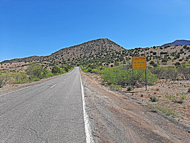
After we exit the plateau, we start climbing again and there are no more gentle slopes for the rest of the climb. We hit double digits in a few places so it will be slow going the rest of the way. Until the end of the plateau the road is two lanes but when we start climbing after the plateau the road goes down to one lane and stays that way for the rest of the ride. There might be a car or two up to the plateau but after that there is very little traffic.
![]()
![]()
After the plateau when we start climbing again we soon come across another cattle guard grate. We then go through a section where the road is cut into the side of the mountain, with exposed rock on one side and drops to the valley below on the other side. This section isn't too long and it has some nice views.
![]()
![]()
Up to this point, the ride is fairly scenic, with interesting vistas. After this rock section though, there aren't many views for the rest of the ride, we mostly ride through terrain and vegetation that blocks any views. Even at the top there isn't much of a view.
![]()
The road is twisty and steep the rest of the way. The road curves every couple of hundred yards and the shrubs prevent you from seeing very far ahead. The shrubbery is low, meaning there isn't any appreciable shade, so you are exposed to the sun.
![]()
After a mile or so we pass the fifth and final cattle guard grate along the road. A mile or so later we reach the top.
![]()
You can't really tell when you are getting close to the top, because of the limited sight lines. When we finally see a downhill traffic sign (drawing of a truck on a decline) then we know we have reached the top.
![]()
If you want to ride a little further, you can continue down the backside to the small town of Mogollon. However, it is about a mile and half descent at 6-7% average gradient, so be aware that you will need to climb that to come back. Mogollon is a quaint little town with a few houses and a few abandoned buildings. Route 159 continues on after Mogollon but the pavement ends about a quarter mile after the town, it becomes gravel/dirt after that.
![]()
All in all, this is a nice climb, with interesting scenery in the first half and challenging climbing in the second half. The road condition is fair and even though the road is very narrow in places traffic is very light so we always felt safe.
This climb is also used in the Tour de Gila, as a mountain top finish. That would certainly make for a grueling stage, to finish up with this climb after riding from Silver City. We will leave that to the pros!

 We've partnered with Sherpa-Map.com to bring you the best route planning tool. With a PRO Membership you can use this climb as a reference when creating your route.

