
18.9
PDI
7.2 mi
DISTANCE
2,827 ft
GAINED
7.4 %
AVG. GRADE
FULL CLIMB STATS
INTRO
Silzer Sattel from Oetz is the gentler of the two ways up to the Sattele, the 1690 m (5545 ft) forest saddle that links the Kühtai road with the Inn Valley above Haiming. From the village of Oetz, at the mouth of the Ötztal, it climbs 11.6 km (7.2 mi) and gains 862 m (2827 ft) at a 7.4% average.
Most of the climb is the lower half of the Kühtai road (L237). It leaves Oetz with a steep first kilometer, eases through the hamlet of Oetzerau, then climbs steadily through the switchbacks above Taxegg - much of it shaded forest - to the high hamlet of Ochsengarten. This is the road the Ötztaler Radmarathon uses for the first climb of its 227 km (141 mi) day, so you're riding the opening ramp of one of Europe's most famous sportives. At Ochsengarten, instead of carrying on toward Kühtai, you turn right onto the quiet Sattele road for a final 2 km at around 8% to the saddle.
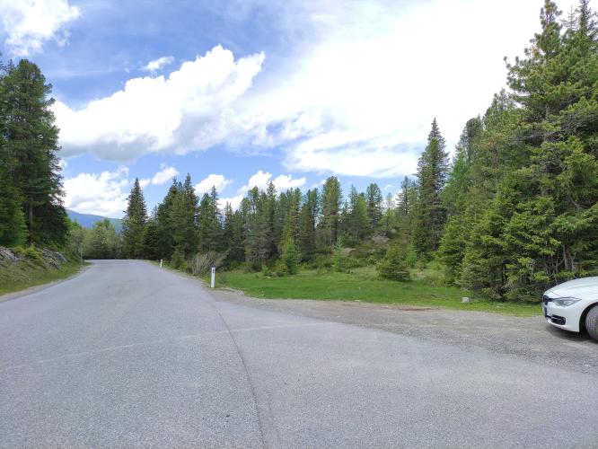
The Sattele itself is understated - a pass sign in light forest rather than a big alpine col - but it's the hinge of one of the best loops in the area. Over the top, the road drops steeply to Haiming and the Inn Valley down the far tougher north ramp, our Silzer Sattel (Haiming) page, and from Haiming the valley road leads back to Oetz.
PLAN YOUR ROUTE
 We've partnered with Sherpa-Map.com to bring you the best route planning tool. With a PRO Membership you can use this climb as a reference when creating your route.
Silzer Sattel (Oetz) climbs 11.6 km (7.2 mi) with 862 m (2827 ft) of elevation gain at an average grade of 7.4%.
The first kilometer out of Oetz is one of the steepest on the climb at 9.3%, then km 2 offers a breather at 4.7% through Oetzerau. From km 3 to km 8 the Kühtai road settles into a steady 7.5-9%, finishing that stretch with a 9.5% kilometer.
Km 9 and 10 ease to about 5% as the road approaches Ochsengarten, and the final 2 km on the Sattele road climb at about 8% to the saddle.
Steepest sections: 91 m (100 yd) at 12.3%, 0.5 km at 10.9%, 1 km at 9.7%, 2 km at 9.0%, 5 km at 8.4%, 10 km at 7.4%.
Roadway: Paved all the way. The L237 Kühtai road is a well-built two-lane mountain road; the Sattele road beyond Ochsengarten is narrower, a quiet local road through forest and pasture. The stretch between Oetzerau and Ochsengarten runs beneath steep slopes and has been closed several times after heavy rain - a rockfall in August 2021 and mudflows in May 2023 each shut it for days to weeks - so check the Land Tirol road reports if there has been a big storm. The Kühtai road is also closed to traffic on the day of the Ötztaler Radmarathon at the end of August.
Traffic: Moderate on the Kühtai road, which is the main route from the Ötztal up to Kühtai, though it carries comparatively little motor traffic for a pass this popular with road cyclists. Once you turn off at Ochsengarten, traffic drops to almost nothing - watch instead for cattle (and what they leave behind) on the road near the top.
Parking: Oetz has several paid public car parks: the central lot in the village, which also allows overnight parking, the Acherkogelbahn lift lot, and the rafting entry lot. The Tourist Information in the village center is the start of the Ötztal tourism board's own Oetz - Kühtai - Sattele road loop and makes an easy meeting point.
Gear: A compact crankset with a 28- or 30-tooth cog is plenty for the steady 7.5-9% grades. You'll descend nearly 900 m (2950 ft) whichever way you go down, and the Haiming side is steep with tight hairpins, so make sure your brakes are in good shape and pack a jacket.
Provisions: Stock up in Oetz, which has shops and cafes. Once you leave the village there's little along the Kühtai road, but Gasthof Marlstein, in the hamlet of Marlstein just off the Sattele road above Ochsengarten, is a good place for a break near the top.
Before heading out on any cycling adventure check out our Things to Bring on a Cycling Trip and use our interactive check list to ensure you don't forget anything.
Oetz is the gateway to the Ötztal and has a carefully preserved historic center, with old guesthouses such as the Gasthaus Stern. The Turmmuseum, housed in the oldest secular building in the village, has an award-winning collection of local history and two centuries of landscape painting. For a rest-day swim, the Piburger See sits in a nature reserve on the ridge just above Oetz at 915 m (3002 ft) and warms to around 24°C (75°F) in summer, making it one of the warmest mountain lakes in Tirol.
Riders arriving by train can use the Ötztal station in the Inn Valley a few kilometers north of Oetz. From the top of this climb, Kühtai and the Finstertaler reservoir, Hahntennjoch and the steep TIWAG road above Silz are all within reach - see other climbs nearby, or build a custom route from here, with our Routes in the Area tool.
ROUTE MAP

MEMBER RATING
CURRENT WEATHER
PJAMM TRIPS ADVENTURE STARTER BUNDLES
Check out PJAMM Adventure's prepackaged (self-guided) cycling trips. They will help you plan, document and conquer your next adventure.
NEARBY CLIMBS (0) RADIAL PROXIMITY
FROM No Climbs Found
MEMBER REVIEWS & COMMENTS
Let us know what you thought of this climb. Signup for our FREE membership to write a review or post a comment.
Already have an account?
LOG IN HERE
