7.7
PDI
2.4 mi
DISTANCE
1,010 ft
GAINED
8.1 %
AVG. GRADE
FULL CLIMB STATS
Page Contributor(s): (Cover photo) Spenser Moreland, Google
INTRO
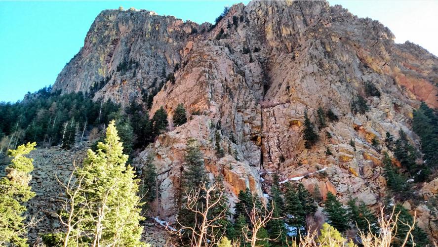
This 2.4 mile bike climb is located in NM, USA. The average gradient is 8.1% and there is a total elevation gain of 1,010 ft, finishing at 7,047 ft.
Use the profile tool, route map, and weather forecast to conquer this cycling climb.
Use the profile tool, route map, and weather forecast to conquer this cycling climb.
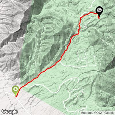
PLAN YOUR ROUTE
See more details and tools regarding this climb's grade via our interactive Profile Tool.
Information Not Available
If you have any information regarding this climb, we'd like to hear from you. Click the CONTRIBUTE button to share your thoughts with us.
Information Not Available
If you have any information regarding this climb, we'd like to hear from you. Click the CONTRIBUTE button to share your thoughts with us.
Before heading out on any cycling adventure check out our Things to Bring on a Cycling Trip and use our interactive check list to ensure you don't forget anything.
Information Not Available
If you have any information regarding this climb, we'd like to hear from you. Click the CONTRIBUTE button to share your thoughts with us.
ROUTE MAP
MEMBER RATING
CURRENT WEATHER
PJAMM TRIPS ADVENTURE STARTER BUNDLES
Check out PJAMM Adventure's prepackaged (self-guided) cycling trips. They will help you plan, document and conquer your next adventure.
NEARBY CLIMBS (0) RADIAL PROXIMITY
FROM No Climbs Found
MEMBER REVIEWS & COMMENTS
Let us know what you thought of this climb. Signup for our FREE membership to write a review or post a comment.
Already have an account?
LOG IN HERE
josephbcoolman
I lived in Albuquerque for 11 years. I climbed this road at least 4 times a month. It's very fun, hard and it has beautiful views of the Sandia mountains and the Duke City. It does get more difficult at the top. It's almost a one lane road at the top, so be careful of oncoming vehicles. The decent is fast, still be careful of autos who don't see fast moving cyclists. It's a must do if you're in the area....