13.7
PDI
14.8 mi
DISTANCE
2,980 ft
GAINED
3.6 %
AVG. GRADE
FULL CLIMB STATS
INTRO
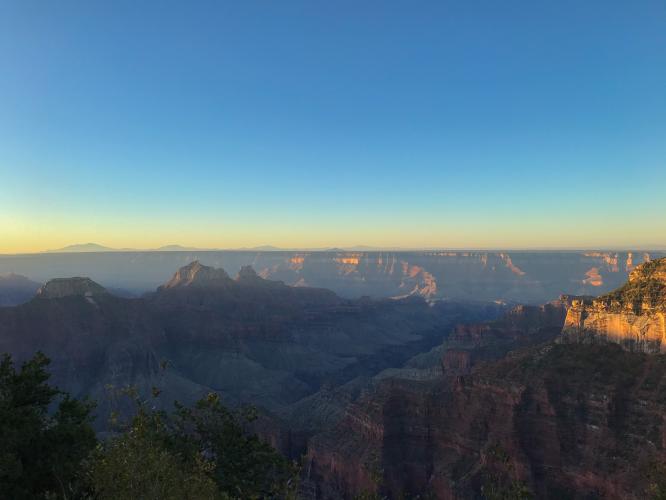
Arizona State Road 89A boasts more climbs on it than any other road in the entire state, so it's no wonder that we stumbled across one more at the most famous National Park in the world. Excellent views abound on this one, from the Vermilion Cliffs National Monument at the start to the forested Kaibab Plateau.
PLAN YOUR ROUTE
See more details and tools regarding this climb's grade via our interactive Profile Tool.
Parking:
There is parking at the Pasture Canyon Lookout Point, about 2.1 miles (3.4km) into the climb.
Roadway:
The road past the Kaibab Visitor Center (SR 67) is closed winters (the visitor center itself is only open on weekends during the winter months). While you can still ride and finish the climb, there will be no support, and odds are high that there will be snow covering the road.Click here for more info on Grand Canyon North Rim operating seasons.
Information Not Available
If you have any information regarding this climb, we'd like to hear from you. Click the CONTRIBUTE button to share your thoughts with us.
Before heading out on any cycling adventure check out our Things to Bring on a Cycling Trip and use our interactive check list to ensure you don't forget anything.
We recommend turning this climb into a full adventure, and staying at the North Rim Lodge, then riding down to the start of the climb (110 miles round trip). Sitting right on the edge of the canyon, the lodge has stunning views (and excellent breakfasts!)
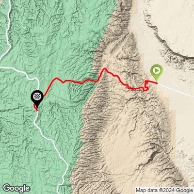
ROUTE MAP
MEMBER RATING
CURRENT WEATHER
PJAMM TRIPS ADVENTURE STARTER BUNDLES
Check out PJAMM Adventure's prepackaged (self-guided) cycling trips. They will help you plan, document and conquer your next adventure.
NEARBY CLIMBS (0) RADIAL PROXIMITY
FROM No Climbs Found
MEMBER REVIEWS & COMMENTS
Let us know what you thought of this climb. Signup for our FREE membership to write a review or post a comment.
Already have an account?
LOG IN HERE