Bombi Pass West Bike Climb - PJAMM Cycling

10.9
PDI
9.5 mi
DISTANCE
2,291 ft
GAINED
4.6 %
AVG. GRADE

FULL CLIMB STATS

INTRO

This 9.5 mile bike climb is located in British Columbia, Canada. The average gradient is 4.6% and there is a total elevation gain of 2,291 ft, finishing at 3,914 ft.

Use the profile tool, route map, and weather forecast to conquer this cycling climb.

See more details and tools regarding this climb's grade via our interactive Profile Tool.
Information Not Available

If you have any information regarding this climb, we'd like to hear from you. Click the CONTRIBUTE button to share your thoughts with us.

Information Not Available

If you have any information regarding this climb, we'd like to hear from you. Click the CONTRIBUTE button to share your thoughts with us.

Before heading out on any cycling adventure check out our Things to Bring on a Cycling Trip and use our interactive check list to ensure you don't forget anything.
Information Not Available

If you have any information regarding this climb, we'd like to hear from you. Click the CONTRIBUTE button to share your thoughts with us.

ROUTE MAP

MEMBER RATING

Not Yet Rated
-
Road
-
Traffic
-
Scenery

CURRENT WEATHER

PJAMM TRIPS ADVENTURE STARTER BUNDLES

Check out PJAMM Adventure's prepackaged (self-guided) cycling trips. They will help you plan, document and conquer your next adventure.
ALL TRIPS
Browse all of our prepackaged trips and find your next adventure!

NEARBY CLIMBS (0) RADIAL PROXIMITY

FROM
No Climbs Found

MEMBER REVIEWS & COMMENTS

Let us know what you thought of this climb. Signup for our FREE membership to write a review or post a comment.
Already have an account?
ROUTE MAP
PROFILE TOOL
Route Data
S.G. (%)
hide
Segment Data
hide

Climb Profile Not Found
CLIMB SUMMARY

Cycling Bombi Pass

FROM CASTLEGAR

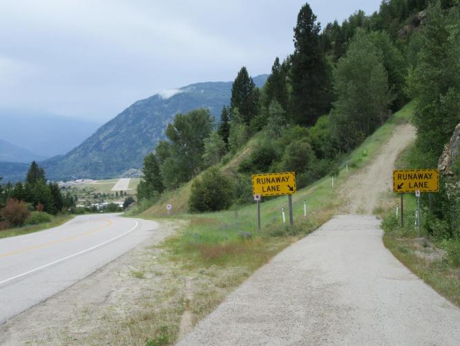
This is another highway 3 climb - this begins in Castlegar and has much the same feel to its start as Anarchist Pass, Osoyoos.  There is a long 5 km/3 miles stretch from the start of the climb to a viewpoint (km 4.5/mile 2.8) that overlooks the town of Osoyoos and the Columbia River that runs along its eastern border.  An interesting view along the first long grade is back to the north at the West Kootenay Regional Airport runway below which provides an interesting contrast from the roadway and, at one spot, the runaway truck ramp (see slideshow).

 After bending left just past the viewpoint, we are bordered by forest the remainder of the climb – the scenery is very nice and this would be an exceptional climb, but for the highway traffic.  There are a few long uphill very straight stretches that can be disheartening if one is weary or challenged by the grade of this climb.

Roadway surface and traffic:  The roadway is in excellent condition and there is good shoulder for nearly the entire climb.  The first 2.5 kilometers have two lanes in our direction.  This is highway traffic, including plenty of big rigs, that can whiz by at 80-100 kph (although the commercial trucks do labor slowly up the grade). This is not the climb for those uncomfortable with fast moving traffic and highway conditions.  

FROM SALMO

The eastern approach to Bombi Pass is very similar in roadway conditions and scenery as the last 8.5km/5.4 miles of Bombi Pass west.