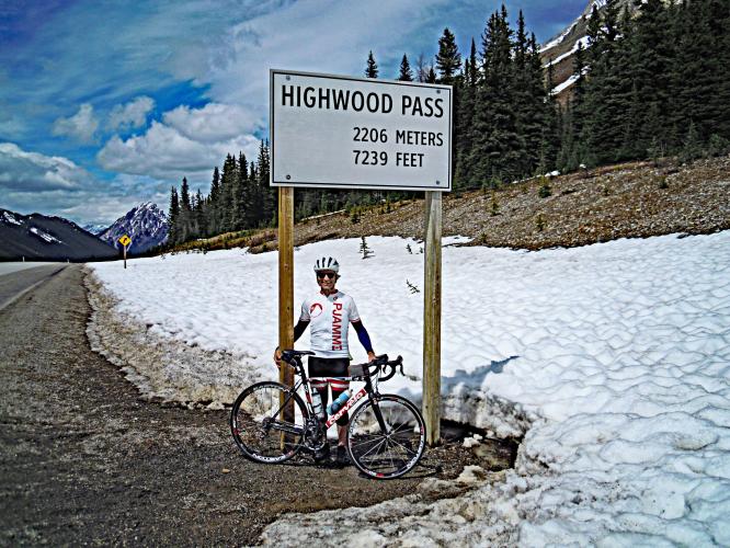
Highwood Pass North Bike Climb - PJAMM Cycling

7.6
PDI
8.5 mi
DISTANCE
1,671 ft
GAINED
3.7 %
AVG. GRADE

FULL CLIMB STATS

Page Contributor(s): Lynn Sugden, Sherwood Park, AB; Leigh McAdam, hikebiketravel.com

INTRO

This 8.5 mile bike climb is located in Alberta, Canada. The average gradient is 3.7% and there is a total elevation gain of 1,671 ft, finishing at 7,148 ft.

Use the profile tool, route map, and weather forecast to conquer this cycling climb.

PLAN YOUR ROUTE

We've partnered with Sherpa-Map.com to bring you the best route planning tool. With a PRO Membership you can use this climb as a reference when creating your route.

See more details and tools regarding this climb's grade via our interactive Profile Tool.
Roadway:  Highway 40 opens after its winter closure on June 14th. Accordingly there exists a window of opportunity when there is no traffic on the climb to the summit from either North or South. The best time to climb Highwood Pass is on a weekday between June 4th and 13th. Post opening, the traffic on this climb is low (a fraction of the traffic experienced in Banff NP just down the road) and is tempered by a two meter shoulder. 

Traffic:  The ride from the Village to the base of the climb (from the North) is busy with traffic up to the beginning of the climb (at the Highway 742 turnoff). Again there is a generous shoulder and from the Village to the campground there is a well constructed, paved and quiet bike path. Weekends are very busy in the area from Highway 1 to Highway 742.
Information Not Available

If you have any information regarding this climb, we'd like to hear from you. Click the CONTRIBUTE button to share your thoughts with us.

Before heading out on any cycling adventure check out our Things to Bring on a Cycling Trip and use our interactive check list to ensure you don't forget anything.
Information Not Available

If you have any information regarding this climb, we'd like to hear from you. Click the CONTRIBUTE button to share your thoughts with us.

ROUTE MAP

MEMBER RATING

Not Yet Rated
-
Road
-
Traffic
-
Scenery

CURRENT WEATHER

PJAMM TRIPS ADVENTURE STARTER BUNDLES

Check out PJAMM Adventure's prepackaged (self-guided) cycling trips. They will help you plan, document and conquer your next adventure.
ALL TRIPS
Browse all of our prepackaged trips and find your next adventure!

NEARBY CLIMBS (0) RADIAL PROXIMITY

FROM
No Climbs Found

MEMBER REVIEWS & COMMENTS

Let us know what you thought of this climb. Signup for our FREE membership to write a review or post a comment.
Already have an account?
ROUTE MAP
PROFILE TOOL
Route Data
S.G. (%)
hide
Segment Data
hide
CLIMB SUMMARY

Cycling Highwood Pass North - Canada’s highest paved road.

Ride 13.6 kilometers gaining 508 meters at 3.6% average grade.

Within the Peter Lougheed Provincial Park on Alberta Highway 40, at 2,179 meters (7,148’) Highwood Pass is the highest paved pass in all of Canada.

Highwood Pass lies in the Misty Range of the Canadian Rockies. The route from the south begins near Lower Kananaskis Lake which, along with the Upper Kananaskis, are a pair of beautiful crystal clear Rocky Mountain Lakes definitely worth the short trip to for hiking and scenic opportunities.  

An appropriate name for the highest pass and paved road in Canada 👍👍

Elpoca Mountain (9,961’)  photo top left.

The road is closed to vehicles from December 1 to June 15 each year for the migration and protection of wildlife.

Views of the Misty Mountains along the climb are spectacular.

Thank you Lynne and Lynn Sugden, AB, CAN

Thank you Leigh McAdam.

The Highwood Pass Loop - One of Canada’s Best Drives - hikebiketravel.com, Leigh McAdam.