
15.7
PDI
6.5 mi
DISTANCE
2,485 ft
GAINED
7.2 %
AVG. GRADE
FULL CLIMB STATS
INTRO
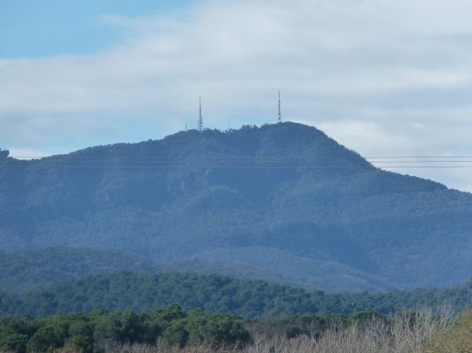
Ask anyone who trains out of Girona for their Rocacorba time and they'll have one. The road is a dead end up the mountain west of Banyoles, there's only one way up, and that makes it the area's measuring stick: Ryder Hesjedal set the unofficial record of about 27 minutes in June 2012, riding it flat out on the Friday before the Tour as he did every year, and David Millar and Michael Barry named their Girona club, Velo Club Rocacorba, after it in 2009.
For the rest of us it's 10.4 km (6.5 mi) from the GI-5247 near the lake to the masts, gaining 757 m (2485 ft) at 7.2%, and it's paced to make you go too hard at the bottom. The first 5 km roll up at 4.5 to 6.5% past Pujarnol and feel easy. Then the lane narrows, the trees close in and the next three kilometers go 10.7%, 9.9% and 8.8%. You get a kilometer at under 4% around km 9 to recover, and the last kilometer goes back up at about 10% to the finish.
The top 4 km were dirt until the mid-2000s; before the road was paved it was mostly used by radio-mast engineers, mountain bikers and the hang-gliding club that built a launch ramp near the summit in 1989. There's no cafe up there now - just the masts, the ramp and, close by, the 12th-century Santuari de Rocacorba on its crag, with the Pyrenees lined up to the north on a clear day.
PLAN YOUR ROUTE
 We've partnered with Sherpa-Map.com to bring you the best route planning tool. With a PRO Membership you can use this climb as a reference when creating your route.
Overall: 10.4 km (6.5 mi) with 757 m (2485 ft) of climbing at a 7.2% average, from 168 m (551 ft) to 912 m (2991 ft) at the masts.
Km 0-5: 4.4%, 5.3%, 6.6%, 5.3% and 5.4% - the long warm-up past Pujarnol.
Km 5-8: 10.7%, 9.9% and 8.8% - the heart of the climb, on the narrow forest lane.
Km 8-9: 3.8% - the breather.
Km 9-10.4: about 10% to the finish.
Steepest sections: 100 m at 12.7%, 500 m at 12%, 1 km at 10.9%, 2 km at 10.8%, 5 km at 8.8%.
Roadway: Paved to the top, but for most of the climb it's a single-track lane with room for one car, with cracked and patched tarmac and leaves and grit under the trees. A herd of goats lives around the upper hairpins and wanders onto the road, especially in the cooler months. It's a dead end, so you come down the same way - about 11 km with no real switchbacks to scrub off speed, so take the blind bends easy.
Traffic: Very light: the odd car heading for the masts or the sanctuary, and a lot of cyclists. On a busy training morning you'll meet riders coming down fast on the narrow sections, so hold your line on the way up.
Parking: Banyoles is the place to leave the car - there's parking along the lake shore - and from there it's a short ride round the south end of the lake to the start. There's nowhere sensible to leave a car at the bottom of the climb itself.
Gear: The middle three kilometers and the last one are close to 10%, so a compact with a 30 or 32 sprocket is the comfortable choice; if you're riding for a time, have your gear sorted before the steep part starts at km 5. In summer go early - the lower slopes are in the shade in the morning, and the afternoons in the Pla de l'Estany get hot.
Provisions: There's no water on the climb and nothing to buy at the top (the old cafe closed years ago), so leave Banyoles with full bottles. The cafes along the lakefront in Banyoles are where most people end up afterwards.
Before heading out on any cycling adventure check out our Things to Bring on a Cycling Trip and use our interactive check list to ensure you don't forget anything.
Girona is the base - a compact old town on the Onyar with hotels, bike shops, rental fleets and plenty of coffee aimed at the riders who live and train there, and it's an easy ride to Banyoles on quiet roads. Banyoles is worth a stop in its own right: the lake hosted the rowing at the 1992 Barcelona Olympics, and a flat path runs all the way around it, good for a cool-down spin with an ice cream.
The classic Girona loops pair Rocacorba with Els Àngels, the climb east of Girona (our Els Àngels des de Madremanya page covers its quieter side), and our Mare de Déu del Mont page climbs the big mountain north-west of Banyoles.
ROUTE MAP

MEMBER RATING
CURRENT WEATHER
PJAMM TRIPS ADVENTURE STARTER BUNDLES
Check out PJAMM Adventure's prepackaged (self-guided) cycling trips. They will help you plan, document and conquer your next adventure.
NEARBY CLIMBS (0) RADIAL PROXIMITY
FROM No Climbs Found
MEMBER REVIEWS & COMMENTS
Let us know what you thought of this climb. Signup for our FREE membership to write a review or post a comment.
Already have an account?
LOG IN HERE
carlinguernsey
This is the key climb in the Girona area. There are extended 10%+ sections and some steeper ramps. As others have noted, the road is bad in some places. The view at the top is panoramic.
redhillaz


Nice climb, mostly 8-9%, a flat section in the middle provides a good respite. The road is in pretty good shape overall, some sections have cracking asphalt and need to be mindful on the decent. Mostly shaded by trees which is nice during the climb. Great views from the top!
boundah
A hidden gem! One way up & down so almost zero traffic. Don't be fooled by the 7.5% average gradient- there are constant changes so it's hard to get a rhythm going. Great views towards the Pyrenees from the top. Careful on the descent: the surface isn't in great condition.
