
29.8
PDI
10.3 mi
DISTANCE
4,224 ft
GAINED
7.7 %
AVG. GRADE
FULL CLIMB STATS
Page Contributor(s): Erwan Treguier, Brittany, France
INTRO
Col du Sabot climbs 16.6 km (10.3 mi) from the Eau d'Olle valley near Vaujany to 2,100 m (6,890 ft) - the highest paved road pass in the Isere department - gaining 1,287 m (4,224 ft) at a 7.7% average grade. It sits on the same high plateau as Alpe d'Huez and the Col de Sarenne, just a valley over, but it's a far quieter, more rugged road than its famous neighbors.
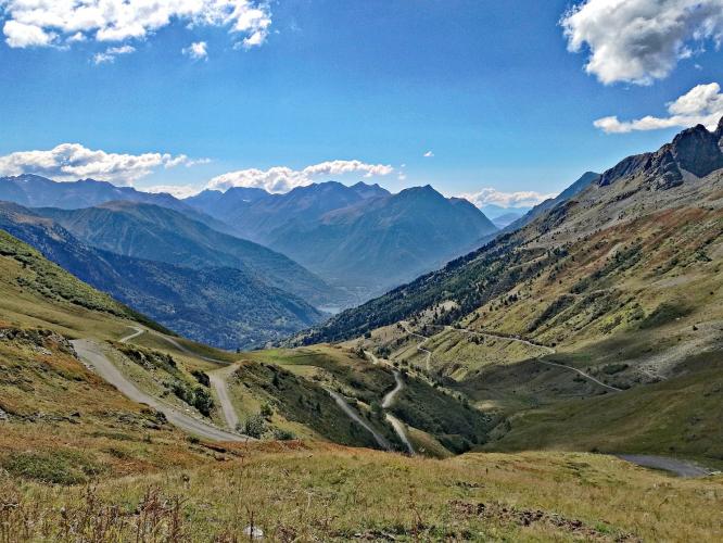
The lower kilometers climb through Vaujany, a real ski-station village with cable cars and shops, but past Vaujany the character changes completely: the road narrows to a single lane, the pavement roughens with loose gravel and stones in patches, and the switchbacks tighten as the road claws up bare alpine terrain with almost no guardrails. Riders and reviewers routinely rank it among the toughest, most remote climbs in the Oisans.
Every Tuesday morning in summer, the Oisans Col Series closes this exact road to motor traffic from 9am to noon for a free, untimed group ride to the pass - it's been running for over a decade, with refreshments at the summit courtesy of the Vaujany and Oisans tourist offices.
At the top, the payoff is a view over the turquoise Lac du Grand Maison reservoir and the Eau d'Olle valley. Like most high Oisans passes, the road typically opens by mid-June and closes around mid-November depending on snow - confirm current conditions before an early- or late-season attempt, especially given how exposed and technical the upper switchbacks are.
PLAN YOUR ROUTE
 We've partnered with Sherpa-Map.com to bring you the best route planning tool. With a PRO Membership you can use this climb as a reference when creating your route.
 The climb averages 7.7% over 16.6 km (10.3 mi), gaining 1,287 m (4,224 ft) from about 824 m (2,704 ft) near Vaujany to the 2,100 m (6,890 ft) summit - the highest paved pass in Isere. It starts as the steepest sustained stretch on the route and never fully relents: the opening quarter-mile averages 11.5%, easing only gradually to 11.0% by the first mile, 9.7% by 2.5 miles, and 9.2% by 5 miles.
Riders routinely rank this among the hardest sustained grades in the French Alps, comparable to the Col du Granon - there's no flat recovery section anywhere on the way to the pass.
Roadway: Paved the entire way, but the character changes sharply above Vaujany - the lower kilometers through the ski station are smooth and well-maintained, while the upper switchbacks narrow to a single lane with rougher, worn asphalt and patches of loose gravel and stones, especially just after the winter opening. The road typically opens by mid-June and closes around mid-November depending on snowfall - check with Vaujany's tourist office before an early- or late-season ride.
Traffic: Light overall, and lightest of all on Tuesday mornings in summer, when the Oisans Col Series closes the road to motor vehicles from 9am to noon for a free, untimed group cycling event that's been running for over a decade. Outside that window, expect occasional local and tourist traffic through Vaujany, thinning to almost nothing above the village.
Parking: Vaujany has close to 500 free parking spaces, plus street parking through the village - a practical base for the climb, with shops, cafes, and a bike shop (Atou'Sport) at the resort's main level. Riders starting from the valley floor near Le Verney, at the very base of the access road, will find additional pull-offs near the reservoir.
Provisions: Vaujany, about a third of the way up, is the last real place to buy food or fill bottles - it has a small supermarket and several cafes at the resort's main level. Above the village there's nothing until the summit, where the Oisans Col Series brings refreshments up on Tuesday mornings in summer; other days, plan to be self-sufficient for the whole upper climb.
Gear: This is one of the more demanding sustained climbs in the Oisans, with segment averages over 11% near the base and no real flat sections above Vaujany - a compact crank and a wide-range cassette are worth having. The rougher, sometimes gravelly pavement in the upper switchbacks also rewards slightly wider tires and a cautious line, especially on the descent.
Before heading out on any cycling adventure check out our Things to Bring on a Cycling Trip and use our interactive check list to ensure you don't forget anything.
Vaujany sits just one valley over from Alpe d'Huez and Le Bourg-d'Oisans, so it's easy to combine Col du Sabot with a stay built around the bigger Oisans classics - Alpe d'Huez, Col de la Croix de Fer, and Col du Glandon are all within a short drive. Col du Sabot itself is the quieter alternative on this side of the valley: fewer tour buses, a rougher road, and a summit view over Lac du Grand Maison that most visitors to the area never see.
If you're staying to ride Alpe d'Huez, Col du Sabot makes a good detour on the way back down the D43 rather than a stand-alone trip. Conditions can shift fast above Vaujany at this altitude - check both the valley and summit with our Weather tool before you head up.
ROUTE MAP

MEMBER RATING
CURRENT WEATHER
PJAMM TRIPS ADVENTURE STARTER BUNDLES
Check out PJAMM Adventure's prepackaged (self-guided) cycling trips. They will help you plan, document and conquer your next adventure.
NEARBY CLIMBS (0) RADIAL PROXIMITY
FROM No Climbs Found
MEMBER REVIEWS & COMMENTS
Let us know what you thought of this climb. Signup for our FREE membership to write a review or post a comment.
Already have an account?
LOG IN HERE
