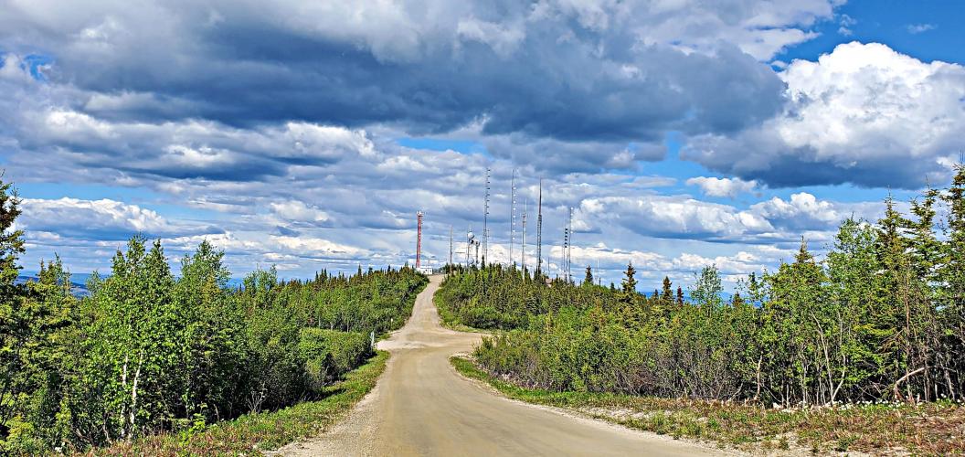
Ester Dome Bike Climb - PJAMM Cycling

12.2
PDI
3.8 mi
DISTANCE
1,697 ft
GAINED
8.3 %
AVG. GRADE

FULL CLIMB STATS

Page Contributor(s): Bryant Robbins and Jason Roland, Palmer, AK, USA

INTRO

This 3.8 mile bike climb is located in AK, USA. The average gradient is 8.3% and there is a total elevation gain of 1,697 ft, finishing at 2,661 ft.

Use the profile tool, route map, and weather forecast to conquer this cycling climb.

PLAN YOUR ROUTE

We've partnered with Sherpa-Map.com to bring you the best route planning tool. With a PRO Membership you can use this climb as a reference when creating your route.

See more details and tools regarding this climb's grade via our interactive Profile Tool.
Roadway:  Gravel but can be ridden with a road bike - 28 or 30mm tires recommended. 
Information Not Available

If you have any information regarding this climb, we'd like to hear from you. Click the CONTRIBUTE button to share your thoughts with us.

Before heading out on any cycling adventure check out our Things to Bring on a Cycling Trip and use our interactive check list to ensure you don't forget anything.
Information Not Available

If you have any information regarding this climb, we'd like to hear from you. Click the CONTRIBUTE button to share your thoughts with us.

ROUTE MAP

MEMBER RATING

Not Yet Rated
-
Road
-
Traffic
-
Scenery

CURRENT WEATHER

PJAMM TRIPS ADVENTURE STARTER BUNDLES

Check out PJAMM Adventure's prepackaged (self-guided) cycling trips. They will help you plan, document and conquer your next adventure.
ALL TRIPS
Browse all of our prepackaged trips and find your next adventure!
Alaska
United States (AK)
22 ROUTES
17 POIs
ROUTE STATS (TOTAL)
287
mi
DISTANCE
43,151
ft
ELEV. GAIN

NEARBY CLIMBS (0) RADIAL PROXIMITY

FROM
No Climbs Found

MEMBER REVIEWS & COMMENTS

Let us know what you thought of this climb. Signup for our FREE membership to write a review or post a comment.
Already have an account?
ROUTE MAP
PROFILE TOOL
Route Data
S.G. (%)
hide
Segment Data
hide
CLIMB SUMMARY

Cycling Ester Dome        Ride 3.8 miles gaining 1,700’ at 8.3% average grade.

Climb summary by PJAMM ambassador Bryant Robbins, Palmer, Alaska.


Ester Dome is located outside Fairbanks Alaska and can be accessed from town via bike paths and quiet roads. The ride can be turned into a loop by adding Henderson Road, although this is a considerably more primitive option than the main Ester Dome Road. The climb itself is entirely gravel and generally steep. Although the gravel is mostly well compacted, it does make the ten-plus percent grades that little bit more challenging.

There are two summits at the top. The topo map lists the one to the right as Ester Dome, but the one to the left is slightly higher according to the map. There is an observatory, a number of antennas, and a giant swing at the top. We leave it to you to decide which is most interesting, but only the swing was open to the public when we were there. The summit seems to be a local gathering place. A band was setting up when we arrived at the top, so you might be greeted with music and a cold beverage if you ride it on a weekend.