![Cycling Lagunas de Mojanda, Ecuador panoramic view of gravel road with white truck being unloaded of bikes, next to large body of water and tall mountain in background]()
Cycling Lagunas de Mojanda - some of the greatest cobbles in the world.
Ride 14.6 kilometers gaining 1,232 meters at 7.9% average grade.
Climb summary and photos by PJAMM ambassador Hernando Bermudez.
![Cycling Lagunas de Mojanda, Ecuador Cycling Lagunas de Mojanda, Ecuador - photo collage; signs for Mojanda; PJAMM Cyclist rides beyond cattle in roadway]()
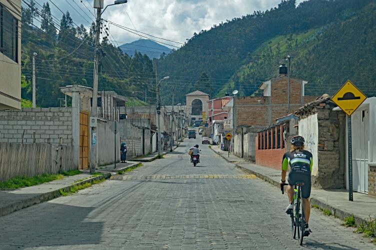
This was the first climb on my trip to Ecuador. After landing at the Quito Airport I was picked up by my companion for this trip, Esteban of Carro Escoba, one of the only SAG services available in Ecuador. With this being my first experience riding a cobbled climb I was a bit unsure what to expect. My prior research consisted of looking through the Strava activities that included the segment for the climb, where I was unable to find any images of anyone who had done the climb on a road or gravel bike. This, combined with Esteban’s belief that a mountain bike was needed, led us to securing a rental mountain bike from a friendly bike shop before driving the hour and a half north to the town of Otavalo where the climb starts. Upon reaching the starting spot I was convinced to start the ride on my road bike with its 23mm wide tires by the smooth brick road thinking I could switch to the MTB if necessary.
![Cycling Lagunas de Mojanda, Ecuador PJAMM Cyclist rides on cobbled roadway at climb's beginning]()
I’m thankful for the deception those few meters of brick road caused, because despite the much rougher nature of the actual cobbles that make up the climb, I managed to ride it all on my own bike. I would certainly recommend wider tires to anyone doing this ride as you'll be able to run lower pressures for more comfort and be less likely to hit the space between the cobbles just so that it causes a fall; I had two or three scares of this sort during my ride but managed to stay upright. Most of the road is paved with smaller cobbles but there are larger cobbles lined up to form lanes in the road, I don’t recommend trying to ride on these lines as they offer lower traction.
![Cycling Lagunas de Mojanda, Ecuador Cycling Lagunas de Mojanda, Ecuador - up close view of cobblestone roadway]()
The lower slopes of the climb are still inside town and it’s important to be prepared for off-leash dogs that can be quite scary. I’ve been told by more experienced folks that spraying them with water from a bottle is a good strategy to keep them away.
There are a few steep pitches on that beginning section but I could still manage them seated with my 34 chairing and 32 cog. I avoided standing almost entirely, as the natural swaying and loss of traction made it not worthwhile.
After the road leaves town the scenery changes to high altitude forest, soon turning into Paramo, and the road settles around 8-9% for about five miles before hitting a couple of miles above 10% and then easing to 2-3% for the final mile or so before reaching the lake at the top.
![Cycling Lagunas de Mojanda, Ecuador Cycling Lagunas de Mojanda, Ecuador - photo collage shows PJAMM Cyclist riding on one-lane mountain roadway; gravel and cobblestone roadway]()
I was curious about how much the cobbles added to the difficulty of the climb, so I decided to try and do a non-scientific comparison. On the left is the data for miles 5-7 of the Mojanda climb, while on the right is data from three weeks before on a two mile segment close to the top of the Alto del Aguila climb in Colombia (Alto del Anguila, Pacho). The starting altitude was almost the same and the temperature was about 75 degrees on both days.
![]()
I took about 35% more time to complete the Mojanda segment with a bit less power and at slightly lower HR, and this seems like a good approximation of the extra difficulty added by these cobbles. For a scientific study about this see this article from Science Direct.
![Cycling Lagunas de Mojanda, Ecuador PJAMM Cyclist Hernando stands with two thumbs up next to lake]()
Thank you Hernando!

 We've partnered with Sherpa-Map.com to bring you the best route planning tool. With a PRO Membership you can use this climb as a reference when creating your route.

