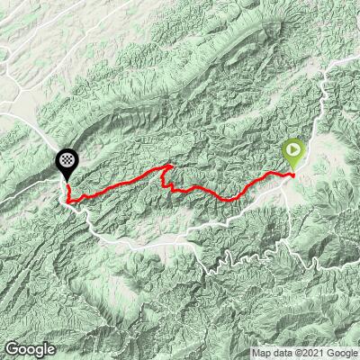
5.2
PDI
14.7 mi
DISTANCE
2,249 ft
GAINED
-0.58 %
AVG. GRADE
FULL CLIMB STATS
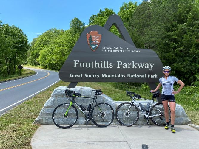
Page Contributor(s): Carla and Tom Morton, Granger, IN, USA
INTRO
Ride from the northernmost point of the Foothills Parkway to the mid-point in Walland. There are eight unnamed scenic viewpoints along this route.
PLAN YOUR ROUTE
There are two primary climbs on this route: (a) 4.6 miles at 4.2% at the beginning, and (b) 1.5 miles at 5.8% beginning at mile 8.7.
See more details and tools regarding this climb's grade via the “Profile Tool” button.
Roadway: This is a two lane road in excellent condition with a narrow shoulder throughout most of the ride.
Traffic: Mild.
Parking: On the side of the road at the start of the climb (Map; Street View).
Provisions: At Marathon Gas at the start of the climb, or near the finish in Townsend 4.5 miles south of Walland on Highway 321 (Map).
Before heading out on any cycling adventure check out our Things to Bring on a Cycling Trip and use our interactive check list to ensure you don't forget anything.
A moderately challenging option is an out-and-back of this ride - 30 miles gaining 5,280' (Map), or the very challenging out-and-back of the full Parkway to its southern finish/start and back at 63 miles and 8,370' of climbing (Map).
Use the “Routes in Area” button on the menu bar to see other bike climbs in this area.
ROUTE MAP
MEMBER RATING
CURRENT WEATHER
PJAMM TRIPS ADVENTURE STARTER BUNDLES
Check out PJAMM Adventure's prepackaged (self-guided) cycling trips. They will help you plan, document and conquer your next adventure.
NEARBY CLIMBS (0) RADIAL PROXIMITY
FROM No Climbs Found
MEMBER REVIEWS & COMMENTS
Let us know what you thought of this climb. Signup for our FREE membership to write a review or post a comment.
Already have an account?
LOG IN HERE