5.5
PDI
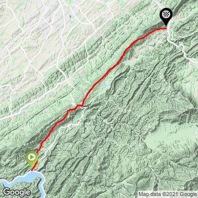
16.7 mi
DISTANCE
2,233 ft
GAINED
0.2 %
AVG. GRADE
FULL CLIMB STATS
INTRO
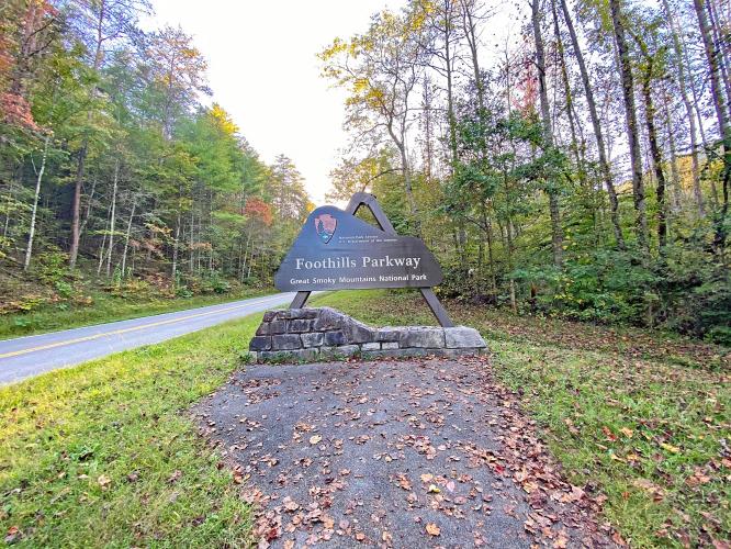
This is the southern beginning of the Foothills Parkway. This segment takes us to the approximate halfway point in Walland seventeen miles northeast. There are eleven unnamed scenic overlooks along this segment of the Parkway. See, Road Trips & Coffee, Foothills Parkway.
PLAN YOUR ROUTE
There is one major climb (6.6 miles at 4.7%) and one minor climb (1.2 miles at 3.4%) on this ride.
See more details and tools regarding this climb's grade via the “Profile Tool” button.
Roadway: This is a two lane road in excellent condition with a narrow shoulder throughout most of the ride.
Provisions: None on the route, but there are food and drinks 3.7 miles west at the Highway 129 store next to the helipad to medivac Tail of the Dragon victims 🤕 (Map; Street View), or seven miles west at Dragon 318 Market (Map).
Before heading out on any cycling adventure check out our Things to Bring on a Cycling Trip and use our interactive check list to ensure you don't forget anything.
A nice option on this ride is to do it as an out and back for the full Parkway at 63 miles and 8,360' (Map) or to the half-way point at Walland and back at 33.5 miles and 4,210' gained (Map).
If you are nutso, the start of the Tail of the Dragon is only 3.2 miles from the start of Foothills Parkway South (Map; Street View).
See more details and tools regarding this climb's grade via the “Profile Tool” button.
ROUTE MAP
MEMBER RATING
CURRENT WEATHER
PJAMM TRIPS ADVENTURE STARTER BUNDLES
Check out PJAMM Adventure's prepackaged (self-guided) cycling trips. They will help you plan, document and conquer your next adventure.
NEARBY CLIMBS (0) RADIAL PROXIMITY
FROM No Climbs Found
MEMBER REVIEWS & COMMENTS
Let us know what you thought of this climb. Signup for our FREE membership to write a review or post a comment.
Already have an account?
LOG IN HERE