4.9
PDI
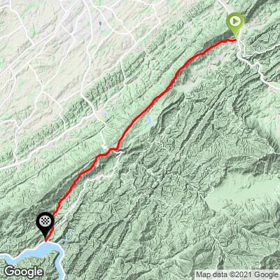
16.7 mi
DISTANCE
2,098 ft
GAINED
-0.17 %
AVG. GRADE
FULL CLIMB STATS
INTRO
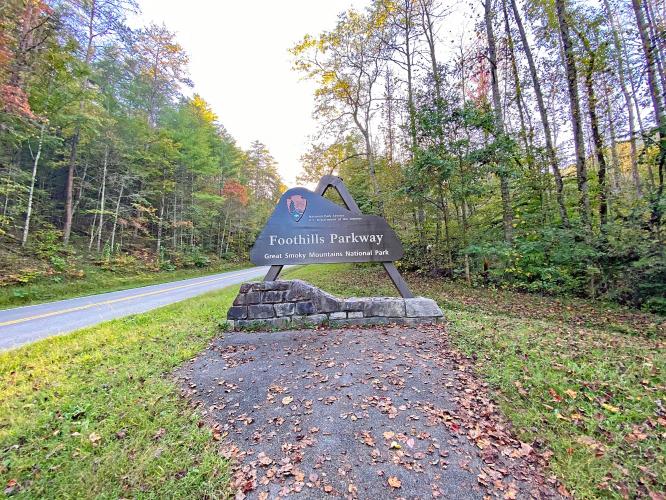
This ride takes us from Walland, the approximate mid-point of the full Foothills Parkway to the southern finish/start point at Lake Chilhowee. We are surrounded by thick forest the entire ride although there are a few openings at the eleven unnamed viewpoints along the way. See Road Trips & Coffee - Foothills Parkway.
PLAN YOUR ROUTE
There are two primary climbs on this route: (a) 2.8 miles at 5.8% at the start and, (b) 2.8 miles beginning at mile 4.8 at 5.3%.
See more details and tools regarding this climb's grade via the “Profile Tool” button.
Roadway: This is a two lane road in excellent condition with a narrow shoulder throughout most of the ride.
Traffic: Mild.
Parking: On the side of the road or at the start, just be careful not to block the Parkway sign (Map; Street View), or at the Bike Parking lot in Townsend 4.2 miles southeast (Map; Street View).
Provisions: 4.6 miles west in Townsend (Map) or at the end of the climb - 3.7 miles west at the Highway 129 store next to the helipad to medivac Tail of the Dragon victims 🤕 (Map; Street View), or seven miles west at Dragon 318 Market (Map).
Before heading out on any cycling adventure check out our Things to Bring on a Cycling Trip and use our interactive check list to ensure you don't forget anything.
This is a nice out-and-back at 33 miles and 4,170' of climbing: Map.
Use the “Routes in Area” button on the menu bar to see other bike climbs in this area.
ROUTE MAP
MEMBER RATING
CURRENT WEATHER
PJAMM TRIPS ADVENTURE STARTER BUNDLES
Check out PJAMM Adventure's prepackaged (self-guided) cycling trips. They will help you plan, document and conquer your next adventure.
NEARBY CLIMBS (0) RADIAL PROXIMITY
FROM No Climbs Found
MEMBER REVIEWS & COMMENTS
Let us know what you thought of this climb. Signup for our FREE membership to write a review or post a comment.
Already have an account?
LOG IN HERE