22
PDI
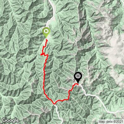
17.7 mi
DISTANCE
4,511 ft
GAINED
4.5 %
AVG. GRADE
FULL CLIMB STATS
Page Contributor(s): Nick Payne, Canberra, Australia
INTRO
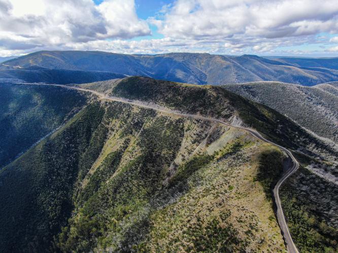
Not only epic, Mount Hotham is Australia's 5th most difficult bike climb.
PLAN YOUR ROUTE
See more details and tools regarding this climb's grade via our interactive Profile Tool.
Information Not Available
If you have any information regarding this climb, we'd like to hear from you. Click the CONTRIBUTE button to share your thoughts with us.
Information Not Available
If you have any information regarding this climb, we'd like to hear from you. Click the CONTRIBUTE button to share your thoughts with us.
Before heading out on any cycling adventure check out our Things to Bring on a Cycling Trip and use our interactive check list to ensure you don't forget anything.
Information Not Available
If you have any information regarding this climb, we'd like to hear from you. Click the CONTRIBUTE button to share your thoughts with us.
ROUTE MAP
MEMBER RATING
CURRENT WEATHER
PJAMM TRIPS ADVENTURE STARTER BUNDLES
Check out PJAMM Adventure's prepackaged (self-guided) cycling trips. They will help you plan, document and conquer your next adventure.
NEARBY CLIMBS (0) RADIAL PROXIMITY
FROM No Climbs Found
MEMBER REVIEWS & COMMENTS
Let us know what you thought of this climb. Signup for our FREE membership to write a review or post a comment.
Already have an account?
LOG IN HERE
NickPayne

This climb divides into three parts. The first third is ~10km of mostly 5-7% gradient, with one short steep section at The Meg when crossing the ridge. The second third is 1-3% false flat. Once through the park gates, the more serious climbing of the final third commences. This section is quite irregular with several sections of over 10% gradient and a couple of short downhill bits. Save something for the final couple of kilometres, which average around 10%.