![Cycling Mount Buffalo, Victoria, Australia sign for Mount Buffalo Chalet]()
Cycling Mount Buffalo, Victoria, Australia
Ride 18.3 kilometers gaining 1,031 meters at 5.6% average grade.
Mount Buffalo is located in Mount Buffalo National Park in Victoria, Australia. This climb is ranked as the seventh most difficult climb in Australia and is one of the most scenic, particularly if you travel 2.6 kilometers past the high point of the climb to Gorge Day Visitor Area where you can see the spectacular views of Mount Buffalo from the platform, including the gorge below via the glass viewing floor - Map to Top.
![Mount Buffalo National Park sign says "Welcome to Mount Buffalo National Park," views along the climb including huge rock walls]()
No cost to enter Mount Buffalo NP as of April 2022.
Mount Buffalo is in the Australian Alps, located in southeast Australia. The alps are the highest mountain range in the country.
![Mount Buffalo National Park bike parked against guardrail at Climb Start, Mt. Buffalo National Park]()
Climb start.
Mount Buffalo National Park was established in 1898 and is one of Australia’s oldest national parks, which is saying quite a lot considering that Australia has 685 national parks (more than any other country). Four percent of this vast continent is covered by national park.
For being such a remote bike climb, this one is quite popular with 17,590 Strava members having completed it as of April 2022.
![Cycling Mount Buffalo road signs along the climb reminding drivers to share the road with cyclists]()
Popular and bike friendly.
Photo left at 1.1 km; photo right at 14.3 km.
Climb Summary by PJAMM Cycling’s Brad Butterfield.
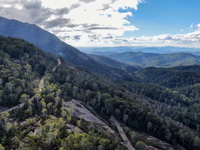
Starting at the entrance to Mt. Buffalo National Park (no entrance fee!) the gradient quickly tilts up to about 5% and stays there for the next ten miles. This being a National Park road, there are some very popular tourist towns (Bright, Harrietville, and others nearby) the road was quite busy the day I rode. Every few minutes a string of cars would pass, but they were all going cyclist friendly speed. A series of hairpins brings you up closer to some remarkable slabs of rock and stunning views of the valleys and surrounding mountains. At the corner marked “The Gap” after just over 16 kilometers of climbing, the real climb is over. However it is a crime not to continue up the road 2.6 more kilometers to reach the view point and cafe. Make a left onto Chalet Road to access the viewpoint and cafe, and thank me later! Up there are the most jaw-dropping views I have yet seen in Australia.
![Cycling Mount Buffalo photo collage shows vies along the climb; sign reading "Beware Wildlife Next 20 km," eucalyptus-lined roadway; Eurobin Creek]()
Photo bottom right - pass over Eurobin Creek at kilometer 2.5.
![Cycling Mount Buffalo huge rock faces and Eurobin Falls]()
Eurobin Creek flows to and over Eurobin Falls.
It is a 0.8 mile out and back hike to Eurobin Falls from the road (AllTrails - Eurobin Falls Walk).
![Cycling Mount Buffalo lush green forestation and mountain views]()
![Cycling Mount Buffalo eucalyptus-lined roadways]()
![Cycling Mount Buffalo aerial drone view shows huge hairpin turn]()
There are plenty of twists, turns and curves on this climb.
![Cycling Mount Buffalo huge slabs of rock 2.6 km past climb finish]()
2.6 kilometers past the climb finish point.
![Cycling Mount Buffalo huge rock face with Mount Buffalo Chalet and lookout and hang glider launch ramp pointed out]()

 We've partnered with Sherpa-Map.com to bring you the best route planning tool. With a PRO Membership you can use this climb as a reference when creating your route.


