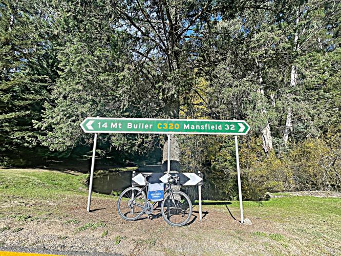
![Cycling Mt. Buller, Victoria, Australia bike parked in front of road sign for Mt Buller and Mansfield]()
Cycling Mt. Buller, Victoria, Australia
Ride 15 kilometers gaining 902 meters at 6% average grade.
Mt. Buller is ranked the tenth hardest bike climb in Australia. This is a popular bike route, with KM markers and Share the Road Signs - 7,200 Strava members have ridden this segment as of April 2022.
![Cycling Mt. Buller, Victoria, Australia Tour down Under KM Marker for Mt. Buller, Share the Road signs, bike parked next to rock with "Mt Buller" carved into it]()
The climb begins in just north of Sawmill Settlement and ends at the resort town of Mount Buller Alpine Village, the Australian ski resort town with the most beds.
![Cycling Mt. Buller, Victoria, Australia Mt. Buller km sign marking 15 km; start elevation 670 m, finish elevation 1590 m]()
The steepest part of the climb is 8.6% and begins at kilometer 13.6 near the top of the climb.
![Cycling Mt. Buller, Victoria, Australia climb start; road sign for Mirimbah Park]()
Climb begins at the entrance to Mirimbah Park by riding east up Mt. Buller Road.
Climb report by PJAMM Cycling’s Brad Butterfield:
At the start coordinate of the climb, there is a large public park offering free parking and restroom. A perfect place to park the car if you are driving into the climb. On the day that I rode Mt. Buller, the park was all but empty -- just me and one Aussie Angler. I couldn’t find any water spigots at the park, so make sure you pack what you need for the ride. The last decent town before the climb is “Mansfield,” about 30 minutes away. The climb gradient never deviates much from the average, making for a mellow, albeit long, ascent to the ski village. There are a series of switchbacks towards the top, but the thick trees block any views of the road and mountains surrounding. In late April when I rode, the summit ski village was nearly a ghost town. There were only a few road workers and one or two mountain bikers. This is a particularly fun descent as the road quality is absolutely perfect and the switchbacks are gentle enough to keep up speed. The only purpose of the road is the ski village, so as long as it’s the off season, I think it’s safe to assume you’ll have the road to yourself.
![Cycling Mt. Buller, Victoria, Australia roadway along the climb; road sign warns of winding road]()
![Cycling Mt. Buller, Victoria, Australia various yellow "Bike Buller" signs along the climb]()
Popular cycling road.
![Cycling Mt. Buller, Victoria, Australia aerial drone views of hairpin turns along the climb]()
The route is very windy and has several great hairpins, particularly near the top.
![Cycling Mt. Buller, Victoria, Australia views along the climb including roadside waterfalls, thick forestation, and a long bright turquoise fence along the roadway]()
![Cycling Mt. Buller, Victoria, Australia road signs for Hell Corner]()
Hell corner is on the steepest segment of road (nearly 9%) at the second to last hairpin near the top.
![Cycling Mt. Buller, Victoria, Australia tiny little gnome house built against tree on road side]()
Built in honor of the local Mountain Pygmy-possums inhabiting the area.
Located at kilometer 1.9.
![Cycling Mt. Buller, Victoria, Australia signs for Dump Inn]()
Dump Inn is a function room on Mt. Buller - Mt. Buller - Dump Inn.
![Cycling Mt. Buller, Victoria, Australia aerial drone view of climb finish at Mt. Buller Alpine Village and Resort]()
Finish at Mt. Buller Alpine Village -- the most rooms of any alpine resort in Australia.

 We've partnered with Sherpa-Map.com to bring you the best route planning tool. With a PRO Membership you can use this climb as a reference when creating your route.

