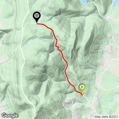
5.9
PDI
3 mi
DISTANCE
1,011 ft
GAINED
6.5 %
AVG. GRADE
FULL CLIMB STATS
Page Contributor(s): Dan Razum, Campbell, CA, USA
INTRO
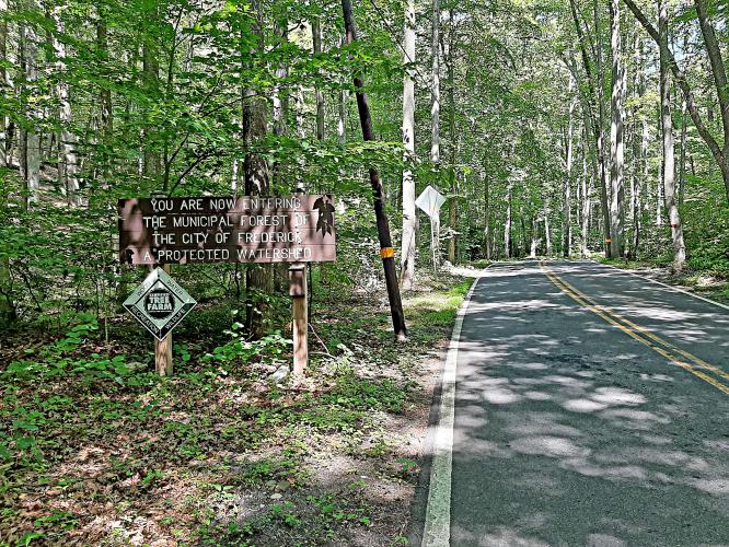
This 3 mile bike climb is located in MD, USA. The average gradient is 6.5% and there is a total elevation gain of 1,011 ft, finishing at 1,598 ft.
Use the profile tool, route map, and weather forecast to conquer this cycling climb.
Use the profile tool, route map, and weather forecast to conquer this cycling climb.
PLAN YOUR ROUTE
See more details and tools regarding this climb's grade via our interactive Profile Tool.
Information Not Available
If you have any information regarding this climb, we'd like to hear from you. Click the CONTRIBUTE button to share your thoughts with us.
Information Not Available
If you have any information regarding this climb, we'd like to hear from you. Click the CONTRIBUTE button to share your thoughts with us.
Before heading out on any cycling adventure check out our Things to Bring on a Cycling Trip and use our interactive check list to ensure you don't forget anything.
Information Not Available
If you have any information regarding this climb, we'd like to hear from you. Click the CONTRIBUTE button to share your thoughts with us.
ROUTE MAP
MEMBER RATING
CURRENT WEATHER
PJAMM TRIPS ADVENTURE STARTER BUNDLES
Check out PJAMM Adventure's prepackaged (self-guided) cycling trips. They will help you plan, document and conquer your next adventure.
NEARBY CLIMBS (0) RADIAL PROXIMITY
FROM No Climbs Found
MEMBER REVIEWS & COMMENTS
Let us know what you thought of this climb. Signup for our FREE membership to write a review or post a comment.
Already have an account?
LOG IN HERE
chblue321
Steep in the middle and moderate at the ends. Beautiful route along a stream. Some S turns in the middle in the steep section. A few parking areas after the steep section near the top.
Huber.J
Completed this climb as part of a fondo. Fully shaded, nice twists and turns, some steep sections. Worth seeking out.
arielatom
Hamburg is one of the area's staple climbs. The lower portion follows a small brook, and the middle third of the climb has a steep section leading into the S bend that hits a peak gradient in the mid teens. Road surface was redone in 2017, it is in superb condition. Hamburg Rd is just as much fun to descend as it is to climb.