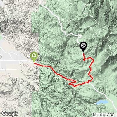
21.4
PDI
19.2 mi
DISTANCE
4,503 ft
GAINED
4.3 %
AVG. GRADE
FULL CLIMB STATS
INTRO
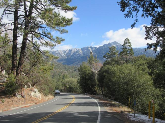
This climb begins at a section of Highway 74 that has been recognized a scenic state route. At mile 11.5 we turn left onto Highway 243 to ride through Idyllwild and complete the climb up to Pine Cove.
PLAN YOUR ROUTE
4.3% average grade (4.8% climb only). There are a few brief descents along the climb - 7% of the climb is descent, 48% is in the 0-5% range, and 44% is at 5-10%. The steepest quarter-mile is 7.7% and steepest mile 6.3%.
See more details and tools regarding this climb's grade via the “Profile Tool” button.
Roadway: This is a two lane highway in good condition with a shoulder that varies from none to wide enough to ride the bike in. There is no rideable shoulder much of the climb.
Traffic: Mild, but it does pick up on Friday and Sunday afternoons.
Parking: On the side of the road at the start of the climb - Map; Street View.
Provisions: A couple of great spots for food and beverages along this climb - Mountain Center at 12.7 miles (Map) and our favorite, the quaint town of Idyllwild, 17 miles from the climb's beginning which has nice diners, a bakery, store, etc. (Map).
Before heading out on any cycling adventure check out our Things to Bring on a Cycling Trip and use our interactive check list to ensure you don't forget anything.
We got pastries and coffee at The Village Lane in Idyllwild and that was a very nice place. However, there do appear to be many choices for fun and good food in Idyllwild - Google Map and Reviews.
ROUTE MAP
MEMBER RATING
CURRENT WEATHER
PJAMM TRIPS ADVENTURE STARTER BUNDLES
Check out PJAMM Adventure's prepackaged (self-guided) cycling trips. They will help you plan, document and conquer your next adventure.
NEARBY CLIMBS (0) RADIAL PROXIMITY
FROM No Climbs Found
MEMBER REVIEWS & COMMENTS
Let us know what you thought of this climb. Signup for our FREE membership to write a review or post a comment.
Already have an account?
LOG IN HERE
MSchube


Second attempt at this climb. On Veterans Day I turned back at Mountain Center (thanks work stress and booster shot). Several sources have described it as “underrated†and I would agree. The grade never seemed to get over 8% and often was in the 3-5% range. It is a Highway climb but I am so desensitized to traffic it doesn't bother me. If I had to guess, maybe one car every few minutes but it wasn't constant. Most cars (actually lots of pick ups and SUVs; I've also seen lots of motorcyclists too) give you a good berth going up or coming down. Climbing up and out of the San Jacinto river drainage is quite stunning, as is the descent. Then you continue grinding up to the Idyllwild sign followed by a short downhill into town. Then after the fire station back climbing to the fire station in Pine Cove. That was probably the most challenging stretch. There was still snow on the ground from last week's storm but the road was completely clear, though with the usual road detritus in spots.