
19.4
PDI
17.6 mi
DISTANCE
4,100 ft
GAINED
4.3 %
AVG. GRADE
FULL CLIMB STATS
INTRO
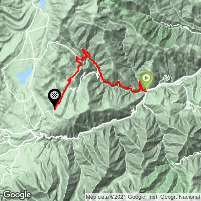
Olette to Col de la Llose climbs 28.6 km (17.8 mi) from the village of Olette in France's Pyrénées-Orientales, gaining 1,506 m (4,940 ft) at an average grade of 4.3% to reach the pass at 1,869 m (6,132 ft). It's one of the longest climbs in the eastern Pyrenees, though rarely a steep one - the grade never holds above about 8% for any real stretch.
The road climbs out of the Têt valley through the village of Ayguatébia-Talau, with views back toward the Canigou massif, before rolling on through increasingly wild, sparsely populated terrain toward the Capcir plateau. Riders consistently describe the climb as remote and quiet - it's common to see fewer than ten cars over the full round trip - and the scenery, especially in the upper reaches, is considered some of the most striking in the range.
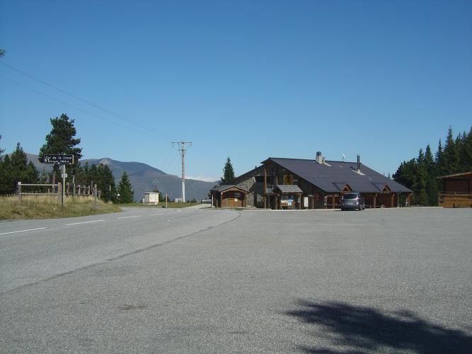
Col de la Llose itself sits at the edge of a Nordic ski domain in the Capcir, quiet and snowbound in winter but open, empty, and green for cycling the rest of the year. Olette is also the starting point for several other PJAMM climbs nearby - Col de Creu, Côte de Marians, and the Route de Jujols - making it a useful base for a multi-day trip into the Pyrénées-Orientales; see our Routes in the Area tool for other climbs near Olette.
PLAN YOUR ROUTE
 We've partnered with Sherpa-Map.com to bring you the best route planning tool. With a PRO Membership you can use this climb as a reference when creating your route.
 Olette to Col de la Llose averages 4.3% over 28.6 km (17.8 mi), gaining 1,506 m (4,940 ft) from 630 m (2,066 ft) at Olette to 1,869 m (6,132 ft) at the pass.
This is a long climb built more on distance than steepness. The steepest quarter-mile averages 10.9%, and even the steepest 100 meters only reaches about 20.6% - both brief exceptions rather than the rule. Over any longer stretch the grade settles down considerably: the steepest mile averages 7.3%, and the steepest 5 km block holds just 6.1%. There's also real rolling terrain mixed into the profile, with roughly 266 m (874 ft) of net descent along the way, mostly through the middle section near Ayguatébia-Talau.
The result is a climb that rewards pacing over punchy efforts - riders who go out too hard on the lower ramps tend to pay for it over the following two-plus hours.
Roadway: The road is paved for its entire length and generally in good condition, though riders have reported occasional loose gravel on some sections, particularly on the upper stretches near the Capcir plateau.
Traffic: Traffic is about as light as it gets on a paved Pyrenean climb - multiple riders report seeing fewer than ten cars on the full round trip. The road sees a little more local traffic near Olette and Ayguatébia-Talau, then quiets down almost entirely above.
Parking: Olette has roadside parking near the village center, at the base of the climb. There's a water fountain in the village to fill bottles before setting out, with another in Ayguatébia-Talau partway up - the stretch above that point has few reliable water sources, so top off at both.
The grade rarely gets steep for long, so most riders can handle this on a standard double or mid-compact setup, though the sheer length (28.6 km/17.8 mi) still makes a compact crankset (34/50) a comfortable choice, especially if you're combining this with other climbs in the area.
Water is the bigger concern than gearing here: fill up at the fountains in Olette and Ayguatébia-Talau, since there's little reliable water between there and the pass. A Nordic ski domain sits at Col de la Llose itself, with a snack bar that offers refreshments and water refills in season - a welcome summit reward, though don't count on it being open outside the main season.
Before heading out on any cycling adventure check out our Things to Bring on a Cycling Trip and use our interactive check list to ensure you don't forget anything.
Olette sits in the Têt valley (Conflent) of the eastern Pyrenees and doubles as a base for several other PJAMM climbs in the immediate area, including Col de Creu, Côte de Marians, and the Route de Jujols - worth combining into a multi-day trip if you're making the drive out this way.
The climb passes through genuinely remote high country once it clears Ayguatébia-Talau, with views toward the Canigou massif on the way up and, near the pass, access to the wilder Puig de la Tossa above 2,000 m for riders looking to extend the day.
This is a long day out with little shade and few services above the lower villages, so plan around the heat in summer and carry more water than you think you'll need.
ROUTE MAP
MEMBER RATING
CURRENT WEATHER
PJAMM TRIPS ADVENTURE STARTER BUNDLES
Check out PJAMM Adventure's prepackaged (self-guided) cycling trips. They will help you plan, document and conquer your next adventure.
NEARBY CLIMBS (0) RADIAL PROXIMITY
FROM No Climbs Found
MEMBER REVIEWS & COMMENTS
Let us know what you thought of this climb. Signup for our FREE membership to write a review or post a comment.
Already have an account?
LOG IN HERE
