
18.9
PDI
10.2 mi
DISTANCE
3,284 ft
GAINED
6.1 %
AVG. GRADE
FULL CLIMB STATS
INTRO
Sella Ciampigotto is the long western road climb from the Cadore up to the Razzo uplands. It starts in the Piave valley at Treponti, just below Vigo di Cadore, and climbs 16.4 km (10.2 mi) on the SP619, gaining 1001 m (3284 ft) at a 6.1% average to the 1790 m (5873 ft) pass near the regional border between Veneto and Friuli-Venezia Giulia.
The average undersells the shape of the climb. A steeper opening pulls you up to Vigo and Laggio di Cadore, then nearly 10 km of uneven forest road alternates steady climbing with almost-flat breathers. The real work is saved for the top: a ladder of a dozen-plus tightly stacked hairpins climbs at 8-9% for several kilometers, with short ramps steeper than that, before the last few hundred meters ease through thin forest to the pass sign.
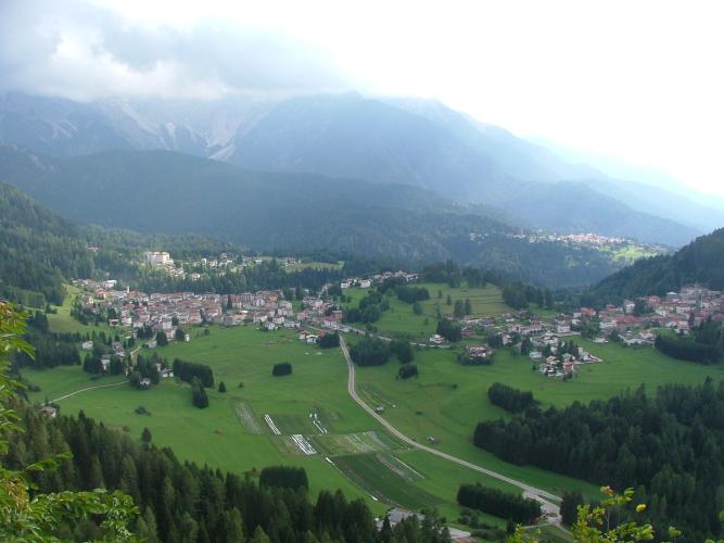
This is a quiet road - mostly wooded, lightly trafficked, and a world away from the busy Dolomite passes to the west. At the top the Razzo plateau opens up: summer pasture with grazing cattle, a small bar and a mountain refuge. From the pass the road carries on east past Sella di Razzo toward Sauris, so Ciampigotto works as a gateway into the Carnic Alps as much as a climb in its own right.
PLAN YOUR ROUTE
 We've partnered with Sherpa-Map.com to bring you the best route planning tool. With a PRO Membership you can use this climb as a reference when creating your route.
Sella Ciampigotto (west) climbs 16.4 km (10.2 mi) with 1001 m (3284 ft) of elevation gain at an average grade of 6.1%.
The opening 2 km from Treponti average about 7% as the road climbs toward Vigo di Cadore. From there to around km 9 the grade is irregular - kilometers of 4-7% mixed with a near-flat stretch around km 8 (1.5%) - so there is room to settle into a rhythm.
The climb changes character at km 10. From there to the top the road averages about 7.5%, peaking at 8.9% for km 14 through the stacked hairpins below the pass, before the final few hundred meters ease off to the summit.
Steepest sections: 91 m (100 yd) at 11.6%, 0.5 km at 10.2%, 1 km at 9.4%, 2 km at 8.8%, 5 km at 7.9%, 10 km at 6.6%.
Roadway: Paved the whole way. The west side is a proper two-lane mountain road and generally in good shape, though rider reports have noted cracks and uneven patching in the tight hairpins of the upper section, so pick your lines carefully on the descent. The pass sits at 1790 m (5873 ft) and most riders tackle it between June and September.
Traffic: Light. Through Vigo and Laggio di Cadore you'll share the road with local cars, but above Laggio the SP619 becomes a quiet forest road serving the Razzo plateau, with only occasional cars and motorbikes.
Parking: There's no dedicated lot at the Treponti junction. Vigo di Cadore and Laggio di Cadore, both on the route in the first few kilometers, are the practical places to leave a car - park where permitted in the villages and roll back down to the start, or simply start from Laggio and skip the opening kilometers.
Provisions: Laggio di Cadore, a few kilometers into the climb, is the last village with shops - fill bottles and grab food there. Above Laggio there's nothing for more than 10 km of forest road until the seasonal bar and refuge on the Razzo plateau at the top.
Gear: The average is moderate, but the hairpins near the top hold 8-9% for several kilometers, so a compact crankset with a 28- or 30-tooth cog is a comfortable setup. The pass is at 1790 m (5873 ft) and the descent is long and mostly shaded, so pack a jacket even on a warm day in the valley.
Before heading out on any cycling adventure check out our Things to Bring on a Cycling Trip and use our interactive check list to ensure you don't forget anything.
Vigo di Cadore is a small, Ladin-speaking village and worth a stop on the way back down. The church of Sant'Orsola on the village square dates from the 14th century - it was built for Ainardo da Vigo, and its deep projecting roof has sheltered the frescoes on its facade, and inside a fresco cycle tells the life of St. Ursula.
At the top, the Razzo plateau (Altopiano di Razzo) is open summer pasture for cattle, sheep and goats, and in winter a small ski slope - it has been nominated repeatedly in the FAI's "I Luoghi del Cuore" census of Italy's most-loved places. From the pass the road continues east past Sella di Razzo toward Sauris, covered on our Sella di Rioda and Sella Festons pages, and Passo della Mauria starts almost at the same valley junction as this climb. See other climbs nearby, or build a custom route from here, with our Routes in the Area tool.
ROUTE MAP

MEMBER RATING
CURRENT WEATHER
PJAMM TRIPS ADVENTURE STARTER BUNDLES
Check out PJAMM Adventure's prepackaged (self-guided) cycling trips. They will help you plan, document and conquer your next adventure.
NEARBY CLIMBS (0) RADIAL PROXIMITY
FROM No Climbs Found
MEMBER REVIEWS & COMMENTS
Let us know what you thought of this climb. Signup for our FREE membership to write a review or post a comment.
Already have an account?
LOG IN HERE
