37.6
PDI
9 mi
DISTANCE
4,608 ft
GAINED
9.7 %
AVG. GRADE
FULL CLIMB STATS
Page Contributor(s): Ard Oostra, Switzerland; Ron Hawks, Las Vegas, USA
INTRO
Alto de Gamoniteiro East is one of the toughest climbs in Spain, tucked into the Sierra del Aramo in the Cantabrian Mountains of Asturias. From the edge of Pola de Lena, the road climbs 9.0 miles and gains 4,608 feet at an average grade of 9.7%, good for 131st on the list of the world's hardest climbs.
The route is fully paved, though narrow and rough in stretches, with patched, potholed asphalt on some of the upper ramps.
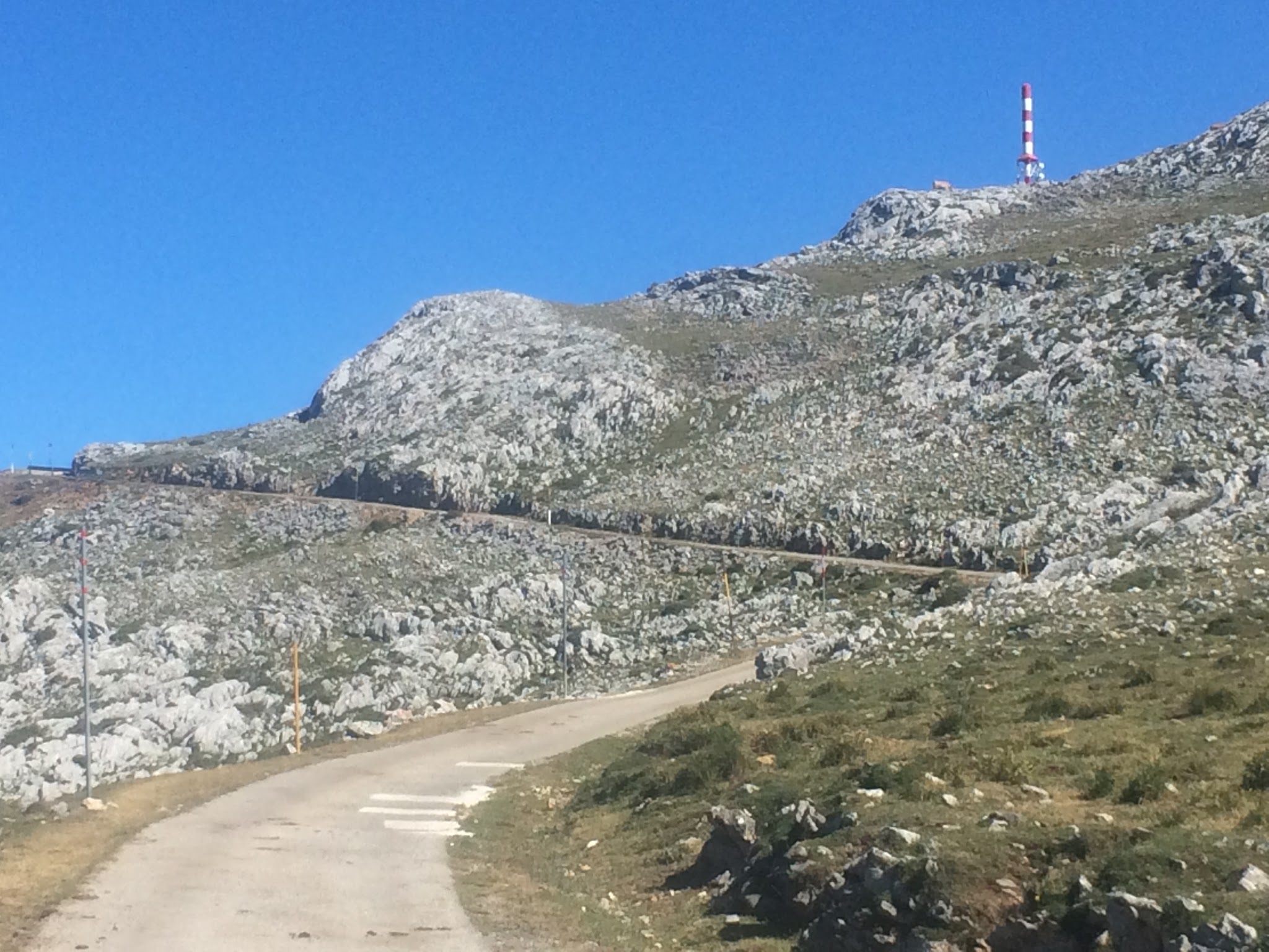
The final third stacks up the punishment: gradients spike toward 17% around 3 kilometers from the top, and the steepest full kilometer, averaging 13%, begins near km 13.5. A radio tower and old military installation mark the barren, rock-strewn summit, a look riders have compared to Mont Ventoux.
Gamoniteiro - "Altu d'El Gamoniteiru" in Asturian - made its Vuelta a España debut in 2021, when Miguel Ángel López soloed away in the final 4 kilometers of Stage 18 to beat Primož Roglič, Egan Bernal, and Enric Mas to the summit, instantly making it one of the hardest single-day mountain finishes in the sport. This eastern ascent from Pola de Lena is the more commonly ridden of the mountain's two approaches; a shorter western side climbs from near San Martín.
PLAN YOUR ROUTE
 We've partnered with Sherpa-Map.com to bring you the best route planning tool. With a PRO Membership you can use this climb as a reference when creating your route.
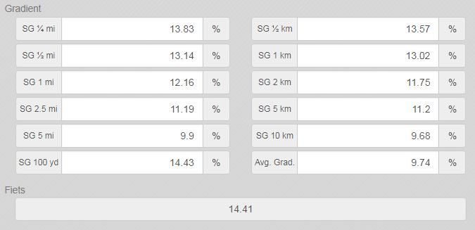
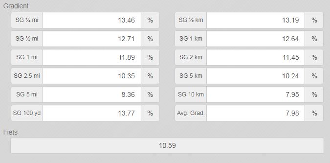
 Gamoniteiro East's 9.7% average grade undersells how hard the finish is. The steepest quarter-mile point-to-point reaches 13.9%, the steepest full mile averages 12.2%, and even the hardest 5 continuous miles still average 9.9%. Nearly every ramp in the closing 3 kilometers sits in double digits, with pitches touching 17% on the steepest switchbacks - the kind of sustained, irregular steepness that puts this among the hardest sustained climbs in Spain.
Roadway: The climb is paved for its entire length, but the surface is inconsistent - decent asphalt lower down gives way to narrower, rougher pavement with patched potholes in the final kilometers near the summit. There are no reports of active closures or resurfacing work heading into the 2026 season.
Traffic: This is a quiet rural mountain road with light local and agricultural traffic outside of race days. Expect solitude on most rides, though the road narrows enough in spots that courtesy with any oncoming vehicle matters.
Parking: Pola de Lena, a good-sized town with a train station on the Asturias-León line, is the practical base. Park in town near the roundabout where AS-230 begins climbing toward La Cobertoria and Gamoniteiro.
Pola de Lena has grocery stores, cafes, and a bakery or two - stock up on food and water here, since there's nothing at all once you leave town. The summit sits at nearly 1,800 meters and is exposed to wind with no shelter, so pack a wind vest or light jacket for the descent even on a warm Asturian summer day.
A bike with a wide enough gear range for sustained double-digit pitches (a compact crank and at least a 30-tooth rear cog) is strongly recommended given the closing kilometers.
Before heading out on any cycling adventure check out our Things to Bring on a Cycling Trip and use our interactive check list to ensure you don't forget anything.
Gamoniteiro sits in the same corner of Asturias as the legendary Alto de l'Angliru, one of the hardest climbs ever used in a Grand Tour, and Gamoniteiro West, the mountain's other approach - all three are within a short drive of Pola de Lena, making this a natural base for a multi-day Asturian climbing trip.
Pola de Lena itself has modest lodging and dining options; Oviedo, about 30 minutes away by car, offers a wider range of hotels and restaurants for a more comfortable stay. See other climbs nearby, or map out a custom multi-climb route from here, with our Routes in the Area tool.
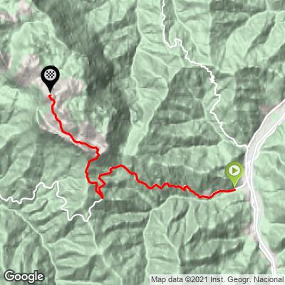
ROUTE MAP
MEMBER RATING
CURRENT WEATHER
PJAMM TRIPS ADVENTURE STARTER BUNDLES
Check out PJAMM Adventure's prepackaged (self-guided) cycling trips. They will help you plan, document and conquer your next adventure.
NEARBY CLIMBS (0) RADIAL PROXIMITY
FROM No Climbs Found
MEMBER REVIEWS & COMMENTS
Let us know what you thought of this climb. Signup for our FREE membership to write a review or post a comment.
Already have an account?
LOG IN HERE