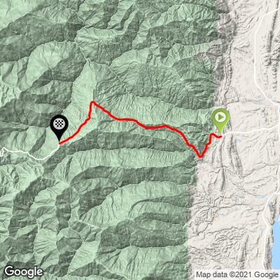
19.8
PDI
11.9 mi
DISTANCE
3,619 ft
GAINED
5.7 %
AVG. GRADE
FULL CLIMB STATS
INTRO
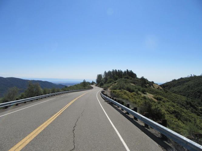
This very scenic and practically private climb begins just at Alder Creek/Hwy 162, 18 miles west of Interstate 5/Willows, California. Within a half mile we enter Mendocino National Forest and climb from the open oak studded fields of the lower portion, into the low shrub covered foothills and finally into an alpine setting by the final third of the climb.
PLAN YOUR ROUTE
See more details and tools regarding this climb's grade via our interactive Profile Tool.
Roadway & Traffic:
Surface is excellent, traffic is very light.
Parking:
This is a remote climb and you can park off the road near the start.
There is no water source near the climb, so bring extra.
Before heading out on any cycling adventure check out our Things to Bring on a Cycling Trip and use our interactive check list to ensure you don't forget anything.
The Mendocino National Forest offers some good hiking and pretty Northern California scenery. Check out hotels near the climb.
ROUTE MAP
MEMBER RATING
CURRENT WEATHER
PJAMM TRIPS ADVENTURE STARTER BUNDLES
Check out PJAMM Adventure's prepackaged (self-guided) cycling trips. They will help you plan, document and conquer your next adventure.
NEARBY CLIMBS (0) RADIAL PROXIMITY
FROM No Climbs Found
MEMBER REVIEWS & COMMENTS
Let us know what you thought of this climb. Signup for our FREE membership to write a review or post a comment.
Already have an account?
LOG IN HERE