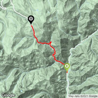
Scott Summit South Bike Climb - PJAMM Cycling

5.3
FIETS
6 mi
DISTANCE
2,197 ft
GAINED
6.9 %
AVG. GRADE

FULL CLIMB STATS

INTRO

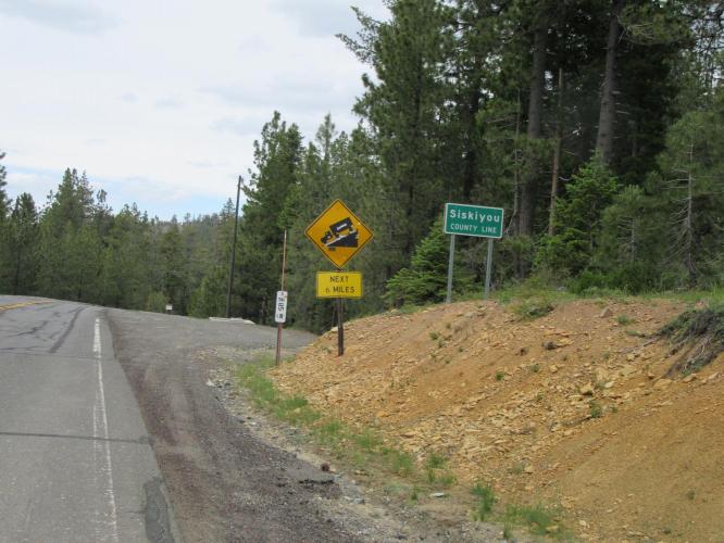
Scott Summit South - This is an exceptional climb – twisting and turning as it runs parallel with Tangle Blue Creek, and further up the climb, Scott Mountain Creek. We are variously bounded by huge pine trees and rock mountains sloping steeply down to the roadway.

See more details and tools regarding this climb's grade via our interactive Profile Tool.
Information Not Available

If you have any information regarding this climb, we'd like to hear from you. Click the CONTRIBUTE button to share your thoughts with us.

Information Not Available

If you have any information regarding this climb, we'd like to hear from you. Click the CONTRIBUTE button to share your thoughts with us.

Before heading out on any cycling adventure check out our Things to Bring on a Cycling Trip and use our interactive check list to ensure you don't forget anything.
Information Not Available

If you have any information regarding this climb, we'd like to hear from you. Click the CONTRIBUTE button to share your thoughts with us.

ROUTE MAP

MEMBER RATING

Not Yet Rated
-
Road
-
Traffic
-
Scenery

CURRENT WEATHER

PJAMM TRIPS ADVENTURE STARTER BUNDLES

Check out PJAMM Adventure's prepackaged (self-guided) cycling trips. They will help you plan, document and conquer your next adventure.
ALL TRIPS
Browse all of our prepackaged trips and find your next adventure!

NEARBY CLIMBS (0) RADIAL PROXIMITY

FROM
No Climbs Found

MEMBER REVIEWS & COMMENTS

Let us know what you thought of this climb. Signup for our FREE membership to write a review or post a comment.
Already have an account?
ROUTE MAP
PROFILE TOOL
Route Data
S.G. (%)
hide
Segment Data
hide

Climb Profile Not Found
CLIMB SUMMARY

Scott Summit

IMG_1467.JPG

Scott Summit South

This is an exceptional climb – twisting and turning as it runs parallel with Tangle Blue Creek, and further up the climb, Scott Mountain Creek.  We are variously bounded by huge pine trees and rock mountains sloping steeply down to the roadway.   The “average” grade is 7.3%, but the climb does kick up to 12% for an extended mile during the climb, before easing back down to the aforementioned 7%.  There are sharp turns on steep pitches, so caution is mandatory on the descent.  The roadway is in very good condition and traffic is light.  As with many of the climbs in this remote section of northern California, we touch Klamath National Forest on this one (the National Forest begins just to the south of the Scott Mountain Summit).

IMG_1515.JPG     IMG_1516.JPG

While this is technically a state highway upon which traffic can travel by at a good clip, there is light traffic in this part of the world.   This is a great climb, particularly as an out-and-back  from Callahan.

Scott Summit North

Ranked just a tad lower in difficulty than Scott Mountain South, the northern approach to the summit is “only” 5.6% for 6.8 miles.  The climb begins at the bridge over the East Fork Scott River and is a fairly consistent 6% over the next 6.8 miles to the summit.  There is not much shade on this side of the summit, so be prepared for a hot sun beating down on you if you tackle this climb during the summer.  The roadway surface is good and there is mild traffic along this climb.  The road quality is good but not great. As noted above, try this as an out-and-back from Callahan at 25 miles and 4,320’ of climbing.

IMG_1431.JPG     IMG_1440.JPG