51.5
PDI
39.3 mi
DISTANCE
9,700 ft
GAINED
4.2 %
AVG. GRADE
FULL CLIMB STATS
Page Contributor(s): Hernando Bermudez, Seattle
INTRO
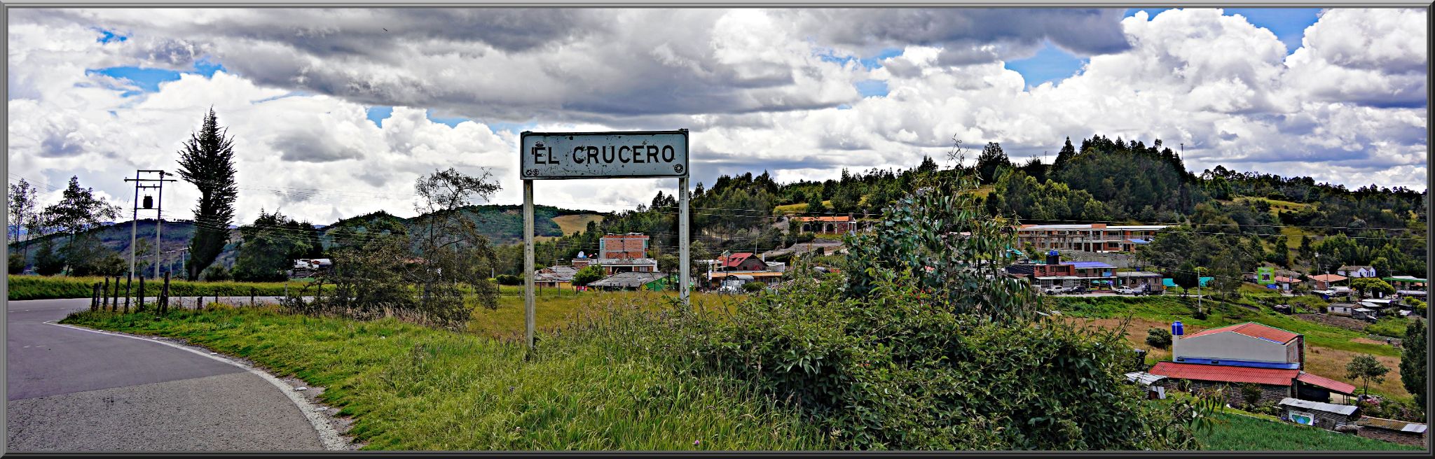
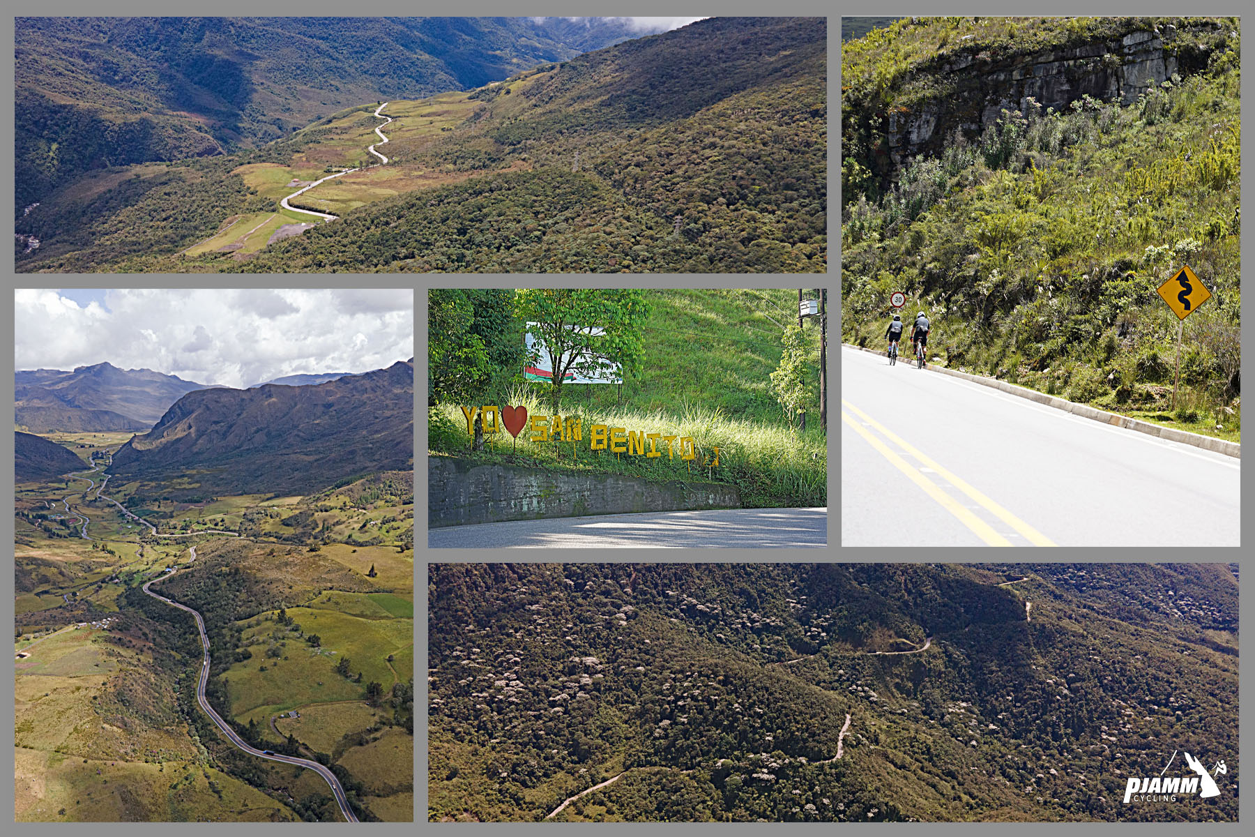
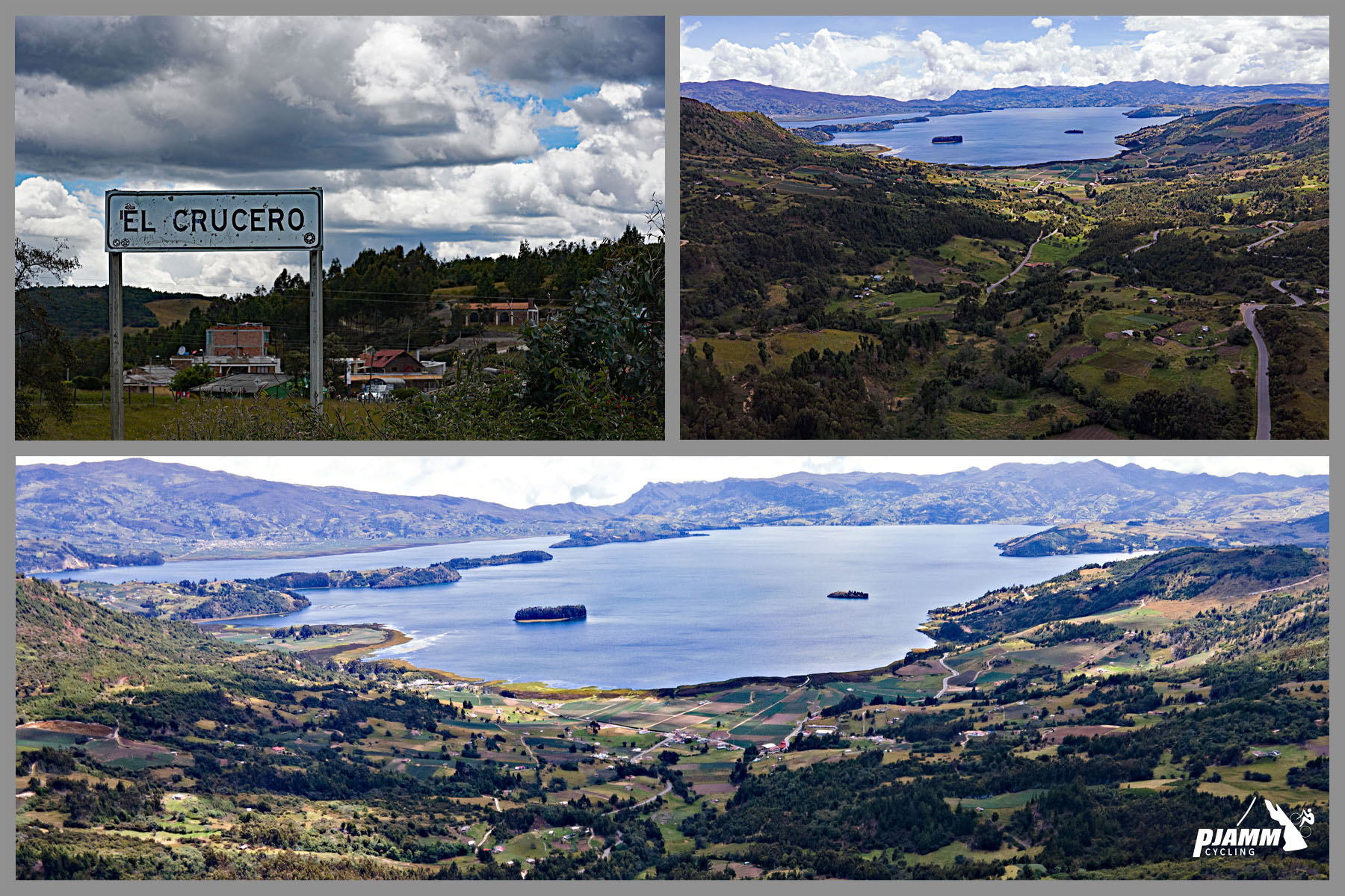
El Crucero is the longest paved climb in Colombia. From our start near Pajarito, the road climbs 39 miles and 9,700 feet 4.2%, topping out at 11,359 feet near the páramo above Lake Tota - currently ranked the 38th-hardest climb worldwide. The full historic ascent, as ridden by locals and tour groups, actually begins about 30 km further down in Aguazul, stretching the total distance to roughly 92 km (57 miles) and 3,165 meters (about 10,380 feet) of gain from the Llanos foothills all the way to the pass.
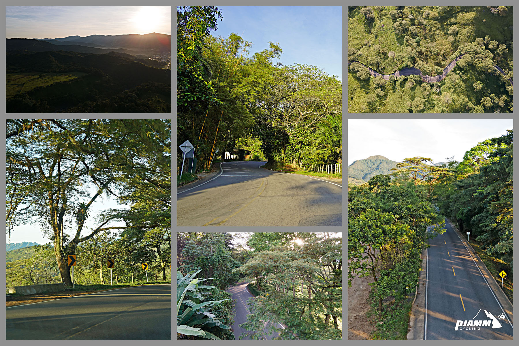
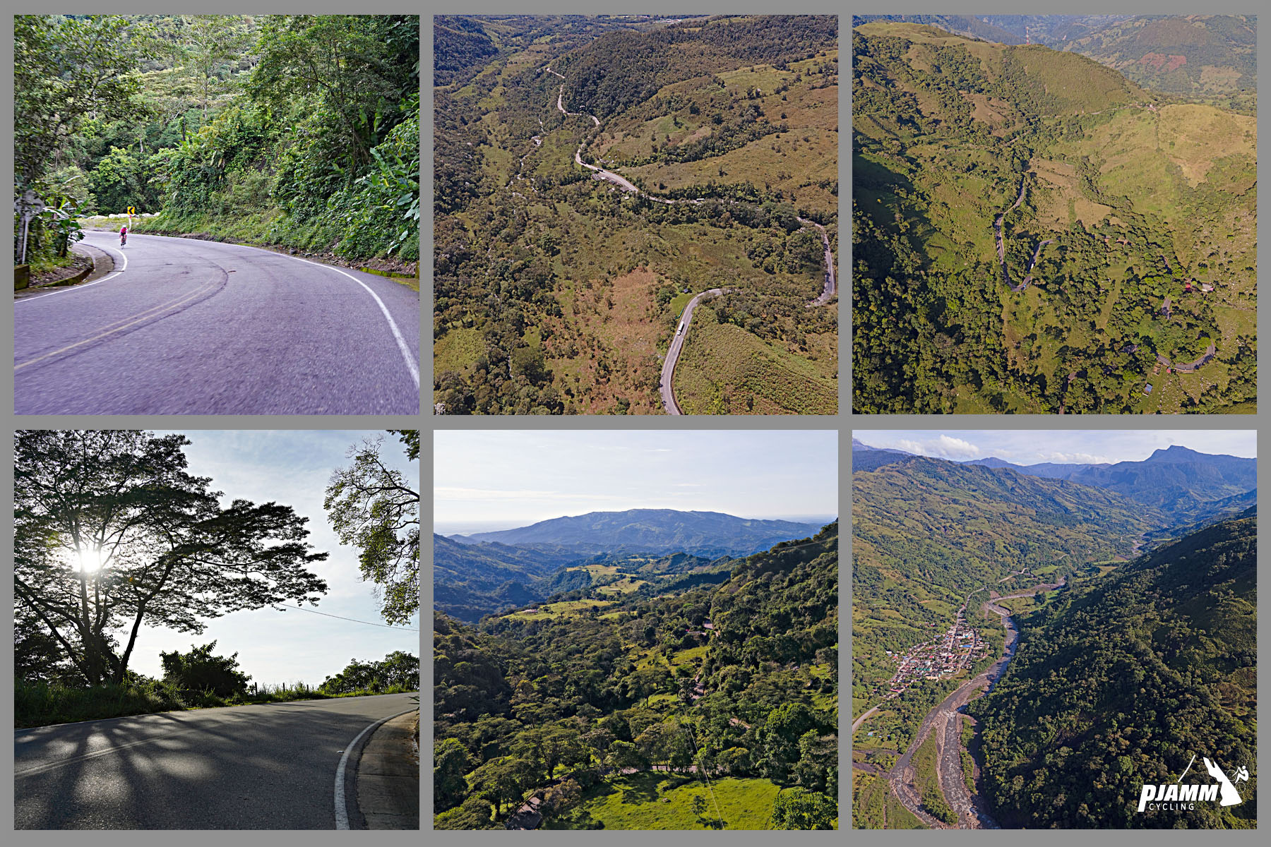
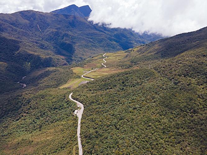
What makes El Crucero remarkable is the sheer variety it packs into one road. You start in the tropical lowlands of the Llanos Orientales, climb through humid cloud forest along the Cusiana River, and finish above treeline in true páramo - frailejones, cold wind, and thin air above 3,000 meters. The hardest stretch comes about 10 km past Pajarito: a sustained 24k section averaging over 6% with repeated double-digit ramps, before the grade eases through the high Toquilla valley for the final push to the summit.
The road follows the path Simón Bolívar's army took in 1819 during the Libertador campaign, crossing the same páramos of the Eastern Andes on the way to the battles that won independence for Colombia and its neighbors.
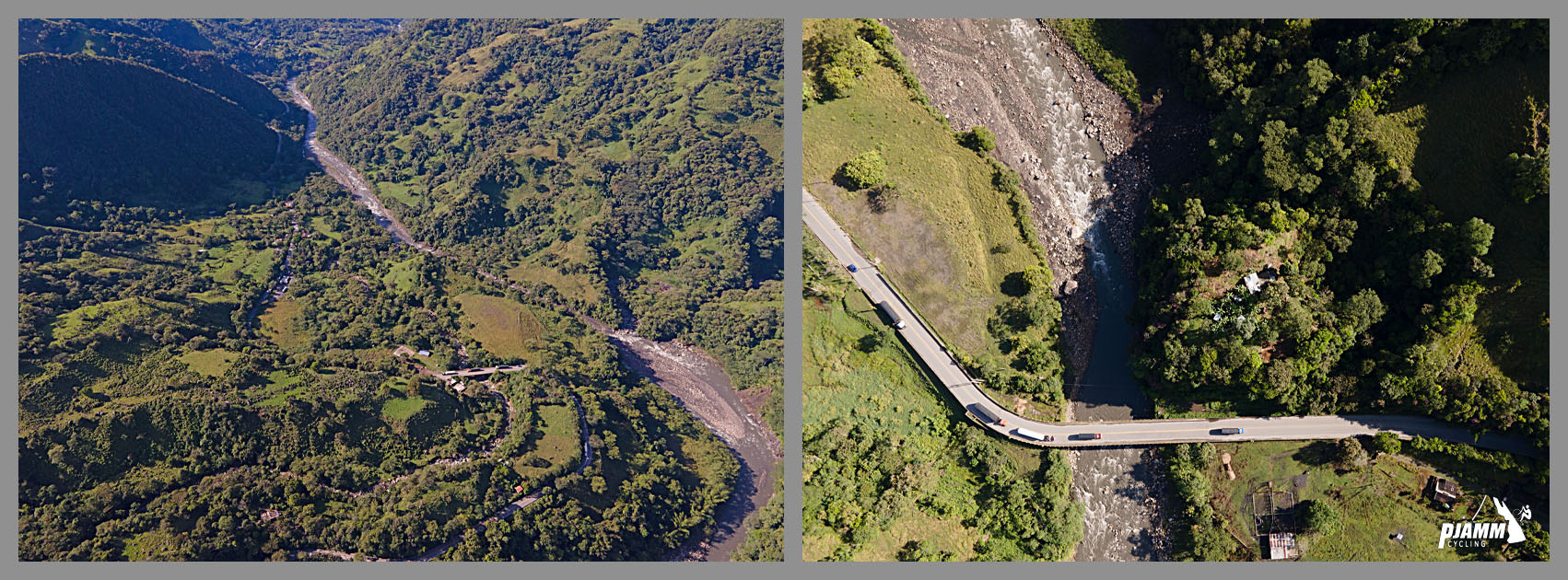
It's also a genuinely important regional highway, not just a scenic backroad: traffic is real, and the corridor has been repeatedly disrupted by landslides and bridge damage near Pajarito in recent years, including a full bridge collapse.
PLAN YOUR ROUTE
 We've partnered with Sherpa-Map.com to bring you the best route planning tool. With a PRO Membership you can use this climb as a reference when creating your route.
 El Crucero's average of 4.2% hides a very uneven profile. The first several kilometers past Pajarito are gentle, but roughly 10 km in, the road tips into its hardest section - about 24 km averaging over 6%, with frequent ramps into the double digits as the route climbs into cloud forest along the Cusiana River. That's the crux of the climb; pace yourself here rather than in the lower kilometers.
Past that section the grade relents into the Toquilla valley, a roughly 12-kilometer stretch averaging around 2% - a welcome recovery zone, though at over 3,000 meters altitude and often into a headwind, it rarely feels easy. The final kilometers kick back up to 7%+ in short ramps before the true summit near the páramo above Lake Tota, at 11,359 feet - the high point on our measured segment.
If riding the complete historic route from Aguazul, add roughly 30 km and around 300 meters of extra climbing below Pajarito, including the Alto Boquerón climb-and-descent that comes before this measured segment even starts.
Roadway: The road is a paved, two-lane national highway (Colombia's Ruta 62 / Transversal del Cusiana) in generally good condition, but it runs through a geologically unstable corridor. The Los Grillos and Chorro Blanco sectors near Pajarito have seen repeated landslides, bridge damage, and a full bridge collapse in recent years, and the route has been closed for repairs multiple times, most recently reported in late 2025. Expect occasional potholes and rough patches even when the road is officially open, and confirm current conditions locally or via INVÍAS before you ride - this isn't a corridor to assume is intact without checking.
Traffic: This is a real regional highway connecting Casanare's Llanos to Boyacá's interior, so expect a mix of cars, buses, and some truck traffic, heavier near Aguazul and Pajarito and lighter as you climb into the páramo. A total restriction on heavy cargo vehicles has been imposed on sections of this corridor because of the ongoing instability, which works in cyclists' favor by keeping trucks off some of the road.
Parking: There's no dedicated cyclist parking or trailhead. Riders typically start from a hotel or lodging in Aguazul or Pajarito, both of which have basic accommodations. Aguazul, the larger of the two, has mostly 2- and 3-star hotels in its urban core; Pajarito is smaller and more limited.
This is a long, high-altitude climb through multiple climate zones, so pack for all of them. You'll start warm and humid near Aguazul or Pajarito and finish cold and windy above 3,000 meters in the páramo - arm and knee warmers, a packable rain/wind shell, and a base layer are worth carrying even if the day starts hot.
Small roadside stalls in the upper Toquilla valley sell trout and local cheese, but don't rely on them being open or stocked.
Carry more water and food than you think you need - there's a long stretch with nothing between Pajarito and the summit, and no services at all at the top. A GPS or offline map is worth having; cell coverage thins out in the páramo.
Before heading out on any cycling adventure check out our Things to Bring on a Cycling Trip and use our interactive check list to ensure you don't forget anything.
Aguazul (Casanare) and Pajarito (Boyacá) are the two realistic bases, with Aguazul the larger town and closer to Yopal's airport (about 30 minutes away). Both have basic guesthouse-style lodging rather than resort-style hotels, so book ahead and keep expectations modest.
Because this corridor has a real history of landslide and bridge closures, build a buffer into your trip and check current road status (INVÍAS or local news) before committing to a start point - a closure partway up can turn this into a long, frustrating detour. If riding with a support vehicle, agree on a plan for the exposed, weather-prone final kilometers, since conditions above 3,000 meters can change quickly.
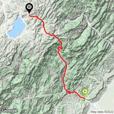
ROUTE MAP
MEMBER RATING
CURRENT WEATHER
PJAMM TRIPS ADVENTURE STARTER BUNDLES
Check out PJAMM Adventure's prepackaged (self-guided) cycling trips. They will help you plan, document and conquer your next adventure.
NEARBY CLIMBS (0) RADIAL PROXIMITY
FROM No Climbs Found
MEMBER REVIEWS & COMMENTS
Let us know what you thought of this climb. Signup for our FREE membership to write a review or post a comment.
Already have an account?
LOG IN HERE