![Cycling Glengariff Forest, Ireland PJAMM Cyclist rides bike on one-lane narrow gravel country road, surrounded by green pastures and hills]()
Cycling Glengariff Forest, Ireland
Ride 1.8 kilometers gaining 234 meters at 13% average grade.
There are fantastic views of the southern Irish mountains on this ride at the southern end of the country. This climb is in Glengarriff Forest which is a nature reserve owned by the public.
![Cycling Glengariff Forest, Ireland photo collage shows aerial drone view of PJAMM Cyclist on Glengariff Forest road, sign for Barkley Lake, narrow, one lane roadway, green hillsides and forestation]()
![Cycling Glengariff Forest, Ireland bike parked in ferns on side of road, unmarked forested roadway]()
You may need GPS to help find this one - the road is not marked.
The Glengariff Forest road is a road so steep and narrow, it’s tough to imagine that residents actually frequent the road for daily use, but they do. We saw three cars on our ride day and had to unclip and let them pass. Many sections are hardly wide enough for a small car. Clipping back in on the sadistic slopes is no small feat!
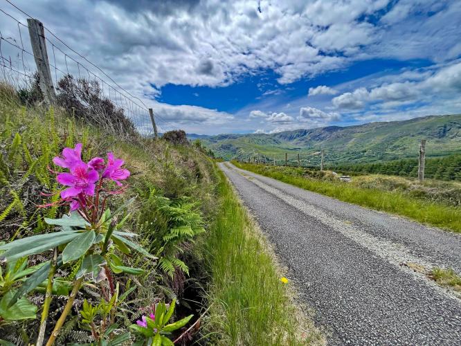
![Cycling Glengariff Forest, Ireland photo collage shows remoteness of the Glengariff Forest road climb, narrow roadway with grass dividing the center, heavily forested roads, bright pink foxglove flowers]()
This is a very narrow, remote road.
The first half of the climb is covered in thick trees. Then, suddenly, you leave the trees behind and views of the surrounding mountains unfold like an expensive postcard. Call me uncultured, but before I rode here, I had no idea that Ireland had such intense mountain displays like the one on the Glenariff Forest Road. Although short, this is a worthwhile detour to take during your time in Ireland. As for parking, if you drive to this remote climb, it will be difficult. The road at the bottom is narrow with no pullouts. The highway above is probably your best bet. There are a number of pull outs within a few miles of the climb finish point.
![Cycling Glengariff Forest, Ireland photo collage shows stunning views on second half of climb; roadway opens up to views of irish hillsides]()
There are some stunning views along the climb.
![Cycling Glengariff Forest, Ireland climb finish, T-intersection of L8976 and N71]()
Finish at the T intersection of L8976 and N71.
This climb may not be one to go out of your way to do, but if you are in the area it is a fun, steep, little road with dense forests that we did not regret taking the time to experience.
![]()
That’s a wrap!

 We've partnered with Sherpa-Map.com to bring you the best route planning tool. With a PRO Membership you can use this climb as a reference when creating your route.

