Cycling Allihies RTE Mast, Ireland
Ride 2.7 kilometers gaining 291 meters at 11% average grade.
This remote Ireland Top 10 bike climb is into the Miskish and Knockgour mountains of the Slieve Miskish range, just east of the Beara Peninsula at the southern tip of the country.

This climb is ranked as the second ardest in Ireland. While it is fairly short in distance, it more than makes up for the brevity with major pitch - the climb averages 13%.

The climb begins by riding up an unmarked road soon passing Beara Bridle Way, which is Ireland’s first horse trail.

Keep your eyes peeled for the castle tucked into the hillside near the start of the climb.
Climb summary by PJAMM Cycling’s Brad Butterfield:
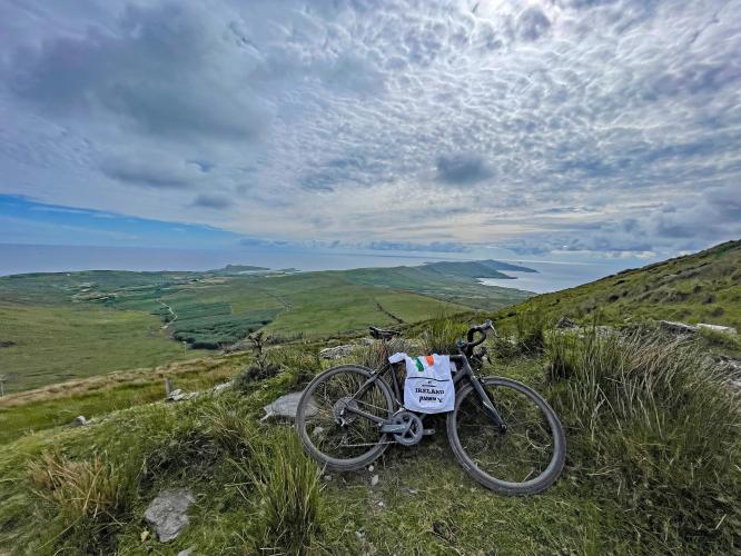
Here, you are nearly as far south as one can reach in the country of Ireland. This is a stunning country. The Irish landmass seems to pop out of the bay like an ancient serpent in strange places, making for a really unique coastline. On our climb, you pass a few small houses at the bottom, but past those, there is no development on this road. On your left as you climb there are a couple castles in view.

No shortage of views back to the Beara Peninsula as we gain altitude.
Without any points of respite, the road charts up to a radio tower. Our summit point ends with the paved road, but if you're feeling adventurous, you can take the gravel road to the tippy top of the mountain and stand next to the radio tower.

Climb summary by PJAMM Cycling’s Tayler Hockett:
A super hard and super fun climb! It starts at about 10% and doesn’t get any easier after that - there are four segments with 15+% grade in fact.

A quick right-hand turn off the main road starts you up this very remote road, the first mile is not too bad as you can see the coast and and some truly spectacular views of the ocean and valley below. Soon the pitch picks up and the road's surface deteriorates. With about two kilometers remaining it gets real steep for a moment and the road is a mix of gravel and asphalt with lots of potholes, so bring your climbing gears and 28 m tires!

As the road turns to full gravel (but manageable on road bike) you will see ancient private property posts that seem outdated and not in force.

Be sure to turn left at kilometer 1.8 onto Knockroe West (Knockroe East is straight).
The fun is just getting started - the part of this climb that makes it unique is the five hairpins near the finish. You ride up these concrete turns which give you a crazy grip while you hit the chunky gravel on the flat sections. This goes for about a kilometer and ends at a gate to a radio tower. The road is decent if you’ve got some wider tires. The views are spectacular and this road tests the legs and bike handling. For sure a must-do if you can get to it.


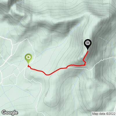
One kilometer from the top.

You can stop one kilometer from the top where a set of five hairpins for 500 meters at 12.6% average grade begin. As you can see from the satellite view of this segment, there is gravel for most of this stretch but also cement in the steeper sections to provide traction. Here is what PJAMM’s Tayler Hocket and Brad Butterfield write about this section:
Tayler: Oh yeah, totally doable on road bike. It even had those grated/grippy turns that helped when it got a little off camber.
Brad: Yes, doable on a standard road bike. Once the road turns to gravel there are a series of tight switchbacks that take you to the summit gate. Past the gate the road levels off.