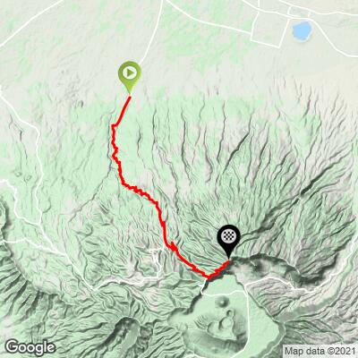
63.9
PDI
21.3 mi
DISTANCE
8,824 ft
GAINED
7.6 %
AVG. GRADE
FULL CLIMB STATS
Page Contributor(s): Ties Arts, Bussum, Netherlands; Rene De jong
INTRO
This 21.3 mile bike climb is located in Jawa Timur, Indonesia. The average gradient is 7.6% and there is a total elevation gain of 8,824 ft, finishing at 9,006 ft.
Use the profile tool, route map, and weather forecast to conquer this cycling climb.
Use the profile tool, route map, and weather forecast to conquer this cycling climb.
PLAN YOUR ROUTE
See more details and tools regarding this climb's grade via our interactive Profile Tool.
Information Not Available
If you have any information regarding this climb, we'd like to hear from you. Click the CONTRIBUTE button to share your thoughts with us.
Information Not Available
If you have any information regarding this climb, we'd like to hear from you. Click the CONTRIBUTE button to share your thoughts with us.
Before heading out on any cycling adventure check out our Things to Bring on a Cycling Trip and use our interactive check list to ensure you don't forget anything.
Information Not Available
If you have any information regarding this climb, we'd like to hear from you. Click the CONTRIBUTE button to share your thoughts with us.
ROUTE MAP
MEMBER RATING
CURRENT WEATHER
PJAMM TRIPS ADVENTURE STARTER BUNDLES
Check out PJAMM Adventure's prepackaged (self-guided) cycling trips. They will help you plan, document and conquer your next adventure.
NEARBY CLIMBS (0) RADIAL PROXIMITY
FROM No Climbs Found
MEMBER REVIEWS & COMMENTS
Let us know what you thought of this climb. Signup for our FREE membership to write a review or post a comment.
Already have an account?
LOG IN HERE
mblanarik
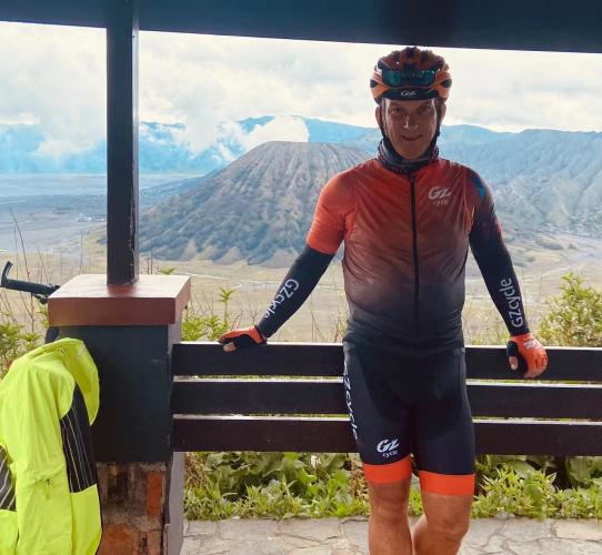
Nice climb pleasing gradients up to the National Park entrance. From there the road gets significantly narrower, the tarmac quality worsens and it starts to be really steep. I rode on a Saturday afternoon, partly in rain, traffic was - once out of Pasuruan - almost non-existent, mainly local motorcycle traffic. Unfortunately the central town of Mt. Bromo area (Cemorolawang) cannot be reached on tarmac from this climb. If you want to stay up here to visit Mt. Bromo you have the option to ride back to the King Kong viewpoint and then hike down (narrow slippery treck; 400m altitude loss) or follow further down to the rim and take a jeep ride accross the sandy caldera (it can be ridden on a gravel or MTB) to reach the town. Otherwise you have to descend all the way back to Pasuruan and drive up from Probolingo back to the other side of the crater. The Probolingo approach can be cycled as well, but it has ALL the traffic going towards Mt. Bromo & Cemorolawang.