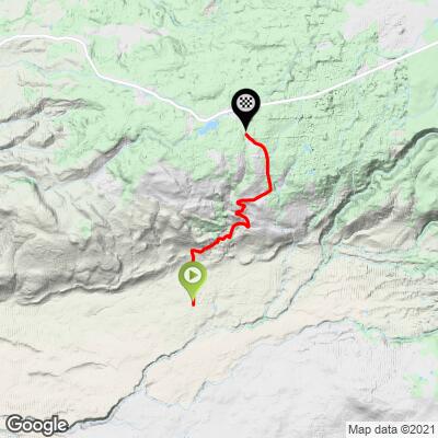
9.6
PDI
4.5 mi
DISTANCE
1,587 ft
GAINED
6.7 %
AVG. GRADE
FULL CLIMB STATS
INTRO
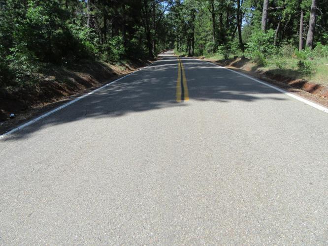
This is a wonderful climb near Mt. Lassen in Northern California. In an alpine setting from the start, we travel a fairly short distance (4.4 miles) at a moderately tough gradient (7% average) to the top of the climb with views of Mt. Lassen along the way. We feel like, and are in, a remote area during the entire climb. (although 126 Strava riders had done at least one climb on our route as of July, 2016). The road often fluctuates in gradient - 15% then 5% then back to 15% - the 7% average grade is a bit misleading as there are many points along the route where we have to really push the pedals.
PLAN YOUR ROUTE
See more details and tools regarding this climb's grade via our interactive Profile Tool.
Information Not Available
If you have any information regarding this climb, we'd like to hear from you. Click the CONTRIBUTE button to share your thoughts with us.
Information Not Available
If you have any information regarding this climb, we'd like to hear from you. Click the CONTRIBUTE button to share your thoughts with us.
Before heading out on any cycling adventure check out our Things to Bring on a Cycling Trip and use our interactive check list to ensure you don't forget anything.
Information Not Available
If you have any information regarding this climb, we'd like to hear from you. Click the CONTRIBUTE button to share your thoughts with us.
ROUTE MAP
MEMBER RATING
CURRENT WEATHER
PJAMM TRIPS ADVENTURE STARTER BUNDLES
Check out PJAMM Adventure's prepackaged (self-guided) cycling trips. They will help you plan, document and conquer your next adventure.
NEARBY CLIMBS (0) RADIAL PROXIMITY
FROM No Climbs Found
MEMBER REVIEWS & COMMENTS
Let us know what you thought of this climb. Signup for our FREE membership to write a review or post a comment.
Already have an account?
LOG IN HERE
josephbcoolman
I've done this ride three times. I park my car in Manton and do the climb first, then I descend to my car. I've done this in the summer, can get very hot. Bring lots of water, start early. This climb does have 15% pitches and 2 miles of very steep continuous climbing. There are short “relief†sections along this route, so you can recover a bit before it pitches upwards again. Traffic is very low. Small town backroad. Some homes along the way, the people are very friendly if you need water. The first time I road this I had to bail out, call for a ride. The temps got over 100 degree and I bit off more miles than I should have, ran out of water. The two other times I rode this it's was wonderful.