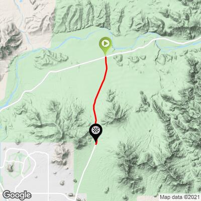
2.8
PDI
3.6 mi
DISTANCE
680 ft
GAINED
3.6 %
AVG. GRADE
FULL CLIMB STATS
INTRO
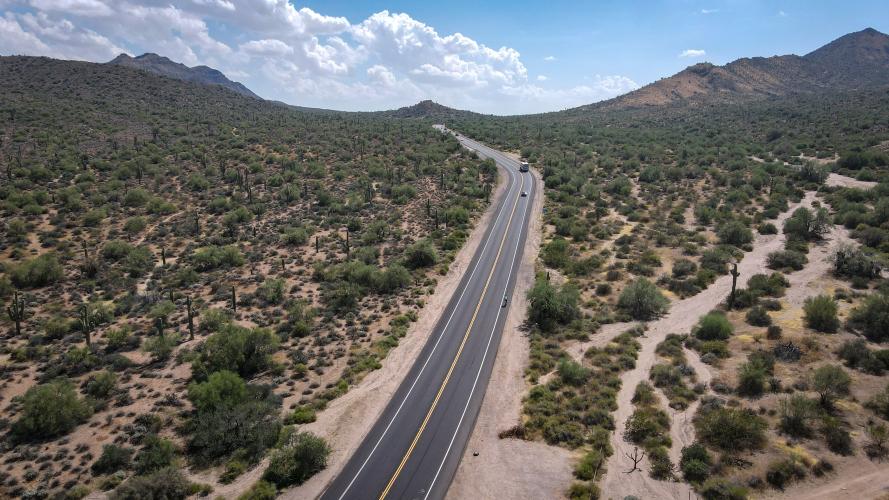
A mild but extremely popular climb in the Phoenix area. This is a good hill to ride on a TT bike while training for the IRONMAN Arizona Bike Course
PLAN YOUR ROUTE
See more details and tools regarding this climb's grade via our interactive Profile Tool.
Best done as part of a longer ride - many local group rides ride up the Beeline Highway, turn right on to Bush Hwy towards Saguaro Lake, then ride through the Salt River canyons to get to the pass.
There's plenty of parking along the climb (it's a very popular mountain biking spot). Tonto National Forest passes are required to park at the rec sites here, but we didn't have one and were fine.
Traffic is very heavy, especially on weekends. The road surface is great (9/2021) and there is a designated bike lane along the entire road.
Information Not Available
If you have any information regarding this climb, we'd like to hear from you. Click the CONTRIBUTE button to share your thoughts with us.
Before heading out on any cycling adventure check out our Things to Bring on a Cycling Trip and use our interactive check list to ensure you don't forget anything.
Information Not Available
If you have any information regarding this climb, we'd like to hear from you. Click the CONTRIBUTE button to share your thoughts with us.
ROUTE MAP
MEMBER RATING
CURRENT WEATHER
PJAMM TRIPS ADVENTURE STARTER BUNDLES
Check out PJAMM Adventure's prepackaged (self-guided) cycling trips. They will help you plan, document and conquer your next adventure.
NEARBY CLIMBS (0) RADIAL PROXIMITY
FROM No Climbs Found
MEMBER REVIEWS & COMMENTS
Let us know what you thought of this climb. Signup for our FREE membership to write a review or post a comment.
Already have an account?
LOG IN HERE
Makparshall580827
It was disappointingly short. I went up and over and back up and over, it wouldn't be a bad climb to do reps of. It's short and gradual. The better options are the climbs on apache trail. They are a lot bigger and longer