16.8
PDI
6.7 mi
DISTANCE
2,588 ft
GAINED
7.3 %
AVG. GRADE
FULL CLIMB STATS
INTRO
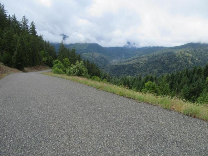
"An isolated climb near Grants Pass in southern Oregon, the east side of Cedar Flats Road is a steep test over a very narrow road that carries little traffic. Stout from the start, the grade eases about one half mile into the ascent. Soon very good views arrive down into the valley in places. From here the grade goes up and down as you ride through the mostly pine forest. Within one mile of the summit you find the steepest sustained grade on the hill and long views both left and right. Soon the grade eases and the climb ends at an unmarked but obvious summit. Though not as difficult, the west side of Cedar Flats is also a solid climb over a narrow road." (This quote is presented with the approval of John Summerson, from his book, The Complete Guide to Climbing (by Bike), 2nd Edition, pg. 208.)
PLAN YOUR ROUTE
See more details and tools regarding this climb's grade via our interactive Profile Tool.
Information Not Available
If you have any information regarding this climb, we'd like to hear from you. Click the CONTRIBUTE button to share your thoughts with us.
Information Not Available
If you have any information regarding this climb, we'd like to hear from you. Click the CONTRIBUTE button to share your thoughts with us.
Before heading out on any cycling adventure check out our Things to Bring on a Cycling Trip and use our interactive check list to ensure you don't forget anything.
Information Not Available
If you have any information regarding this climb, we'd like to hear from you. Click the CONTRIBUTE button to share your thoughts with us.
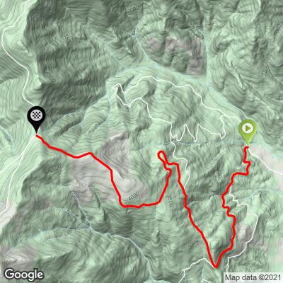
ROUTE MAP
MEMBER RATING
CURRENT WEATHER
PJAMM TRIPS ADVENTURE STARTER BUNDLES
Check out PJAMM Adventure's prepackaged (self-guided) cycling trips. They will help you plan, document and conquer your next adventure.
NEARBY CLIMBS (0) RADIAL PROXIMITY
FROM No Climbs Found
MEMBER REVIEWS & COMMENTS
Let us know what you thought of this climb. Signup for our FREE membership to write a review or post a comment.
Already have an account?
LOG IN HERE