Conde Creek Bike Climb - PJAMM Cycling

16
PDI
10.7 mi
DISTANCE
3,032 ft
GAINED
5.2 %
AVG. GRADE

FULL CLIMB STATS

INTRO

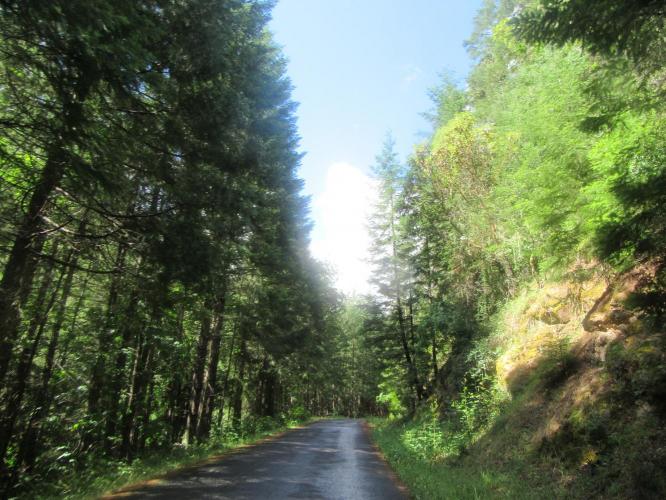
"Conde Creek Road near Medford in southern Oregon is a very isolated and stout climb along a single lane road. From the cattle guard the grade ramps up quickly to begin the assault. The slope continues to be variable from this point as you ride through thick woods along the ridgeline. There are several small descents along the way which lower its average grade. Near the top the woods open up a bit and the listed climb ends at an unmarked top. The road continues to climb but over very shallow grade. You can continue to ride this road near the top of Dead Indian Memorial Road." (This quote is presented with the approval of John Summerson, from his book, The Complete Guide to Climbing (by Bike), 2nd Edition, pg. 209.)

See more details and tools regarding this climb's grade via our interactive Profile Tool.
Information Not Available

If you have any information regarding this climb, we'd like to hear from you. Click the CONTRIBUTE button to share your thoughts with us.

Information Not Available

If you have any information regarding this climb, we'd like to hear from you. Click the CONTRIBUTE button to share your thoughts with us.

Before heading out on any cycling adventure check out our Things to Bring on a Cycling Trip and use our interactive check list to ensure you don't forget anything.
Information Not Available

If you have any information regarding this climb, we'd like to hear from you. Click the CONTRIBUTE button to share your thoughts with us.

ROUTE MAP

MEMBER RATING

Not Yet Rated
-
Road
-
Traffic
-
Scenery

CURRENT WEATHER

PJAMM TRIPS ADVENTURE STARTER BUNDLES

Check out PJAMM Adventure's prepackaged (self-guided) cycling trips. They will help you plan, document and conquer your next adventure.
ALL TRIPS
Browse all of our prepackaged trips and find your next adventure!
Crater Lake
United States (OR)
10 ROUTES
29 POIs
ROUTE STATS (TOTAL)
258.3
mi
DISTANCE
29,750
ft
ELEV. GAIN

NEARBY CLIMBS (0) RADIAL PROXIMITY

FROM
No Climbs Found

MEMBER REVIEWS & COMMENTS

Let us know what you thought of this climb. Signup for our FREE membership to write a review or post a comment.
Already have an account?
ROUTE MAP
PROFILE TOOL
Route Data
S.G. (%)
hide
Segment Data
hide
CLIMB SUMMARY

Climb Summary

IMG_1989.JPG     IMG_1990.JPG

Uhhhhh  . . . the climb has . . . a bit of a rural feel to it . . .

Conde Creek is a narrow one lane road off of Dead Indian Memorial Road and can be done as an out-and-back from the start of that climb (Map; 47.6 miles, 6,631’ of climbing).  From Dead Indian Memorial Road, descent about 11 miles to where the road flattens out and then turn around and come back up this monster.  The road rough but has no major potholes or cracks to speak of as of August, 2016.  Traffic along this road is light, but we did encounter some brisk moving pickup trucks, so be cautious

IMG_2001.JPG     IMG_2008.JPG

Rural . . but peaceful and scenic