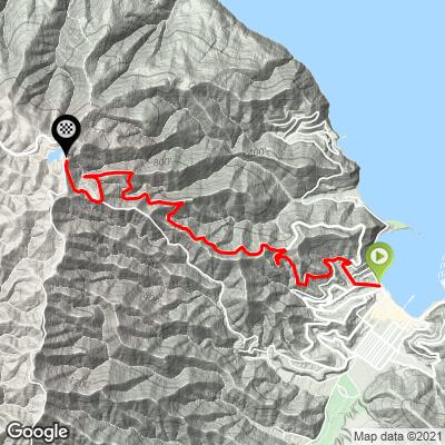
11.1
PDI
2.9 mi
DISTANCE
1,459 ft
GAINED
9.2 %
AVG. GRADE
FULL CLIMB STATS
INTRO
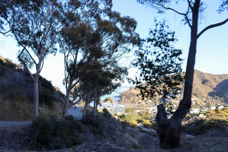
You can truly convince yourself that you're riding in the Mediterranean while doing the climbs on Catalina island.
PLAN YOUR ROUTE
See more details and tools regarding this climb's grade via our interactive Profile Tool.
Road is well paved and primarily traveled by tourists in slow moving golf-carts.
In order to ride the last 2 miles of the climb or anywhere beyond the town of Avalon, you need a Freewheeler Bike Pass to get into the Catalina Island Conservancy. (Annual passes for $35 may be found and purchased here)
If you're making the trip out to Catalina Island, odds are you won't have your car with you since the only way to the island is the ferry. Bikes are allowed to be brought on the ferries, but if you can't take yours with you, bike and e-bike rentals are also available on the island.
Before heading out on any cycling adventure check out our Things to Bring on a Cycling Trip and use our interactive check list to ensure you don't forget anything.
If you're going to do this climb, don't miss out on the chance to spend the entire day on Catalina Island! Here are some of our favorite post-ride hangout spots:
Food: The Lobster Trap; Bluewater Avalon
Local Brews (☕️+🍻): Catalina Coffee & Cookie Co; Catalina Island Brew House
ROUTE MAP
MEMBER RATING
CURRENT WEATHER
PJAMM TRIPS ADVENTURE STARTER BUNDLES
Check out PJAMM Adventure's prepackaged (self-guided) cycling trips. They will help you plan, document and conquer your next adventure.
NEARBY CLIMBS (0) RADIAL PROXIMITY
FROM No Climbs Found
MEMBER REVIEWS & COMMENTS
Let us know what you thought of this climb. Signup for our FREE membership to write a review or post a comment.
Already have an account?
LOG IN HERE
jerbburleson
I am curious what type of bike is best for this steep climbing. Surely there is one brand made to limit the arduous nature of the constant uphill.