
20
PDI
7.6 mi
DISTANCE
3,074 ft
GAINED
7.3 %
AVG. GRADE
FULL CLIMB STATS
INTRO
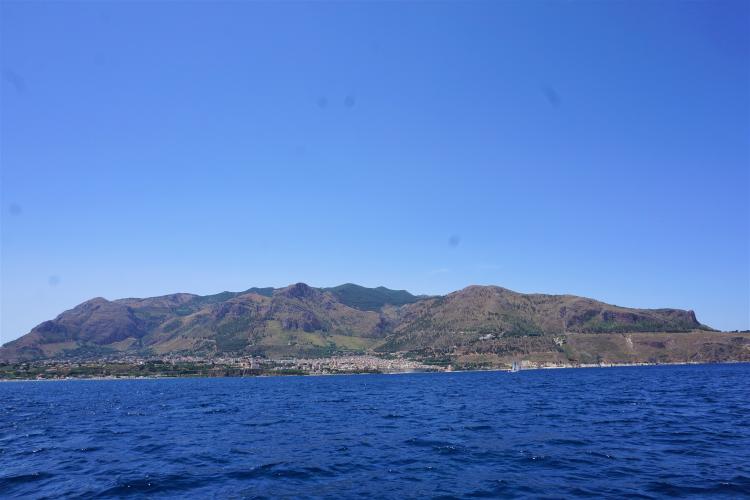
Monte Inici is the second-highest peak in the province of Trapani at 1,064 m (3,491 ft), a forested massif rising straight from the Gulf of Castellammare in northwest Sicily. This climb starts just outside Castellammare del Golfo at about 111 m (364 ft) and covers 12.2 km (7.6 mi) with 937 m (3,074 ft) of climbing at a 7.3% average, finishing near 1,000 m (3,281 ft) on the upper slopes.
This is gravel-bike territory rather than a road climb. Most of it follows an unpaved forest road through pine, holm oak and cork oak, and it is steep: the steepest mile averages 14.0% and the steepest 100 m (110 yd) touches 23.3%. There is no water on the mountain, but the views over the gulf are the reward. The summit area is known as Li Niveri, after the stone cellars where snow was once stored as ice.
Fires burned parts of the mountain in March and May 2024 (about 130 hectares in May), so expect some scorched slopes and patchier shade than the forest once gave.
PLAN YOUR ROUTE
 We've partnered with Sherpa-Map.com to bring you the best route planning tool. With a PRO Membership you can use this climb as a reference when creating your route.
Monte Inici averages 7.3% over 12.2 km (7.6 mi), gaining 937 m (3,074 ft) from about 111 m (364 ft) to 1,000 m (3,281 ft). The average understates how hard the steep parts are. The steepest 100 m (110 yd) reaches 23.3%, the steepest 0.4 km (0.25 mi) averages 16.1%, and the steepest kilometer averages 14.0%, which is a lot to ask on a loose surface.
Over longer stretches the grade settles: the steepest 2 km (1.2 mi) averages 12.7%, the steepest 5 km (3.1 mi) averages 8.6%, and the steepest 10 km (6.2 mi) averages 7.9%. In practice that means a few very hard sections inside a long, firm climb with little time to recover. Choose a very low gear, and expect traction rather than power to be the limit on the steepest pitches.
Roadway: Mostly unpaved. The main way up the mountain is the forest road that leaves the SS 187 (the road toward Scopello and San Vito lo Capo) at the Belvedere junction and runs up the eastern flank through the forestry reserve, past the Fossa del Bue and the Vaccaria woods toward the summit. The surface is compact and well kept in places, but water has cut grooves into it, so take care at speed. There are no guardrails, and forestry vehicles use the road and can appear suddenly around bends. The descent starts on gravel and then reaches asphalt that is worn in places. Tires of 35 mm or wider are the sensible choice.
Traffic: Very little on the forest road itself - mainly forestry staff and the occasional hiker or rider. The SS 187 at the foot carries traffic to Scopello and San Vito lo Capo, so take care on the approach.
Parking: The Inici Belvedere equipped area, run by the regional forestry service, is the natural place to start: it sits on the left just after the locality of Crocifisso as you drive from Castellammare toward Scopello, with picnic tables, toilets and a non-drinking water point. Opening times and seasonal access are set by the Sicilian forestry department, so check before driving up in summer.
Provisions: Carry all the water you need. There is no supply on the mountain, and the fountains at the picnic area are not drinking water. Fill up in Castellammare del Golfo and bring food for a long day, since the loose surface slows the pace.
Gear: A gravel or mountain bike is the right tool, and the climb suits e-bikes too. Wide tires (35 mm or more) at lower pressure help on the grooved sections, and a very low gear helps on the steepest pitches. Bring a spare tube and a pump or CO2 since there is no help on the mountain, a windproof layer for the summit where fog can form even in summer, and sun protection. Brake early on the descent: the road has erosion grooves and no guardrails, and forestry vehicles share it.
Before heading out on any cycling adventure check out our Things to Bring on a Cycling Trip and use our interactive check list to ensure you don't forget anything.
Castellammare del Golfo, at the bottom of the climb, is a harbor town with an Arab-Norman castle mentioned by the geographer Idrisi in 1154 and an 18th-century cathedral on a tufa spur above the sea. The Belvedere viewpoint above town is worth a stop on the way down, especially at sunset. At the foot of the mountain you will find the ruins of the Castello di Inici, the Madonna della Mendola sanctuary and the former Sanclemente barony estate.
Nearby, the village of Scopello and the Zingaro reserve - Sicily's first nature reserve, with about 7 km (4.3 mi) of coastline - make a good rest day, and the caves of Monte Inici can be visited on guided trips run by the Castellammare section of the Italian Alpine Club (CAI). Summers are hot and fire risk is real here, so spring and autumn are the better seasons. Fog on the summit is common, so check conditions with our Weather tool before you go.
ROUTE MAP

MEMBER RATING
CURRENT WEATHER
PJAMM TRIPS ADVENTURE STARTER BUNDLES
Check out PJAMM Adventure's prepackaged (self-guided) cycling trips. They will help you plan, document and conquer your next adventure.
NEARBY CLIMBS (0) RADIAL PROXIMITY
FROM No Climbs Found
MEMBER REVIEWS & COMMENTS
Let us know what you thought of this climb. Signup for our FREE membership to write a review or post a comment.
Already have an account?
LOG IN HERE
