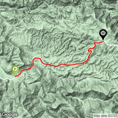
5.4
PDI
4.2 mi
DISTANCE
1,107 ft
GAINED
4.8 %
AVG. GRADE
FULL CLIMB STATS
INTRO
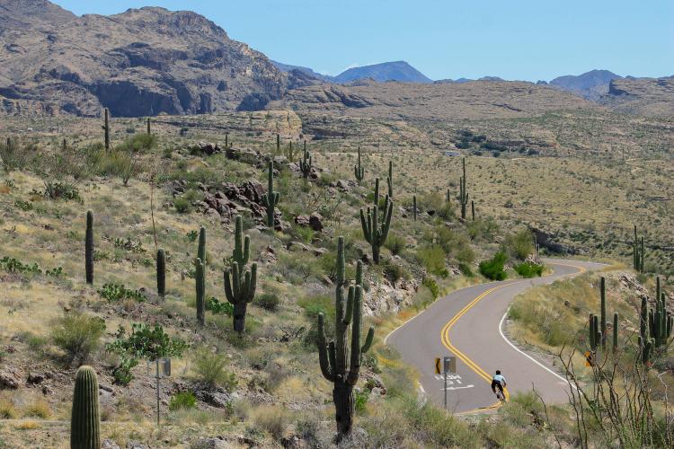
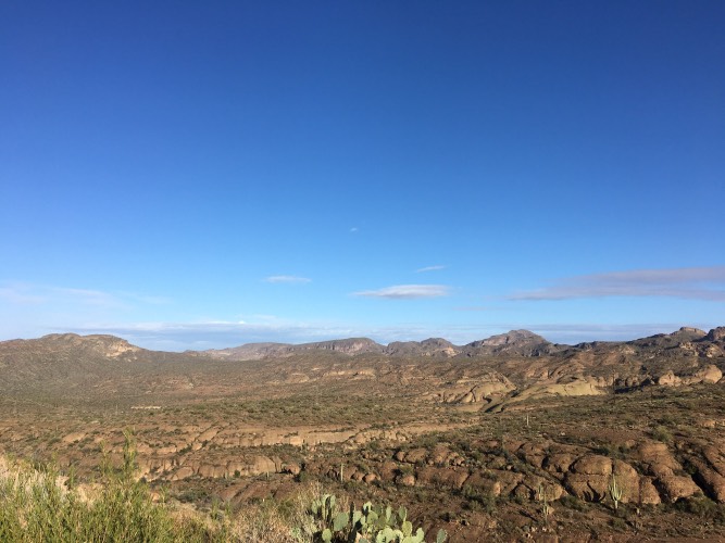
Climb out of a desert canyon, starting at an iconic old-western biker bar.
PLAN YOUR ROUTE
See more details and tools regarding this climb's grade via our interactive Profile Tool.
Parking:
There's plenty of free parking right outside the Tortilla Flat Biker Bar, right at the start of the climb. Information Not Available
If you have any information regarding this climb, we'd like to hear from you. Click the CONTRIBUTE button to share your thoughts with us.
Before heading out on any cycling adventure check out our Things to Bring on a Cycling Trip and use our interactive check list to ensure you don't forget anything.
Stop in the biker bar for some cold brews, souvenirs, and barbecue (with a homemade prickly-pear BBQ sauce)
ROUTE MAP
MEMBER RATING
CURRENT WEATHER
PJAMM TRIPS ADVENTURE STARTER BUNDLES
Check out PJAMM Adventure's prepackaged (self-guided) cycling trips. They will help you plan, document and conquer your next adventure.
NEARBY CLIMBS (0) RADIAL PROXIMITY
FROM No Climbs Found
MEMBER REVIEWS & COMMENTS
Let us know what you thought of this climb. Signup for our FREE membership to write a review or post a comment.
Already have an account?
LOG IN HERE
HakenBaconator


Pretty climb. Not terribly difficult, but the views are pretty worth it. Be ready for a screaming descent back down after turning around where the road turns to dirt.
dreidtri
No one out here in the middle of nowhere, except the climb, which doesn't kick that steep, but is about as long as one will find in the PHX area. Really nice views at the top.
sam.lionman
The routed climb is open, but the rest of the dirt road to Roosevelt Dam is closed to all traffic due to recent flooding. I just tried it last week on my gravel bike and made it about 4 miles up the road before I gave up, since I was stopping every 100 yards to walk over a rockslide or something. Parts wouldn't have been rideable on a mountain bike.
If you're going to do this one, don't miss out on the Canyon Lake climb - the prettier of the two IMO. Also, Tortilla Flat is a party. Historic biker bar with some great food local brews and live music.