![]()
Cycling Finestraler Damm - World #92
Ride 22.2 kilometers gaining 1806 meters at 7.4% average grade (9.5% climb only)
Summary by PJAMM ambassador Ard Oostra, Montreux, Switzerland.
![]()
The climb to Haininer berg is almost continuously steep. We do not recommend attempting this one during hot weather because the cyclist is exposed to the sun during some longer stretches, especially in and around the villages. Most of the climb goes through forested areas though. The road is wide, in a good state and traffic is quite low.
![]()
At the summit (not very interesting scenery wise) there is a short down hill to the south, about 150 m down, where the road joins the ascension (west-east) to Kuhtai (2020 m altitude). This upper part of the climb to Kuhtai from the west is a mix of steep sections and some lower percentages (especially along the small river). One passes on the left side a dam and a lake. From there its only a short climb up to Kuhtai village and Kuhtai pass.
![]()
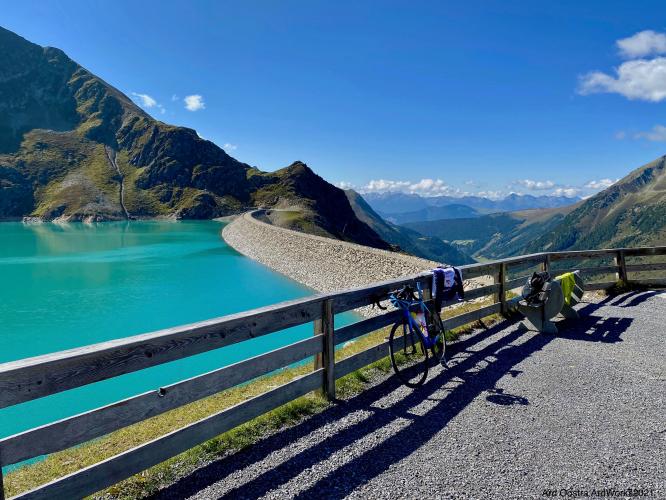
But those who want to climb the additional 350 or so meters up to Finsterstraler dam have to take a right turn about one kilometer before the Kuhtai summit. The dam, consisting of natural rocks, is well visible. This road up the dam is for authorized traffic only. On my day of climbing there were some heavy trucks on one section of the road due to construction work. Other than the construction vehicles, overall this climb has almost nonexistent traffic. I crossed several hikers but didn’t see any other cyclists. The road surface is a combination of asphalt and concrete slabs, overall in good condition. The road is steep, comparable to the Haininger berg section.
![]()
Close to the top of the dam is a tunnel (equipped with light) that makes a 180 degree turn in the mountain. Interesting to see this from the top of the dam.
The road ends at a wooden house somewhat higher than the dam. Both from this viewpoint and from the top of the dam one can enjoy the amazing scenery of the lake, surrounding mountains, and views on the Kuhtai valley and beyond. Definitely worthwhile to discover!
![]()
![]()
Thank you Ard!!

 We've partnered with Sherpa-Map.com to bring you the best route planning tool. With a PRO Membership you can use this climb as a reference when creating your route.

