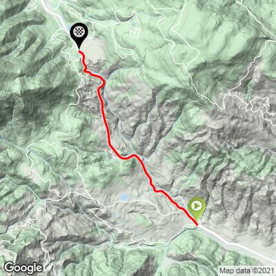
8.6
PDI
3.3 mi
DISTANCE
1,311 ft
GAINED
7.6 %
AVG. GRADE
FULL CLIMB STATS
INTRO
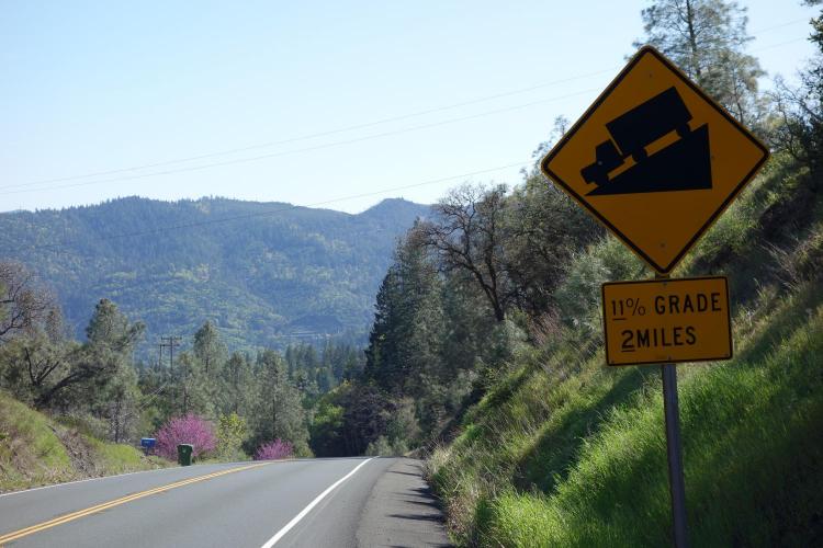
This is a climb along what can be a moderately busy highway for its first mile. However, the lanes are wide and there is a good shoulder most of way. We are surrounded by trees most of the trip, but there is the occasional view of the Mayacama mountain range that we are riding up into (Cobb Mountain, which we ascend towards, is the highest point in the 52 mile Mayacama Range which runs through Mendocino, Lake, Napa and Sonoma Counties).
PLAN YOUR ROUTE
See more details and tools regarding this climb's grade via our interactive Profile Tool.
Information Not Available
If you have any information regarding this climb, we'd like to hear from you. Click the CONTRIBUTE button to share your thoughts with us.
Information Not Available
If you have any information regarding this climb, we'd like to hear from you. Click the CONTRIBUTE button to share your thoughts with us.
Before heading out on any cycling adventure check out our Things to Bring on a Cycling Trip and use our interactive check list to ensure you don't forget anything.
Information Not Available
If you have any information regarding this climb, we'd like to hear from you. Click the CONTRIBUTE button to share your thoughts with us.
ROUTE MAP
MEMBER RATING
CURRENT WEATHER
PJAMM TRIPS ADVENTURE STARTER BUNDLES
Check out PJAMM Adventure's prepackaged (self-guided) cycling trips. They will help you plan, document and conquer your next adventure.
NEARBY CLIMBS (0) RADIAL PROXIMITY
FROM No Climbs Found
MEMBER REVIEWS & COMMENTS
Let us know what you thought of this climb. Signup for our FREE membership to write a review or post a comment.
Already have an account?
LOG IN HERE