
24.3
PDI
17.8 mi
DISTANCE
4,977 ft
GAINED
4.5 %
AVG. GRADE
FULL CLIMB STATS
INTRO
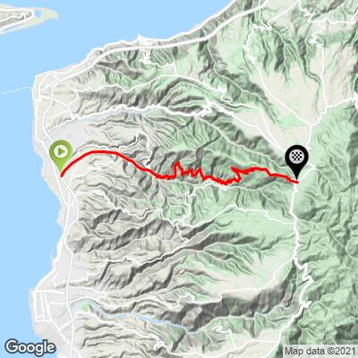
Galico - Gambarie is a full sea-to-summit climb in Calabria, Italy, starting near the coast at Gallico - a seaside district of Reggio Calabria on the Strait of Messina - and finishing 28.6 km (17.8 mi) later in Gambarie, the mountain resort at the heart of Aspromonte National Park. The climb gains 1,517 m (4,977 ft) at a 4.5% average grade, starting at just 33 m (109 ft) above sea level and topping out near 1,318 m (4,323 ft).
The road itself is new: the Gallico-Gambarie provincial highway was built in stages over nearly two decades - the first section opened in 2005, a second in 2009, and the long-awaited third stretch through Calanna and Sant'Alessio in Aspromonte wasn't completed until December 2024, with a final short extension opening as recently as November 2025. The payoff is a smooth, modern road that climbs steadily through nine viaducts, with the Strait of Messina, the Aeolian Islands, and on clear days Mount Etna visible below for much of the ascent.
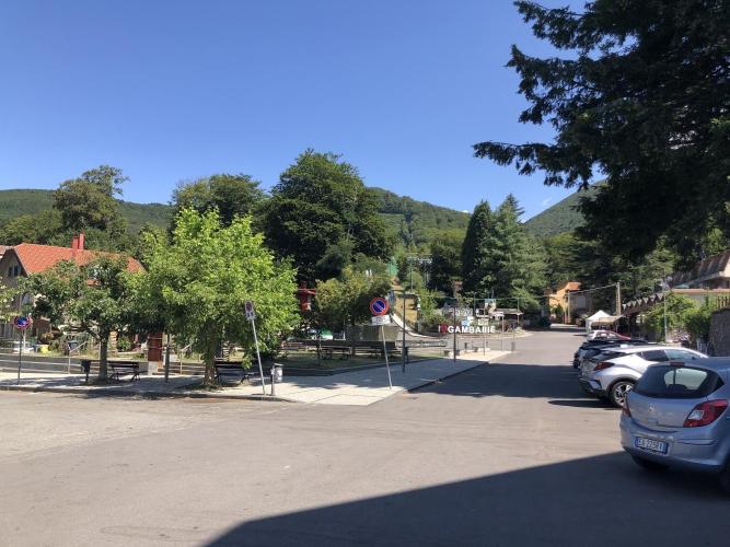
Gambarie is Calabria's main winter sports town, a small ski resort at over 1,300 m in the heart of the Aspromonte massif - the finish sits right in the town center, near the chairlift and the main piazza. Because the road is still relatively new infrastructure, it's worth checking current Città Metropolitana di Reggio Calabria advisories for any residual work before you go.
PLAN YOUR ROUTE
 We've partnered with Sherpa-Map.com to bring you the best route planning tool. With a PRO Membership you can use this climb as a reference when creating your route.
 Galico - Gambarie averages 4.5% over 28.6 km (17.8 mi), gaining 1,517 m (4,977 ft) from sea level at Gallico to Gambarie at 1,318 m (4,323 ft) in Aspromonte National Park.
The grade is remarkably consistent for such a long climb - there's no flat coastal run-in and no easy stretch near the top. The steepest kilometer averages 11.0%, and the steepest 2 km still averages 9.0%, both in the early ramps above the coast; the closing kilometers into Gambarie ease to a more moderate 5-6%.
Roadway: The SP1 Gallico-Gambarie is a modern, well-paved provincial highway, built new in stages between 2005 and November 2025 - the final short extension near Podargoni only opened to traffic in late 2025. Expect smooth, wide pavement with nine viaducts and several roundabouts; because parts of the route are still newly opened, check current Città Metropolitana di Reggio Calabria advisories for any residual construction before you go.
Traffic: This is a "strada a scorrimento veloce" - a fast-flow road built specifically to speed car and commercial traffic between the coast and the Aspromonte interior - so vehicles can move quickly, especially on the lower and middle sections; be alert through the viaducts, where shoulders can narrow. Traffic thins out closer to Gambarie.
Parking: Gallico, at the base, is a coastal district of Reggio Calabria with on-street parking near the SP1's junction with the SS18 coastal road. At the finish, Gambarie's main piazza has public parking within a short walk of the town center.
Provisions: Gallico and the lower villages along the route (Calanna, Laganadi, Sant'Alessio in Aspromonte) have small shops and cafes; Gambarie itself, as a resort town, has multiple restaurants, bars, and a grocery store for a proper finish-line meal.
Gear: A standard road bike with a compact or triple crankset is a good idea given nearly 29 km of sustained, mostly 4-7% climbing with little flat recovery - and the finish sits above 1,300 m, so pack a layer for the descent even on a warm coastal day.
Before heading out on any cycling adventure check out our Things to Bring on a Cycling Trip and use our interactive check list to ensure you don't forget anything.
Reggio Calabria, at the foot of the climb, has a lively seafront promenade (the Lungomare Falcomatà) and the Museo Archeologico Nazionale, home to the Riace Bronzes - worth a visit before or after the ride.
Gambarie is Calabria's main mountain resort, with a small ski area and a network of hiking and mountain-biking trails through Aspromonte National Park's beech and pine forests - it's a legitimate warm-weather escape from the Calabrian coast as well as a winter destination.
See other bike climbs near Reggio Calabria and the Aspromonte massif with our Routes in the Area tool.
ROUTE MAP
MEMBER RATING
CURRENT WEATHER
PJAMM TRIPS ADVENTURE STARTER BUNDLES
Check out PJAMM Adventure's prepackaged (self-guided) cycling trips. They will help you plan, document and conquer your next adventure.
NEARBY CLIMBS (0) RADIAL PROXIMITY
FROM No Climbs Found
MEMBER REVIEWS & COMMENTS
Let us know what you thought of this climb. Signup for our FREE membership to write a review or post a comment.
Already have an account?
LOG IN HERE
