
22.6
PDI
15 mi
DISTANCE
4,314 ft
GAINED
5.3 %
AVG. GRADE
FULL CLIMB STATS
Page Contributor(s): Bryant Robbins, Palmer, AK, USA
INTRO
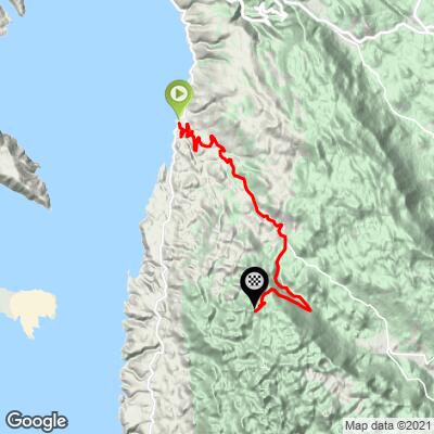
This is a true sea-to-summit climb: 24.1 km (15.0 mi) from the harbor at Sveti Juraj, 16 m (52 ft) above the Adriatic, to the Babić Siča entrance of Northern Velebit National Park at 1289 m (4,230 ft), with 1315 m (4,314 ft) of gain at an average of 5.3%. The grade is never extreme - the steepest kilometer averages 9.6% - but it's a long, sustained effort up the seaward wall of Croatia's largest mountain range.
The first half climbs through bend after bend on the open slope above the coast, with the view over the Kvarner islands widening at every turn. Above the hamlet of Oltari the character changes completely: the road turns south into quiet beech forest and rolls, then climbs, for the last 9 km (5.6 mi) to the park entrance.
Northern Velebit became a national park in 1999, and Babić Siča is its main northern gateway - the start of the unpaved road to Zavižan, the Velebit Botanical Garden, and the long-distance Premužić Trail. It's also genuinely wild country; bears and wolves still live in these forests.
PLAN YOUR ROUTE
 We've partnered with Sherpa-Map.com to bring you the best route planning tool. With a PRO Membership you can use this climb as a reference when creating your route.
 The climb averages 5.3% over 24.1 km (15.0 mi), but it falls into three distinct sections.
The first 8 km (5.0 mi) out of Sveti Juraj are moderate, holding mostly between 4% and 6%. The hardest stretch comes next: from kilometer 8 to kilometer 14 the grade rises to 7-9% for six straight kilometers, including the steepest kilometer of the climb at 9.6% and the steepest half-kilometer at 10.5%.
After the Oltari area at about kilometer 15, the road flattens out and even dips slightly, then rolls gently at 2-3% for several kilometers through the forest. The final 5 km (3.1 mi) climb again at mostly 5-6%, with a last kick of close to 8% before the park entrance at 1289 m (4,230 ft).
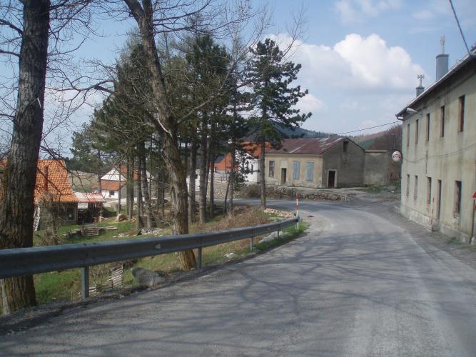
Roadway: The road is paved all the way from Sveti Juraj to the Babić Siča entrance - the county road over Oltari is the highest fully paved pass road on Velebit, and the national park describes the 10 km branch from Oltari to Babić Siča as asphalt. It's narrow and winding, with many tight bends on the lower half. Beyond Babić Siča, the 7 km road on to Zavižan is unpaved and suitable only for a gravel or mountain bike.
Traffic: Light. The lower road carries local traffic between the coast and Krasno, and the upper branch serves only park visitors and a few hamlets. Expect more cars on summer weekends, when the Babić Siča - Zavižan road is open to vehicles (currently Friday to Sunday only). This stretch of coast is known for the bura, a powerful, gusty northeasterly wind - on a bura day, the exposed lower switchbacks and the descent back to the sea can be dangerous.
Parking: Sveti Juraj is a small harbor village on the D8; park considerately in the village near the harbor, close to where the road to Krasno leaves the coast road. Fuller services are in Senj, about 10 km (6.2 mi) north.
There are no dependable services between Sveti Juraj and the park entrance. The building beside the road at Oltari was a mountain hut for many years but is now a private holiday rental, so don't count on a stop there - leave the coast with full bottles and enough food for a climb of well over an hour. Rangers at Babić Siča sell park tickets (cash only), and cyclists entering by bike get a discounted ticket.
You'll go from Mediterranean heat at sea level to a cool beech forest at 1300 m, and the Velebit crest is often much colder and wetter than the coast, so pack a jacket for the descent. Standard compact road gearing is plenty for the 5-9% grades.
Before heading out on any cycling adventure check out our Things to Bring on a Cycling Trip and use our interactive check list to ensure you don't forget anything.
Senj, a short ride up the coast, is the obvious base, and its 16th-century Nehaj Fortress, on the hill above the old town, is worth a visit. Inland from Oltari, the village of Krasno is home to a Marian shrine church that is one of Croatia's best-known pilgrimage sites, as well as the country's only forestry museum; since May 2025 the Lika Line bus has connected Senj and Otočac with Krasno.
If you have a gravel bike or a spare day, continue past Babić Siča to Zavižan, home to Croatia's highest weather station and the Velebit Botanical Garden, founded in 1967, which holds around 300 plant species at about 1480 m.
The weather on the Velebit crest can be very different from the coast - check conditions at the top of the climb with our Weather tool before setting out.
ROUTE MAP
MEMBER RATING
CURRENT WEATHER
PJAMM TRIPS ADVENTURE STARTER BUNDLES
Check out PJAMM Adventure's prepackaged (self-guided) cycling trips. They will help you plan, document and conquer your next adventure.
NEARBY CLIMBS (0) RADIAL PROXIMITY
FROM No Climbs Found
MEMBER REVIEWS & COMMENTS
Let us know what you thought of this climb. Signup for our FREE membership to write a review or post a comment.
Already have an account?
LOG IN HERE
