Diamond Mountain Road Bike Climb - PJAMM Cycling

10.1
PDI
3.3 mi
DISTANCE
1,452 ft
GAINED
8.3 %
AVG. GRADE

FULL CLIMB STATS

INTRO

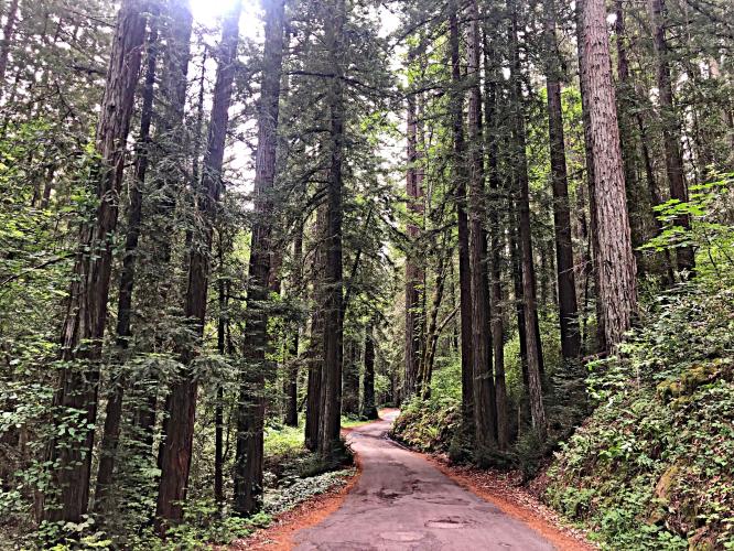
This is an exceptional, yet brief, climb in the northwest section of Napa Valley. This climb more than any other in Napa County offers a legitimate redwood forest-like experience. Although there are negligible vineyard views throughout the climb, we are treated to a near-private ride, completely shaded by a canopy of tree branches (redwoods for much of the climb), and one spectacular photo op of Mt. St. Helena eight miles north. We highly recommend this short up-and-back climb for those traveling through or near Calistoga - you will not be disappointed.

PLAN YOUR ROUTE

We've partnered with Sherpa-Map.com to bring you the best route planning tool. With a PRO Membership you can use this climb as a reference when creating your route.
8.2% average grade (8.6% climb only) with 26% at 10-15%, 6% at 15-20%, and 1.6% ≥20%.  The steepest quarter-mile is 15.6%.

See more details and tools regarding this climb's grade via the “Profile Tool” button.
Roadway:  Narrow two lane rural roadway winding through the redwoods with no center line and in fair to poor condition.

Traffic:  Minimal.

Parking:  On the side of the road at the start of the climb - MapStreet View
Provisions:  In Calistoga 1.5 miles northwest (Map) or St. Helena seven miles southeast (Map). 
Before heading out on any cycling adventure check out our Things to Bring on a Cycling Trip and use our interactive check list to ensure you don't forget anything.
If you have travelled to Napa County to cycle, you are welcome to contact me at john@pjammcycling.com if you have any questions about the area. I grew up and live in neighboring Sonoma County, but do have a good working knowledge of Napa. 

Use the “Routes in Area” button on the menu bar to see other bike climbs in this area. 

ROUTE MAP

MEMBER RATING

Difficulty: Strenuous
2
Road
5
Traffic
3
Scenery

CURRENT WEATHER

PJAMM TRIPS ADVENTURE STARTER BUNDLES

Check out PJAMM Adventure's prepackaged (self-guided) cycling trips. They will help you plan, document and conquer your next adventure.
ALL TRIPS
Browse all of our prepackaged trips and find your next adventure!
Sonoma County
United States (CA)
19 ROUTES
39 POIs
ROUTE STATS (TOTAL)
269.3
mi
DISTANCE
41,801
ft
ELEV. GAIN

NEARBY CLIMBS (0) RADIAL PROXIMITY

FROM
No Climbs Found

MEMBER REVIEWS & COMMENTS

Let us know what you thought of this climb. Signup for our FREE membership to write a review or post a comment.
Already have an account?

Oct 3, 2021
difficulty: Strenuous
scenery: 3
traffic: 5
road: 2
Oct 3, 2021
scenery: 3
traffic: 5
road: 2
The recent fire has taken Away some of its beauty, and the road is more damaged with a few hairpins that are largely gravel
ROUTE MAP
PROFILE TOOL
Route Data
S.G. (%)
hide
Segment Data
hide
CLIMB SUMMARY

Cycling Diamond Mountain Road, Calistoga, California.

Ride 3.3 miles gaining 1,438’ at 8.2% average grade.

A Bay Area Top 10 Most Scenic Bike Ride

This is an exceptional yet brief climb in the northwestern section of Napa Valley.  

We believe Diamond Mountain Road is the second most scenic climb in Napa County . . . after Mt. St. Helena.


As can be seen from our featured image and the collage below (top right), there are some nice views of the mighty Mt. St. Helena just across the Napa Valley from the Diamond Mountain climb.

DSC04000.JPG

This climb more than any other in Napa County offers a legitimate redwood forest experience.  Although there are negligible vineyard views throughout the climb, we are treated to a near-private ride, completely shaded by a canopy of tree branches, (redwoods for much of the climb) and one spectacular photo op of Mt. St. Helena eight miles north.  We highly recommend this short up-and-back climb for those travelling through or near Calistoga -- you will not be disappointed.  


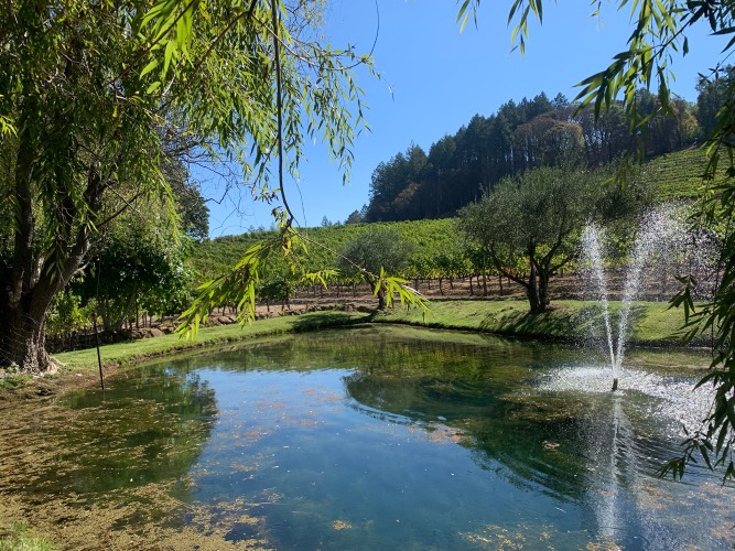
Some of the beautiful scenes along this wonderful climb.

The best segment of redwoods in Napa County.

A beautiful finish.

Traffic and Roadway Surface Report:  This is a very narrow road (essentially one lane towards the top) with no center line, rough pavement, and a fair amount of loose gravel and debris (careful on the descent).  However, there is very little traffic along the climb and we rank this as a fairly safe ascent.

That’s a wrap!!