
17.6
PDI
7.5 mi
DISTANCE
2,778 ft
GAINED
7 %
AVG. GRADE
FULL CLIMB STATS
INTRO
Col du Portel from Biert climbs 12.0 km (7.5 mi) from the village of Biert, in the Arac valley of the Couserans, to the Col du Portel - at 1432 m (4698 ft) the high point of the ridge road that crosses the Massif de l'Arize between Saint-Girons and Foix. It gains 847 m (2778 ft) at a 7.0% average and ranks #239 in France and #1278 in the world in our database.
That average hides the real story. The first 5 km (3.1 mi) are a gentle warm-up through woods and pasture, but once the road crosses a small bridge it rears up, and the 3.3 km (2.1 mi) to the Col de la Crouzette average 11.0%, with the steepest kilometer at 13.7%. It's a narrow, mostly shaded lane with few hairpins to break the effort, and riders who know the area regularly compare it with the nearby Mur de Péguère - some rate the Crouzette from Biert as the harder of the two. The forest finally opens in the last kilometer below the Crouzette, and the views back over Biert and south to Mont Valier arrive all at once.
From the Crouzette, the last 3.7 km (2.3 mi) follow a far gentler ridge road east, with a short dip before a final 1.7 km (1.0 mi) at 7.6% to the col and its broad summit meadow. The Biert side of the Crouzette has featured on routes of L'Ariégeoise, the big summer sportive in the Couserans, and our Col du Portel (Rimont) climb joins this one at the Crouzette for the shared run along the ridge.
PLAN YOUR ROUTE
 We've partnered with Sherpa-Map.com to bring you the best route planning tool. With a PRO Membership you can use this climb as a reference when creating your route.
Col du Portel from Biert is 12.0 km (7.5 mi) long and gains 847 m (2778 ft) at a 7.0% average, from 591 m (1940 ft) in Biert to about 1430 m (4691 ft) at the col.
The climb comes in three distinct parts. The first 3.0 km (1.9 mi) leave the village at 6.7%, then the road eases to 3.8% for the next 2.0 km (1.2 mi). The crux follows: 3.3 km (2.1 mi) at 11.0% to the Col de la Crouzette at about km 8.3 (5.2 mi), with the steepest 0.5 km at 14.2%, the steepest kilometer at 13.7% and the steepest 2 km at 12.6%.
From the Crouzette, the ridge road runs 2.0 km (1.2 mi) at an easy 3.6%, including a short descent, before the final 1.7 km (1.0 mi) climb to the Col du Portel at 7.6%. The steepest 5 km of the climb average 9.1%.
Roadway: The road is paved the whole way, but the climb to the Col de la Crouzette is a narrow, winding mountain lane rather than a main road, with a serviceable rather than smooth surface. It's shaded by forest for most of the steep section and only opens up in the last kilometer below the Crouzette, while the ridge road on to the Col du Portel is open and exposed. The Crouzette can stay closed by snow into spring, so check Ariège's Inforoute09 road information before riding outside summer, and take the steep section slowly on the way down.
Traffic: Traffic is light. Beyond Biert the lane serves only scattered hamlets and farms, so passing cars are occasional - but the steep section is narrow enough that you and a descending vehicle may need to squeeze past each other.
Parking: Biert is a small village of around 300 people, so park considerately in the center near the church on Place de l'Église and roll the short distance to the start by the cemetery. At the top, there is a large parking area beside the summit meadow at the Col du Portel, handy if someone is meeting you there.
Gear: The 3.3 km (2.1 mi) at 11.0% to the Crouzette is the reason to bring your lowest gears. Riders have reported walking stretches of it on a 39x25 or even a 32x28, while a 34x30 gets most people up comfortably, so a compact with a 30- to 34-tooth cog is the sensible choice. Start easy - the hardest work comes in the second half. The summit meadow is exposed, so pack a wind layer for the descent.
Provisions: Fill your bottles at the drinking-water fountain at the entrance to Biert's cemetery, right where the climb begins - there are no services on the climb or at either col. In the village center, the restaurant Le Gypaète Barbu on Place de l'Église serves generous, home-cooked food based on local produce; check its opening dates before planning around it.
Before heading out on any cycling adventure check out our Things to Bring on a Cycling Trip and use our interactive check list to ensure you don't forget anything.
Biert is a quiet village of around 300 people in the Arac valley, on the D618 Route des Pyrénées between Saint-Girons and Massat. Saint-Girons, the capital of the Couserans, is the nearest town with a full range of shops and accommodation, while Massat, a few kilometers up the D618, is the starting point for our Mur de Péguère and Col de Port climbs.
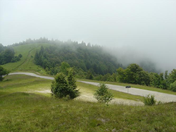
The reward at the top of this climb is the Col du Portel itself: a wide summit meadow where Galloway cattle, horses and sheep graze freely through the summer, and where the slopes are thick with wild blueberries in late summer. On a clear day the view stretches across the main chain of the Pyrenees, with Mont Valier and the Tuc de Mongalas prominent to the south.
The ridge road doesn't stop at the Portel - it continues east to the Col de Péguère, so it's easy to string the Crouzette, the Portel and Péguère into one big day. See other climbs nearby, or build a custom route from here, with our Routes in the Area tool.
ROUTE MAP

MEMBER RATING
CURRENT WEATHER
PJAMM TRIPS ADVENTURE STARTER BUNDLES
Check out PJAMM Adventure's prepackaged (self-guided) cycling trips. They will help you plan, document and conquer your next adventure.
NEARBY CLIMBS (0) RADIAL PROXIMITY
FROM No Climbs Found
MEMBER REVIEWS & COMMENTS
Let us know what you thought of this climb. Signup for our FREE membership to write a review or post a comment.
Already have an account?
LOG IN HERE
