
16.9
PDI
9.5 mi
DISTANCE
2,994 ft
GAINED
5.9 %
AVG. GRADE
FULL CLIMB STATS
INTRO
This is the long way to the Portel, and the quiet one. The Rivèrenert road shares its top few kilometers with the Rimont and Biert climbs, but it gets there up its own valley - a narrow, shaded lane where one rider counted five cars on the whole way up and back down.
It's 15.3 km (9.5 mi) from Illas, just outside Rivèrenert, to the col at 1429 m (4687 ft), gaining 913 m (2994 ft) at 5.9%. The first 2.5 km barely tilt, following the valley at about 2%. After that it settles into 7 to 8% and stays there, with one short flat near km 5.5, all the way to the Col de la Crouzette at about km 12. The hardest kilometer, at 9.6%, comes around km 9, near where the road from Rimont joins.
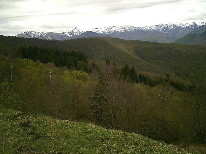
At the Crouzette the trees open up. The ridge road across the Massif de l'Arize runs flat for a kilometer, then climbs the last stretch at about 8% past the summer pastures of La Ruère to the broad, grassy col, with Cap de Campets rising just above it and the main chain of the Pyrenees lined up to the south. The Tour de France first crossed the Portel in 2008 on the way to Foix, with Amaël Moinard leading over the top.
PLAN YOUR ROUTE
 We've partnered with Sherpa-Map.com to bring you the best route planning tool. With a PRO Membership you can use this climb as a reference when creating your route.
Col du Portel from Rivèrenert gains 913 m (2994 ft) in 15.3 km (9.5 mi), a 5.9% average, from 525 m (1724 ft) to 1429 m (4687 ft).
The opening 2.5 km (1.6 mi) along the valley average only about 2%. From there to the Col de la Crouzette at about km 12 (7.5 mi) the road climbs roughly 690 m in 9.5 km (5.9 mi), about 7.3%, broken only by a near-flat 500 m around km 5.5. The steepest stretch is between km 9 and km 10, where it touches 10%.
After the Crouzette the ridge road is flat to slightly downhill for about a kilometer, then climbs the final 1.8 km (1.1 mi) at about 8% to the col. The steepest kilometer averages 9.6%, the steepest 2 km (1.2 mi) 9.2%, the steepest 5 km (3.1 mi) 8.0% and the steepest 10 km (6.2 mi) 7.1%.
Roadway: Asphalt from bottom to top: the D33 up the valley, the D18B from the Rimont junction to the Col de la Crouzette, then the D72 along the ridge. The lower road is narrow, and riders describe the surface as coarse in places, though stretches have been resurfaced. Most of the climb is shaded, so expect damp patches and wet leaves in autumn. Snow can keep the Crouzette and the ridge road closed into spring - check Ariège's Inforoute09 road information before riding outside summer.
Traffic: Very light. The D33 serves Rivèrenert's scattered hamlets and little else; it gets a bit busier on the D18B and the ridge, where summer visitors drive up to the cols and the summit meadow.
Parking: Park considerately in the center of Rivèrenert and roll about a kilometer east to the start at Illas (start on Google Maps). Saint-Girons, a short drive west, has plenty of parking if you'd rather ride out from town. If someone is picking you up, there's a large parking area beside the meadow at the Col du Portel.
Gear: The gradients are steady rather than savage, so a compact with a 28- to 30-tooth cog is plenty for most riders; the hard part is staying patient for an hour or more. You finish on an exposed ridge after a long climb in the shade, and the descent is long, so bring a light jacket.
Provisions: There's nothing to buy on the climb or at the col. Stock up in Saint-Girons and start with two full bottles.
Before heading out on any cycling adventure check out our Things to Bring on a Cycling Trip and use our interactive check list to ensure you don't forget anything.
Saint-Girons, the capital of the Couserans, is the base with everything. On Saturday mornings, from 8 am to 1 pm, the market on the Champ de Mars fills up with mountain honey, cheese and charcuterie from the surrounding valleys. Rivèrenert itself is a quiet commune of about 200 people, with gîtes scattered across its hamlets if you'd rather stay right at the foot of the climb.
At the top you're on the ridge road that ties all the Portel climbs together, so a loop is easy: drop to Biert or Rimont, or carry on east toward the Col de Péguère. Our Col du Portel (Biert) and Col du Portel (Rimont) pages cover the summit meadow and those valleys, and the Rimont page tells the story of the 1944 memorial near the Crouzette.
ROUTE MAP

MEMBER RATING
CURRENT WEATHER
PJAMM TRIPS ADVENTURE STARTER BUNDLES
Check out PJAMM Adventure's prepackaged (self-guided) cycling trips. They will help you plan, document and conquer your next adventure.
NEARBY CLIMBS (0) RADIAL PROXIMITY
FROM No Climbs Found
MEMBER REVIEWS & COMMENTS
Let us know what you thought of this climb. Signup for our FREE membership to write a review or post a comment.
Already have an account?
LOG IN HERE
